
The Indian Ocean guards within its turquoise waters an intricate web of invisible routes that have connected East Africa to the Persian Gulf and the Indian subcontinent for over two millennia. At the heart of this ancient circuit lies the Zanzibar archipelago, an insular mosaic where the modernity of high-speed ferries collides head-on with the artisanal reality of wooden watercraft. This is far more than a mere holiday destination of idyllic beaches; it is a living territory whose economic and social survival depends on an extraordinarily fragile transport network, conditioned by monsoons, a scarcity of modern port infrastructure, and the persistence of ancestral maritime trades.
While commercial catamarans promise timed journeys between Dar es Salaam and Stone Town, the vast periphery of the archipelago survives thanks to an intermodal system where lateen-sail dhows, overloaded cargo barges, and outboard-motor water taxis converge. This duality defines the daily reality of thousands of islanders and tons of cargo transiting between Unguja, Pemba, and the smaller islets. Understanding this mobility ecosystem requires looking beyond tourist postcards and venturing into the low-tide docks, where logistics become a daily exercise of patience, seafaring intuition, and material endurance.
The Naval Architecture of Dhows: Living Engineering Against the Monsoon
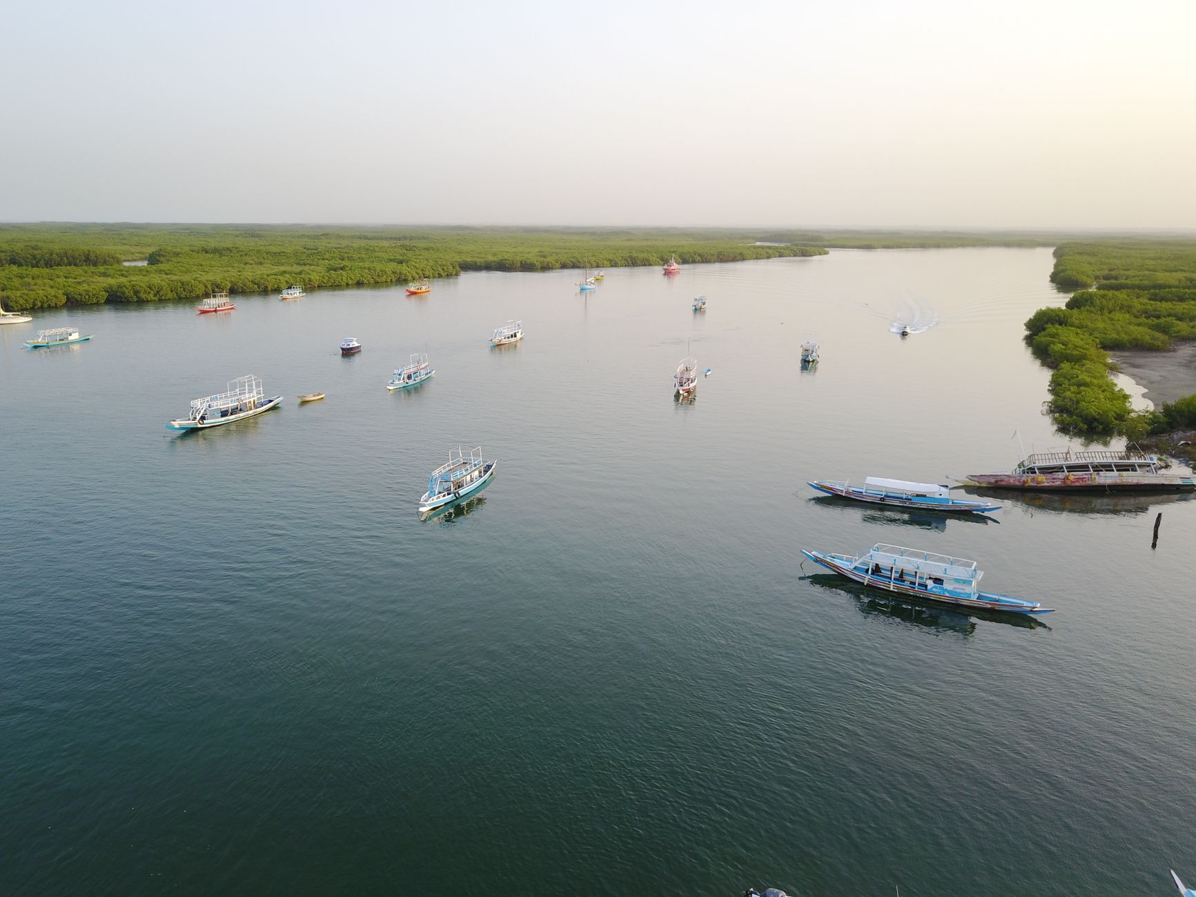
The historical backbone of Zanzibari maritime transport rests on the dhow, a triangular-sail vessel that defies contemporary naval architecture laws through techniques inherited from Persian and Arab boatbuilders. Traditionally constructed from imported teak or mango timber and assembled without metal fasteners—originally sewn with coconut fiber and today reinforced with modern bolts—these hulls represent a perfect adaptation to the capricious currents of the Indian Ocean. The mastery of local shipwrights on the beach of Nungwi lies in calculating by eye the buoyancy and hydrodynamic resistance required to support heavy loads of clove sacks, fuel, and building materials.

However, the reliance on wind power and secular designs places these vessels in constant vulnerability to climate change and the commercialization of routes. Captains, locally known as nahodha, must read subtle shifts in barometric pressure and water color to anticipate the violent turbulence associated with the northeast monsoon (kaskazi) and the southeast monsoon (kusi). The gradual introduction of small diesel engines adapted to traditional hulls has altered the classic silhouette of Indian Ocean navigation, sparking an open debate between the preservation of maritime heritage and the pressing need for safety during increasingly unpredictable crossings.
blockquote>The dhow is not a relic of a nautical past, but the only floating life insurance policy fishing communities have when fossil fuel is inaccessible or prohibitively expensive.
The Strategic Corridor Between Unguja and Pemba: Insular Isolation and Heavy Cargo
Although Unguja commands the lion’s share of international attention and visitor flow, the island of Pemba—known as the green island for its spice plantations and lush vegetation—experiences a far more pronounced reality of isolation. The Pemba Channel, an oceanic trench over eight hundred meters deep, acts as a natural barrier separating the two sister islands. Regular passenger connections rely on a limited number of state and private ferries operating under strict weather constraints, which frequently leaves Pemba disconnected for entire weeks during storm seasons.
The logistics of freight transport toward Pemba reveal the archipelago’s most fragile seams. Wooden barges departing from the secondary ports of Mkoani or Wete carry everything from motorcycles to gas cylinders and perishable goods, piled high without standardized lashing across wave-swept decks. This operational precariousness does not stem from institutional negligence, but from the absolute lack of adequate port cranes and sufficient draft in historical docks. Port authorities face the chronic dilemma of dredging protected coral seabeds or allowing the island’s economy to remain strangled by a lack of logistical capacity.
The Docks of Stone Town: The Friction Between Mass Tourism and the Local Economy
The main port of Stone Town, a designated UNESCO World Heritage Site, concentrates the point of greatest friction between the global tourism industry and local subsistence dynamics. Early in the morning, the main pier turns into a bustling hub where European backpackers with technical gear coexist with local porters balancing refrigerators on their heads and merchants transporting farmed seaweeds for cosmetic export. The high-speed ferry terminal, recently modernized with foreign investment, contrasts jarringly with the adjacent cargo docks, where dockworkers operate under conditions of extreme physical hardship.

This imbalance in infrastructure investments generates palpable social social tensions. While priority is given to floating docks and automated customs controls to streamline traveler transit toward east coast resorts, the traditional wooden pier used by coastal cabotage vessels heading to Tanga and Dar es Salaam suffers from chronic structural neglect. Passenger congestion during religious holidays like Eid or peak season overpowers a system that lacks adequate waiting areas, functional restrooms, and integrated electronic ticketing systems for the local population.
blockquote>Port modernization in Zanzibar is measured by how fast it clears the foreign tourist, too often ignoring the merchant who sustains the basic supply lines of working-class neighborhoods.
Rural Mobility in Unguja: Daladalas, Dirt Roads, and the Invisible Network
Beyond maritime routes, the archipelago’s terrestrial connectivity rests on the shoulders of daladalas, public transport vans that serve as the central nervous system of Unguja island. From the central Darajani terminal in Stone Town, dozens of battered vehicles depart for every corner of the island, from the beaches of Paje to the mangroves of Kizimkazi. These vehicles, crammed with passengers and cargo on makeshift wooden benches, operate under an informal model where schedules do not exist and departure is dictated exclusively by total vehicle occupancy.
The condition of secondary roads feeding this network defines the development level of rural communities. During the heavy rainy season (masika), the red dirt roads leading to seaweed farming villages or the Jozani forest reserves become completely waterlogged, cutting off local schools and health centers. Daladala drivers must perform remarkable mechanical feats to bypass colossal potholes, demonstrating technical resilience that makes up for the absence of sustainable road maintenance plans by the insular government.

The Tide Economy: Natural Harbors and Lunar Cycle Dependency
One of the most fascinating and complex factors of Zanzibar’s transport system is its total submission to the relentless rhythm of the tides. On the eastern coast, characterized by extensive shallow coral reef flats, the sea recedes miles offshore twice a day. This geographical condition entirely nullifies the possibility of using conventional watercraft on fixed timetables, forcing coastal communities to rely on manually dredged channels or modified agricultural tractors functioning as makeshift tugboats to haul heavy barges across the marine mud.
Captains of local fishing skiffs must meticulously calculate tide tables before undertaking any cabotage journey between the smaller atolls. A miscalculation in departure time from Chwaka or Matemwe can strand a vessel for six hours under the blistering equatorial sun. This visceral dependence on the lunar cycle imposes a lifestyle where modern haste is simply impossible, forcing both residents and casual travelers to submit to the inexorable discipline of insular geography.
The Ecological Impact of Maritime Traffic in the Mnemba Marine Sanctuaries
The intensification of tourist transport in motorized speedboats toward diving and dolphin-watching enclaves, especially around the Mnemba atoll and Menai Bay, has generated a silent crisis within the archipelago’s fragile marine ecosystems. The exponential increase in recreational vessel traffic, propelled by noisy outboard engines and sometimes operated without proper environmental training, causes coral reef erosion through illegal anchoring and severe disruption of local marine wildlife migratory routes.

Marine conservation organizations and local fisheries management committees attempt to implement strict speed regulations and zoning rules, but they collide head-on with the economic interests of private tourism operators and a lack of state patrol boats equipped with enough fuel to monitor territorial waters. The current challenge lies in demonstrating that Zanzibar’s long-term tourism viability strictly depends on deceleration and the active protection of its aquatic corridors against ecological collapse.
Practical guide
How to get there: Abeid Amani Karume International Airport (ZNZ) receives regular flights from major East Asian hubs and European airlines. For sea arrivals, high-speed ferries (Azam Marine) connect Dar es Salaam with Stone Town in approximately two hours; booking tickets in advance during high season is strongly recommended.
Internal travel: For journeys between Unguja and Pemba, daily domestic flights are operated by regional carriers like ZanAir or Precision Air, alongside state cargo and passenger ferries whose frequency is irregular and strictly depends on channel weather conditions.
Land transport: Daladalas are the most economical option for traveling across Unguja island, departing primarily from the Darajani terminal in Stone Town. It is advisable to carry cash in Tanzanian shillings in small denominations and confirm the exact fare before boarding.

Car rentals and taxis: Cars and motorcycles can be rented in Stone Town and Nungwi, requiring a temporary local driving permit that rental agencies process directly upon presentation of an international license.
Weather precautions: Avoid planning long crossings in smaller vessels or traditional dhows during heavy monsoon rain months (April and May), and always check wind forecasts and sea conditions before navigating to outer atolls.
Epilogue on the Open Sea: The Human Pulse of an Archipelago in Transit
As evening falls over the coral stone walls of Stone Town and minarets call out the evening prayer, the port recovers a solemn quietude that contrasts with daytime bustle. In the dock’s dim light, the final fishermen mend their nets under the glow of a bulb powered by worn batteries, while the muffled rumble of Indian Ocean waves gently strikes the wooden hulls aligned on the sand. In that suspended instant between tides, Zanzibar’s transport system ceases to be mere logistical infrastructure to reveal itself for what it truly is: a delicate daily pact between human ingenuity and the unpredictable vastness of the ocean.