
Stone Origins in the Central Aegean
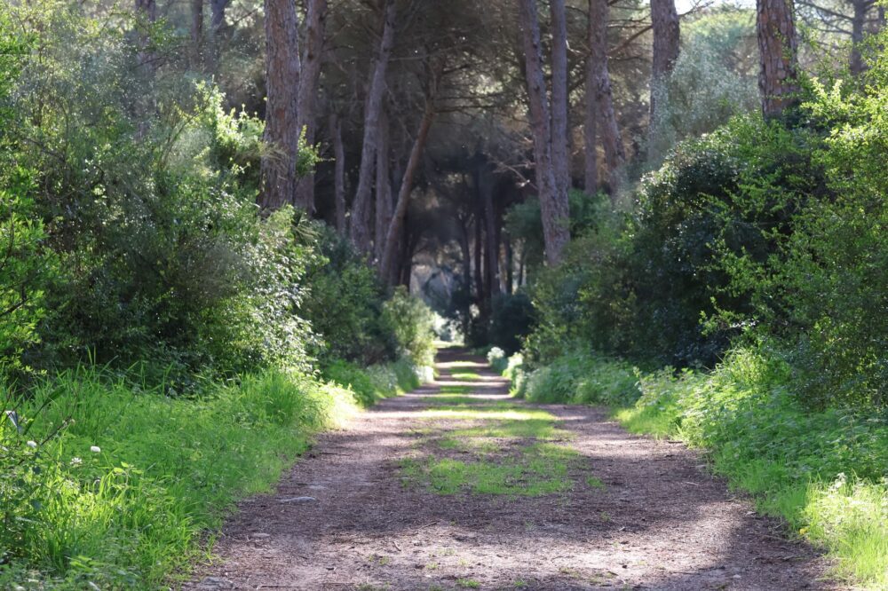
The geography of Naxos, the largest island in the Cycladic archipelago, is defined by a mountainous spine culminating in Mount Zas, a geological landmark over a thousand meters high that has historically dictated human mobility. Unlike other volcanic islands in the Aegean, Naxos features a predominantly granitic and marble geology, which has facilitated the construction of an ancient network of dry-stone paths and agricultural terraces. These routes not only respond to the logic of agrarian subsistence but also constitute a foundational rural transport infrastructure linking fertile interior valleys with coastal coves and roadsteads.
For centuries, the relative isolation between interior valleys—such as Tragea—and port enclaves forced the development of pedestrian engineering based on local gravel and dry masonry. The retaining walls, locally known as pezoulia, allow for the cultivation of Naxian potatoes, olive oil, and citrus fruits on steep slopes, while serving as foundations for paved pathways crossing the island from east to west. This primitive terrestrial connectivity depended entirely on human and animal labor, shaping a network of trade and exchange on a strictly local scale that survived almost unchanged until the second half of the twentieth century.
Road Architecture and the Conquest of Relief
The road modernization process in Naxos began redefining island geography late in the last century, when the first paved highways were laid to connect the capital, Chora, with interior settlements like Apeiranthos and Filoti. However, the rugged topography demanded specific technical solutions to prevent frequent rockfalls on the slopes of Mount Fanari and the gorges of Koronos. Road engineers had to integrate modern layouts while respecting ancient seasonal watercourses and marble terrain irregularities, utilizing stone-clad concrete retaining walls to blend interventions with the natural landscape.
This transition from bridle paths to vehicular roads was not without territorial tensions. While motorized transport facilitated the rapid transfer of perishable goods and mass tourism toward the beaches of Agios Prokopios and Plaka, it also triggered the progressive abandonment of numerous traditional hiking routes. Nonetheless, in recent years, a concerted effort between local authorities and hiking associations has enabled the cataloging and rehabilitation of dozens of kilometers of these historical paths, transforming them into an ecotourism asset that recovers the island’s original pedestrian connectivity.

The dry stone of Naxos is not merely an archaeological relic; it is the logistical skeleton that allowed humans to domesticate a mountain in the middle of the sea.
Cabotaje and Maritime Routes in the Cycladic Heart
Naxos’s geostrategic position in the center of the Cyclades has historically made it an indispensable logistical hub for Aegean navigation. The main port, located in Chora, operates as a convergence point for scheduled ferry lines connecting Piraeus with the Dodecanese and Crete. Port infrastructure has undergone successive expansions to accommodate modern high-speed vessels and heavy cargo roll-on/roll-off ships, a development that radically transformed the insular economy by accelerating the import of supplies and the export of marble and dairy products such as the famous graviera cheese.
However, operations at the port of Chora face constant challenges due to seasonal northern winds, known as the meltemi, which can paralyze maritime traffic for days during peak summer. To mitigate this vulnerability, smaller secondary piers on the eastern and southern coasts, such as Moutsouna, have been kept operational; these historically served to load emery extracted from interior mines. This minor cabotage system complements the major commercial route, recalling that insular survival has always relied on the versatility of its sea accesses.
Hanging Villages and Community Resistance
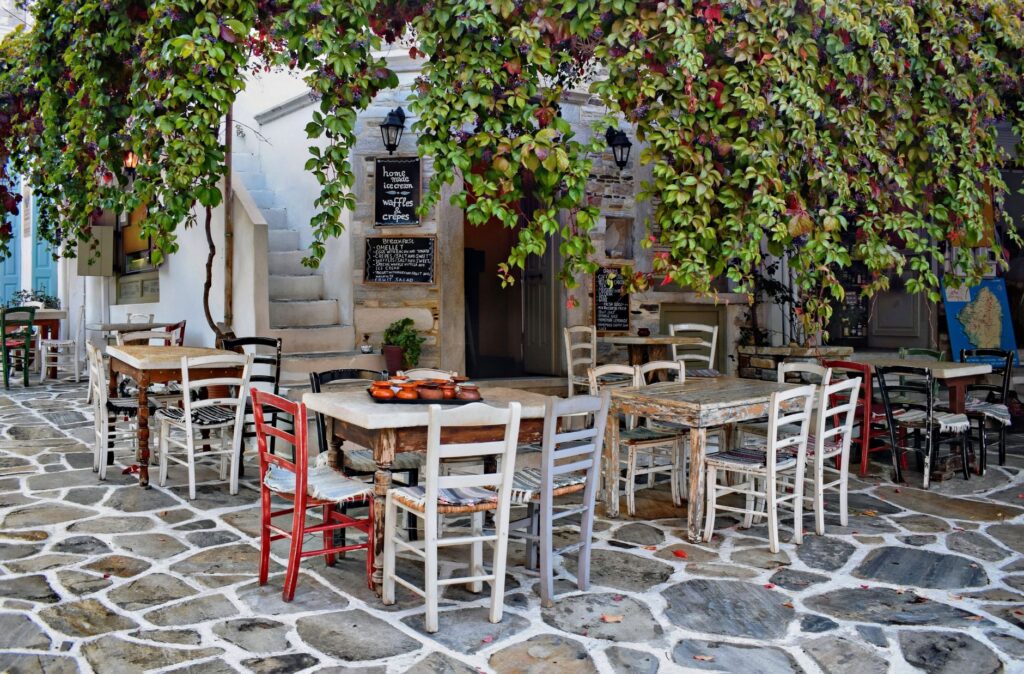
On the slopes of Mount Zas, settlements like Filoti and Apeiranthos demonstrate an exceptional capacity for architectural and social adaptation to their environment. Apeiranthos, in particular, stands out for its marble-paved alleys, Venetian towers, and a compact urban layout designed to protect against both medieval pirate incursions and climatic harshness. The internal connectivity of these villages relies on a labyrinthine network of pedestrian passages and stairways that restrict heavy vehicular traffic, preserving a communal social fabric unusual in heavily touristified areas.
The resilience of these communities against rural depopulation is sustained by the preservation of agricultural traditions, cooperativism, and the self-management of water resources. Traditional public washhouses, restored windmills, and stone fountains—testaments to traditional hydraulic engineering—continue to function as social meeting points. These elements reinforce an internal cohesion that contrasts with the economic seasonality of the coastal strip, demonstrating that the vital pulse of Naxos lies in the complementarity between its mountain communities and its maritime facade.

The Industrial Heritage of Emery and Mining Paths
Beyond agriculture and tourism, Naxos hosted a unique extractive industry during the twentieth century: the exploitation of emery, a high-purity abrasive mineral highly valued in international metallurgical manufacturing. The mines located in the heights of Koronos and Danakos required an extraordinary logistical system to transport the mineral down to the eastern coast. Engineering solutions culminated in 1930 with the construction of an impressive multi-kilometer aerial ropeway, whose metal lattice towers and intermediate stations still punctuate the island’s arid landscape as monuments of industrial archaeology.
The operation of the Moutsouna ropeway represented a revolution in insular connectivity, replacing the mule trains that for decades carried heavy sacks of emery along steep mountain trails. Although the system is currently inactive and undergoing heritage preservation studies, adjacent mining paths continue to serve as exploration routes for hikers interested in the Cycladic industrial history. This forgotten heritage illustrates the technical adaptability of an isolated insular society facing global market demands.

Practical guide
Planning a trip to Naxos requires understanding its dual nature: a heavily developed coast geared toward sun-and-sea tourism and a mountainous interior that demands patience and respect for rural rhythms.
How to get there
- By Air: Naxos National Airport (JNX) operates daily scheduled flights exclusively from Athens International Airport (ATH). The runway is short, meaning only small turboprop aircraft can operate. Advance booking months ahead is strongly recommended due to high seasonal demand.
- By Sea: The port of Chora connects daily with Piraeus via conventional ferries (taking 5 to 6 hours) and high-speed catamarans (approximately 3.5 hours). Frequent connections also exist with neighboring islands such as Paros, Mykonos, Santorini, and Amorgos.
Internal transportation
- KTEL Buses: The public bus network connects Chora with major beaches and villages like Filoti, Apeiranthos, and Apollonas. Schedules expand considerably during summer months, though off-season frequencies may drop to a couple of services daily.
- Car Rental: Essential for exploring rural areas and secluded coves. A compact or mid-size car is recommended, as some mountain village streets are extremely narrow. Quads and scooters are popular but discouraged for long mountain drives due to strong winds.
Accommodation and gastronomy
- Stay Areas: Chora offers the highest concentration of hotels and amenities; Agios Prokopios and Agia Anna are ideal for direct beach access; the Tragea valley (Filoti, Chalki) provides an authentic rural tourism experience and cooler nighttime temperatures.
- Local Produce: Naxos stands out in the Greek gastronomic scene for its food self-sufficiency. Essential products include Protected Designation of Origin Naxian potatoes, local cheeses like graviera and arseniko, and kitron citrus liqueur produced at Chalki’s historic distillery.
The traveler who only visits the beaches of Naxos misses the island’s true engine: a vertical archipelago of stone and memory.
Epilogue: Twilight Light Over the Portara
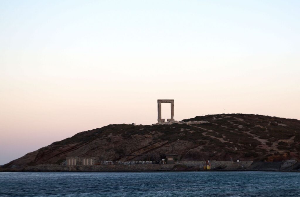
As the sun begins to sink over the Aegean Sea, the millennial marbles of the Portara—the monumental unfinished doorway of the Temple of Apollo crowning the islet of Palatia in Chora—acquire a golden hue that synthesizes Naxos’s ancient identity. Erected in the 6th century BCE under the tyrant Lygdamis, this monumental threshold was never completed, becoming the enduring symbol of an interrupted yet lasting ambition. From this stony watchtower, the steady coming and going of ferries entering and leaving the harbor contrasts with the stony silence of archaic ruins, recalling that modern connectivity is merely the latest link in a millennial maritime chain. Here, where contemporary naval engineering meets the myths of Theseus and Ariadne, the island reveals its true scale: a territory where every stone preserves the memory of the winds, paths, and tides that have woven, century after century, the unalterable pulse of the central Aegean.