
Introduction to a Territory of Limestone Horizons
At the southern tip of the Apulia region, where the Adriatic and Ionian seas converge along a shared horizon, the Salento peninsula unfolds a landscape where limestone and centennial olive groves dictate the rules of human mobility. Historically conceived as a natural stepping stone toward the eastern Mediterranean, this flat, sun-drenched territory has relied for centuries on a network of rural paths, narrow-gauge railway lines, and small fishing ports that today form a connectivity system as fragile as it is fascinating. Unlike the grand alpine arteries or the complex insular systems of northern Europe, Salento operates under a logic of Mediterranean slowness, where every dirt track and nineteenth-century railway station reveals an intricate relationship between geographical isolation and commercial openness.
The purpose of this report is to examine the transportation infrastructure and historical flows that sustain life in this southern corner of Italy, stripping the territory of its usual summer postcard reading. Through an analysis of local railway connections, the defensive architecture of ancient masserie, and the evolution of coastal routes, we will explore how Salentinian communities have historically negotiated their relationship with the territory, confronting the contemporary challenges of mass tourism without losing the identity of their traditional pathways.
The Network of Dry Stone: Rural Paths and Agrarian Boundaries
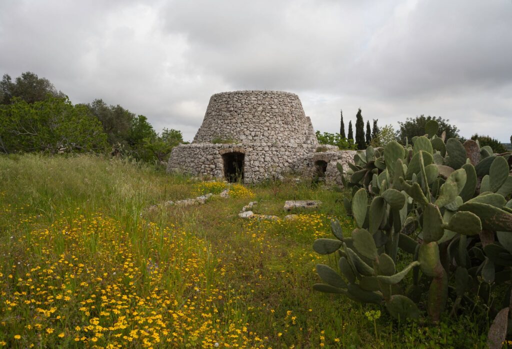
The Salentinian landscape is indelibly defined by kilometers of dry-stone walls, locally known as muretti a secco, which not only demarcate agricultural boundaries but structure the secondary road network connecting interior villages. These routes, carved directly into the calcareous bedrock, served for centuries as the sole communication channels for transporting olives, wine, and wheat to local markets and shipping ports.
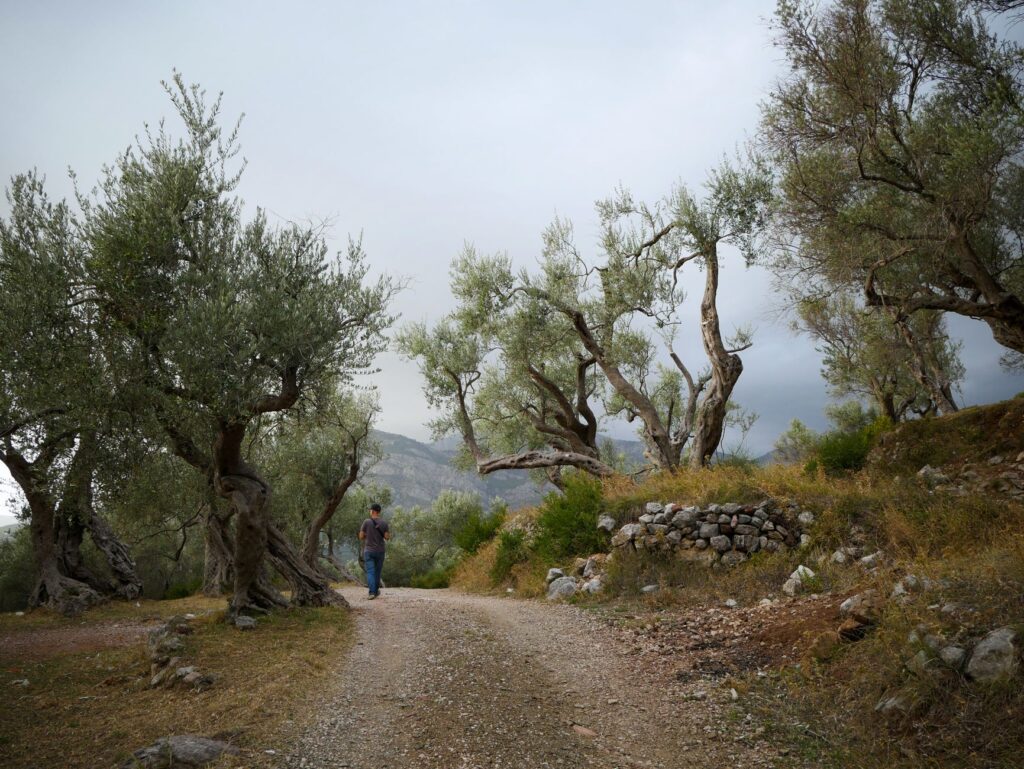
The construction of these paths required a profound geological understanding of the terrain. The parracini, master stone artisans, used rock fragments extracted during plowing to build mortarless barriers capable of withstanding seasonal floods and fierce siroco winds. Today, many of these rural arteries have been paved or integrated into slow-cycling routes, but their original layout remains intact, evidencing a millennial territorial planning that prioritized water permeability and the optimization of short journeys between estates.
Dry stone in Salento is not merely a landscape ornament, but the foundational infrastructure that enabled human habitation in an arid territory exposed to the elements.
Along these routes, masserie—large fortified agricultural estates dating in many cases from the sixteenth and seventeenth centuries—act as historical logistic nodes. These self-sufficient complexes featured olive presses, granaries, and watchtowers to fend off Saracen incursions, operating as small fiefdoms where both agricultural production and terrestrial access control were centralized.
Railways of the Sun: The Narrow-Gauge Tracks of Ferrovie del Sud Est
If rural stone paths structure the agricultural fabric, the railway system historically managed by Ferrovie del Sud Est (FSE) constitutes the backbone of public transport on the Salento peninsula. Conceived in the late nineteenth century and developed throughout the early decades of the twentieth, this narrow-gauge network first connected the small farming municipalities of the interior with the main cities of Lecce, Brindisi, and Taranto, breaking the secular isolation of peasant communities.
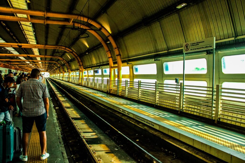
Railway stations in towns such as Gallipoli, Maglie, and Otranto share a common architectural pattern: single-story masonry buildings with gabled roofs and adjacent freight warehouses where wine barrels and olive oil vats were weighed and loaded before shipment to northern ports. Although freight transport by rail has almost completely disappeared, replaced by heavy road freight, FSE tracks continue to transport thousands of local students and commuters.
The operational challenges of this network are notable. The slowness of the trains, due to the sinuosity of the original layouts and the lack of comprehensive electrification across numerous sections, has made the line the subject of ongoing debate regarding infrastructure modernization in southern Italy. Nevertheless, for the observant traveler, this railway offers a privileged window into the backstage of everyday Salento, far from the fast tracks of national high-speed rail.
Cabotage Ports and Coastal Towers: Watching the Adriatic
Salento’s maritime facade, characterized by low limestone cliffs and small sandy coves, features a dense historical network of minor port infrastructures and coastal fortifications. Ports such as San Foca, Castro, and Santa Maria di Leuca functioned for centuries as nodal points for regional cabotage, enabling the exchange of goods with the Balkans and the Greek islands without relying on the major mercantile centers of Bari or Brindisi.
This seafaring vocation was closely tied to defensive needs. Along the entire Salento coastline stands an uninterrupted visual chain of watchtowers—such as Torre del Serpiente in Otranto or Torre Specchiulla—built during the Spanish viceroyalty in the sixteenth century to spot Turkish galleys. Each tower was designed to maintain direct visual contact with adjacent ones, allowing alarm signals to be transmitted via smoke by day and fire by night over dozens of kilometers within minutes.
- Watchtowers: 16th-century defensive optical system based on coastal intervisibility.
- Cabotage Ports: Natural shelters and historical basins for inshore fishing and coastal trade.
- Coves and marinas: Former fisherman anchorages transformed into seasonal settlements.
The synergy between these defensive structures and small ports defined a littoral economy based on self-sufficiency and constant alert. Today, the transformation of these anchorages into marinas has substantially altered their original function, though vestiges of traditional maritime architecture persist in the stone piers and artisanal caulking workshops still operating in secluded corners of the Adriatic coast.
Demographic Pulse and Transport Seasonality
One of the greatest structural challenges of contemporary Salento lies in the extreme seasonality of its mobility flows. During winter months, the peninsula experiences a marked demographic contraction and a drastic reduction in public transport frequency, adapting to an aging resident population dispersed across rural hamlets. However, with the arrival of summer, the floating population multiplies exponentially, congesting secondary roads leading to the beaches of San Focà, Gallipoli, or the Maldives of Salento.
This seasonal duality tests the resilience of local infrastructure. Provincial roads, designed for moderate agricultural traffic, suffer chronic congestion during July and August, while the public bus network operated by Salento in Bus attempts to compensate for train shortcomings through seasonal reinforcements connecting Brindisi and Bari airports with major coastal localities.

Local administrations have sought to mitigate this impact by promoting long-distance bike lanes, such as the Salento section of the Ciclovia dell’Acquedotto Pugliese, which repurposes historical hydraulic infrastructure to provide alternative routes off the asphalt. Nonetheless, private vehicle dependency remains high, raising urgent questions about the long-term environmental sustainability of a tourism model based on mass road access.
Practical guide
How to get there: The primary reference airport is Brindisi-Casale Airport (BDS), located about 40 kilometers north of Lecce, featuring regular domestic and international flight connections. From there, bus and train services connect with the regional railway network of Ferrovie del Sud Est.
When to travel: Spring months (April to June) and early autumn (September to October) offer the best climatic conditions and traffic density for exploring the territory at a leisurely pace. July and August concentrate peak summer tourism and road congestion.
Internal transport: Renting a vehicle is the most flexible option for exploring rural areas and dry-stone paths between masserie. For specific urban and coastal journeys, the combined network of regional trains and seasonal buses covers main hubs, though prior planning is required due to reduced frequencies outside school or seasonal timetables.

Accommodation and gastronomy: Numerous historical masserie have been converted into rural lodgings (agriturismi), offering an immersive experience in traditional agricultural architecture. Local gastronomy revolves around extra virgin olive oil, durum wheat bread, and local pastas such as orecchiette, paired with native wines like Primitivo and Negroamaro.
Epilogue: The Silence of Centennial Olive Groves
As evening falls, when the heat of the southern sun gives way to the breeze blowing simultaneously from the Adriatic and the Ionian, Salento recovers its ancestral rhythm. In the fields flanking the dry-stone paths, the twisted trunks of centennial olive trees—many severely affected over the past decade by the Xylella fastidiosa epidemic—stand silhouetted against a sky of ochre and violet tones, reminding the traveler that the true measure of this territory lies not in the speed of its modern transits, but in the depth of its geological and human memory.
Salento’s connectivity, far from being a mere display of asphalt or railway engineering, reveals itself as a secular pact between humanity and the calcareous soil of southern Italy. A delicate balance between the need to open up to the outside world and the desire to preserve intact the identity of its white-stone villages, where every rural road continues to tell the same millennial story of Mediterranean endurance and rootedness.