
Introduction to Norway’s Northern Frontier
The Lofoten archipelago, situated far above the Arctic Circle in Nordland county, represents one of Europe’s most geologically dramatic landscapes. For centuries, this labyrinth of jagged peaks was isolated by the ferocious currents of the Vestfjorden and narrow sea channels. The survival of its inhabitants depended entirely on rowboats and the mastery of reading tidal currents through treacherous water gaps.
In recent decades, a bold civil engineering policy has radically transformed this geography of isolation. The culmination of the E10 highway, popularly known as King Olaf’s Road, has stitched the main islands together using a sophisticated system of monumental bridges and tunnels carved beneath the seabed. This report examines how modern connectivity has redefined the territory, balancing logistical development with the preservation of a fragile, sea-bound identity.
The Historical Evolution of Insular Mobility
Before the advent of major road infrastructure, transportation across Lofoten relied on historic coastal steamer services and local vessels known as fembøring. Travel between the islands of Austvågøy, Gimsøy, Vestvågøy, and Flakstad was entirely dictated by weather conditions. Winter storms could isolate entire communities for weeks, turning a simple channel crossing into a high-risk venture.
Territorial integration began to take shape in the mid-20th century, but it was not until the inauguration of major engineering projects in the late 1980s and 1990s that the archipelago underwent a true connective revolution. Traditional ferry routes were gradually replaced by pile-supported causeways and suspension structures capable of withstanding the gale-force winds of the Norwegian Sea.
Engineering Milestones of the E10 Route
The backbone of Lofoten is undoubtedly the European route E10, which enters the archipelago from the mainland at Bjerkvik and winds its way to the remote village of Å. Along this route, engineers had to contend with deep fjords and impassable rocky promontories. The solution required a masterful combination of civil works that continues to amaze travelers and transportation specialists alike.
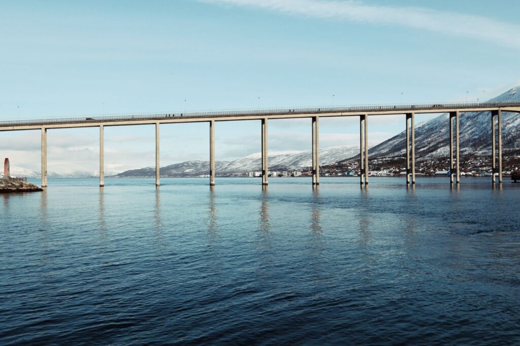
Among the standout structures is the Gimsøystraumen Bridge, opened in 1981, which spans 840 meters across a strong tidal channel using a prestressed box-girder design. This bridge not only united two key islands but proved the technical viability of erecting large-scale structures in severe Arctic environments.
Colossal Bridges Over Indomitable Channels
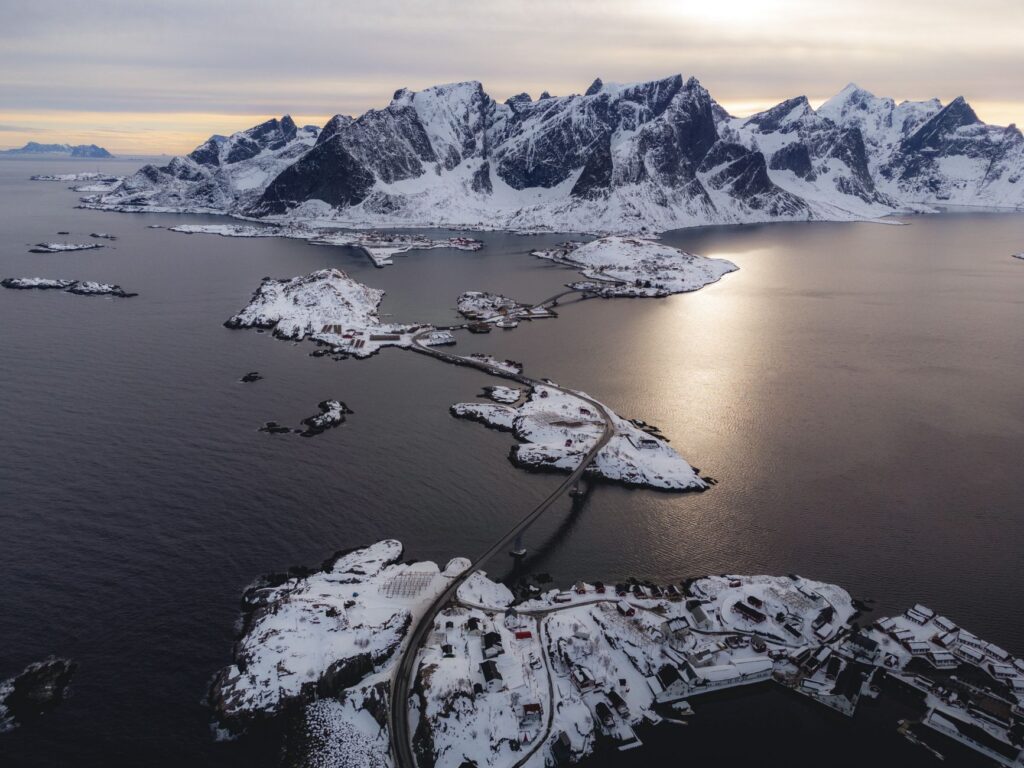
Traveling west along the E10 means crossing a dizzying succession of arched bridges that appear to float between overcast skies and dark waters. The Lofoten bridge system (Lofotforbindelsen) is an exercise in biomimicry and resilience. The structures are designed with high clearance to permit the passage of traditional fishing vessels and coastal ferries operating on secondary routes.
The technical complexity lies in the marine foundations. The piers of these bridges must withstand the constant onslaught of spring tides and seasonal ice pressure. Engineers utilized submerged reinforced-concrete foundations and deep-rock anchors, ensuring structural stability that has weathered historic storms without major failures.
The road is not merely a communication route; it is the invisible thread keeping the economic heart beating in islands sculpted by ice and salt.
Aerodynamic Design Against Polar Winds
One of the greatest challenges in constructing the Lofoten bridges is wind force. During winter months, hurricane-force gusts originating from the North Atlantic can reach critical velocities. For this reason, bridge decks incorporate specialized aerodynamic profiles and perforated wind barriers that reduce turbulence and prevent light vehicles from losing stability.

This attention to technical detail ensures that the archipelago’s main artery remains open for as long as possible, minimizing disruptions in perishable freight delivery and passenger transport to mainland medical centers.
Subsea Tunnels and the Elimination of Bottlenecks
Where orography precluded the construction of bridges or viaducts, Norwegian engineering opted to descend into the depths. Subsea tunnels (undersjøiske tunneler) became the definitive solution for connecting islands separated by abyssal channels. The Faksund and Nappstraumen tunnels are paradigmatic examples of this subterranean technology.
The Nappstraumen tunnel, plunging 63 meters below sea level with a maximum gradient of 8%, connects the islands of Vestvågøy and Flakstad. Its construction required sealing complex geological faults and advanced pumping systems to manage saltwater infiltration, setting an international standard in underwater excavation engineering.
Safety and Ventilation in Submarine Environments
Operating subsea tunnels in remote areas poses extraordinary operational demands. Ventilation systems must continuously refresh air fouled by heavy traffic, while carbon monoxide sensors and closed-circuit television monitor every meter of the roadway in real time.
Additionally, pressurized refuge chambers and adaptive lighting systems have been installed to prevent driver visual fatigue when transitioning between intense sunlight reflected off exterior snow and the artificial dimness of the tunnel.
The Seafood Economy and Fish Transportation
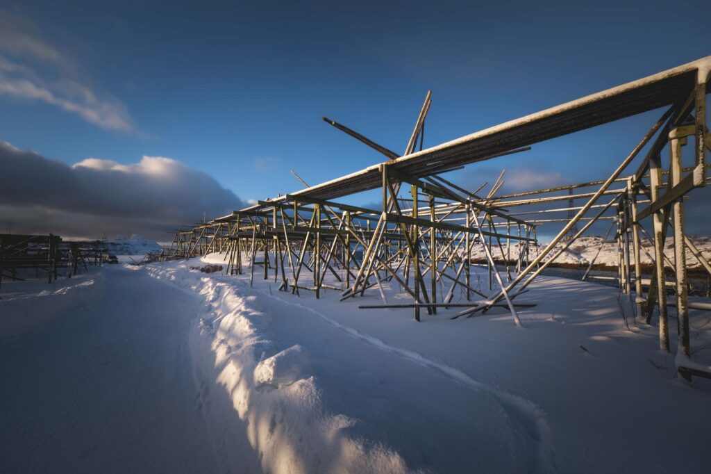
Lofoten’s road infrastructure was not conceived solely for tourism; its fundamental raison d’être is the fishing industry. The archipelago is the global epicenter for the production of tørrfisk (air-dried cod), an ancient export product requiring an exceptionally efficient logistics chain to reach European markets in record time.
Before the unified road network, fish had to be transported via coastal cabotage vessels with inevitable weather-related delays. Today, refrigerated trucks load fresh produce at ports in Reine or Henningsvær and cross the network of bridges and tunnels to connect directly with railway lines in northern Sweden and the European continent.
The Modernization of Fishing Ports
Alongside roads, local docks have undergone profound transformation. Historic ports like Svolvær and Leknes now feature automated unloading facilities, high-capacity cold storage, and deep drafts capable of receiving larger commercial vessels, ensuring the economic competitiveness of local communities against globalized industrial fishing.
Mass Tourism and Sustainability in the Road Network
Lofoten’s opening to continuous road traffic has brought exponential growth in international tourism. During summer months, the E10 absorbs thousands of vehicles including motorhomes, cars, and tour buses, testing the carrying capacity of infrastructure originally designed for local traffic.
This phenomenon has forced regional authorities to implement strict traffic management measures and invest in expanding panoramic viewpoints (nasjonale turistveger) equipped with boardwalks and sanitation facilities that protect the fragile natural environment from mass visitor erosion.
The Environmental Impact of Infrastructure in Fragile Ecosystems
Building roads and bridges in an Arctic environment requires a delicate ecological balance. E10 construction works had to bypass protected seabird nesting zones and indigenous fish spawning grounds. Prior environmental impact assessments demanded the installation of natural acoustic barriers and drainage systems preventing road salt and fuel runoff from contaminating the pristine fjord waters.
Practical guide
Getting There: The main overland access route is the E10 highway from Narvik and Evenes. Regular air connections are also available to Leknes Airport (LKN) and Svolvær (SVJ) via regional flights from Bodø, alongside daily ferry services from Bodø to Moskenes.
When to Travel: To enjoy continuous daylight and favorable road conditions, the period between May and August is ideal. The winter season (January to March) offers spectacular northern lights and snowy landscapes, but requires experience in winter driving over ice sheets.
Driving Requirements: Vehicles must be fitted with appropriate winter tires between November and April. It is essential to consult the official Norwegian traffic portal (Vegvesen) for road conditions and potential temporary closures due to blizzards.
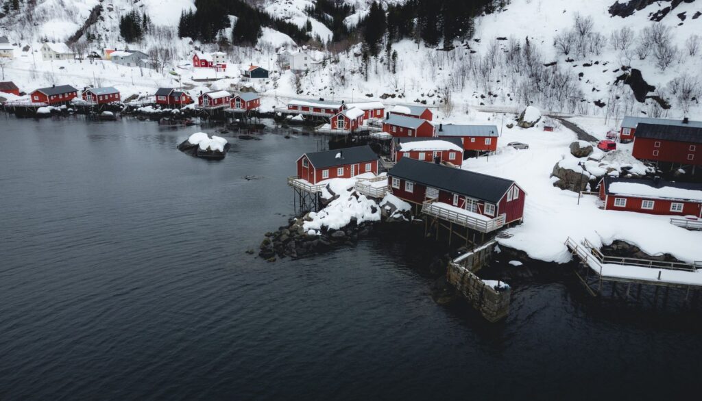
Recommended Accommodation: Opt for traditional rorbuer—restored former fishermen’s cabins converted into tourist lodgings set on wooden stilts at the water’s edge—in locations such as Reine, Hamnøy, and Nusfjord.
Transport Logistics: Renting an electric vehicle is an excellent option as Lofoten’s fast-charging network is well developed, though range planning must account for low temperatures and battery consumption on steep inclines.
Emotional Epilogue on the Threshold of the Norwegian Sea
At dusk, when the golden light of the midnight sun bathes the granitic peaks of Reinebringen and the reflection of stagnant water breaks at the silent passage of a cormorant, Lofoten’s great steel and concrete structures seem to shed their cold technical nature. In that moment of stillness, bridges and tunnels reveal themselves not merely as marvels of modern engineering, but as the natural continuation of human effort to inhabit the planet’s most beautiful and hostile confines. They are the invisible threads ensuring the pulse of these Arctic islands never fades against the immensity of the ocean.