

Origins and Geography of a Volcanic Outpost
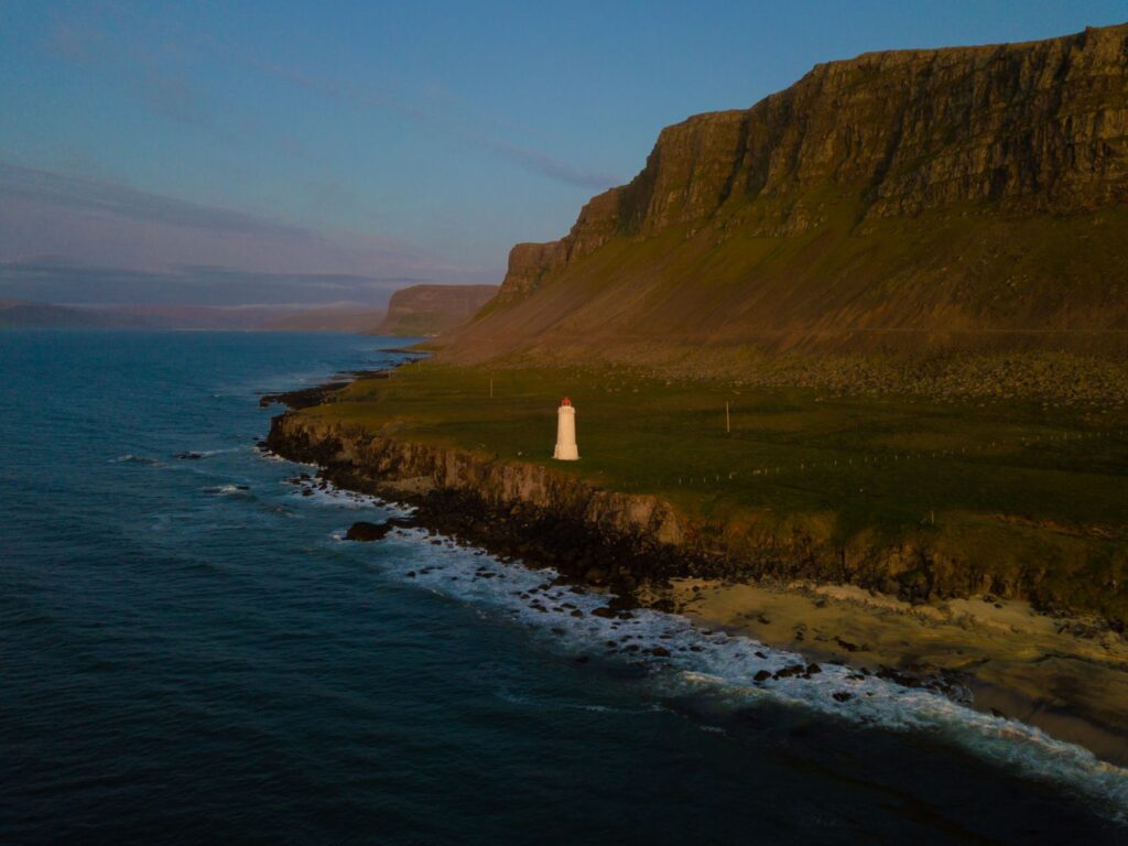
Iceland’s Westfjords, known locally as Vestfirðir, represent one of the country’s most geologically ancient landmasses. Carved by glacial erosion over millions of years, their basaltic cliffs rise vertically above the dark waters of the North Atlantic, creating a labyrinth of sea arms that cut deep into the mainland. Unlike the traditional tourist routes in the south of the country, this region maintains a physical and climatic isolation that conditions any attempt at marine or terrestrial exploration. The complex topography does not permit fast roads; instead, paths wind along the edge of maritime abysses or cross mountain passes frequently blocked by snow.
Understanding the dynamics of this territory requires analyzing the interaction between ocean currents and the subarctic atmosphere. Here, cold water originating from the Arctic collides with warmer branches of the Gulf Stream, generating local microclimates where dense fog and hurricane-force winds can appear without warning. Human settlements, historically established in narrow coastal strips between sea and mountain, have depended on fishing and maritime access for survival. This dependence has forged a unique seafaring culture, where every inlet bears a name tied to shipwrecks, treacherous currents, and natural emergency shelters.
Nautical Planning and Coastal Logistics
Embarking on a traverse of the Westfjords requires a phase of logistical preparation as rigorous as that demanded in the open ocean. Vessels, whether reinforced sailboats or expedition kayaks, must carry redundant navigation systems, as satellite signals can be obstructed by the height of the rock walls. It is essential to study local nautical charts weeks in advance, paying special attention to shallow rocky areas that emerge suddenly at the mouths of the fiords. The tide in this area presents significant ranges, generating tidal currents capable of reaching critical speeds in the narrow passages between islands and peninsulas.
Fuel and provision management is another critical pillar of the expedition. Being an environment with an extremely low population density, technical replenishment points are scarce and far apart. Navigators must plan alternative routes aimed at seeking safe shelter upon the imminent arrival of Atlantic depressions. VHF radio communications are the umbilical cord with the Icelandic Coast Guard, whose headquarters in Reykjavik constantly monitors maritime traffic in these northern waters. The obligation to register the route plan before setting sail is not a mere bureaucratic formality, but a survival tool validated by decades of rescues in the area.
Extreme Meteorology and Boreal Sky Reading
The climate of the Vestfirðir is dominated by instability. Cold fronts descending from Greenland collide with warm European air masses, unleashing katabatic wind phenomena locally known as ós. These winds descend with violence from the elevated plateaus to sea level, transforming a seemingly calm surface in a matter of minutes. For expedition members, constant barometric reading and observation of cloud formations over the summits are vital habits. A lenticular cloud over a fiord peak invariably indicates the arrival of gusty winds that advise against any coastal navigation.
Water temperature, which rarely exceeds nine degrees Celsius even in midsummer, makes the use of immersion suits or watertight protective gear mandatory. A miscalculation resulting in a fall overboard reduces physical response capacity within minutes due to incipient hypothermia. Therefore, onboard safety protocols require permanent lifeline systems and man-overboard drills before venturing into more exposed sections, such as Cape Hornbjarg, the northernmost point of the Hornstrandir peninsula, where cliff walls drop sheer into the open sea.
Life in the Abandoned Settlements of Hornstrandir
The Hornstrandir Peninsula, located at the northern tip of the Westfjords, was systematically depopulated in the mid-20th century due to the unsustainable harshness of living conditions and winter isolation. Today, this territory constitutes a nature reserve where human presence is exclusively seasonal. The old wooden farmhouses, built with materials brought in by the sea, stand as silent witnesses to a subsistence economy based on seabird hunting, eiderdown gathering, and artisanal fishing.

Exploring these abandoned settlements provides insight into the resilience of former inhabitants. The vestiges of old docks, stone corrals, and fish-processing structures blend into the tundra and cliff landscape. Reserve regulations are strict: leaving traces, lighting open fires, or altering historical structures is strictly prohibited. Expedition members landing on these shores must be completely self-sufficient, carrying not only their food but also all generated waste, thereby preserving the fragile ecology of an area where moss and lichen vegetation takes decades to recover from a single footprint.
Marine Fauna and Seabird Colonies
The cliffs of the Vestfirðir host some of the largest seabird colonies in the North Atlantic. During the summer months, millions of puffins, black-legged kittiwakes, guillemots, and razorbills invade the rocky ledges to breed. This display of life contrasts with the severity of the mineral environment. From a navigational standpoint, the massive presence of birds on the water’s surface often marks the location of forage fish schools, serving as a natural guide for reading the biological richness of the marine ecosystem.
In the deep waters of the fiords, cetacean sightings are frequent. Humpback whales and fin whales regularly enter in search of krill and small fish, while grey and harbor seals rest on tidal sandbanks and rocks. Navigators must maintain a prudent distance to avoid altering the feeding behavior of these protected species. Respectful observation from motorless boats or silent electric-propulsion craft offers an intimate perspective of arctic fauna, reminding us that the sea is the primary habitat of these creatures and that humans are mere temporary observers.
Vernacular Architecture and Transport Infrastructure
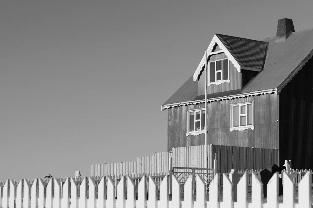
Human adaptation to the hostile environment of the Westfjords is clearly manifested in its vernacular architecture and the evolution of its communication infrastructures. Traditional turf-roofed and stone-walled houses, designed to withstand polar wind assaults and harness the earth’s thermal inertia, have progressively given way to wooden structures clad in corrugated metal sheeting—an imported material that proved highly resistant to salt corrosion and persistent humidity.
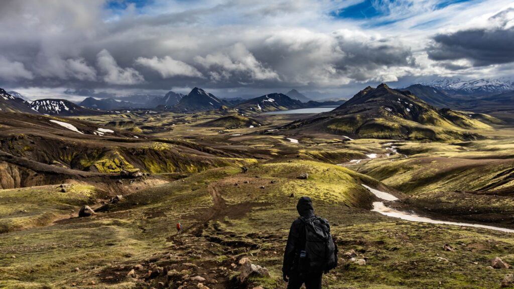
On the other hand, the road network is a work of constant engineering. Single-lane tunnels excavated into live rock, equipped with lateral pull-outs to allow vehicles to pass each other, dot the routes communicating the different fiords. These tunnels not only shorten distances but bypass the most dangerous mountain passes, traditionally impassable for much of the year. For travelers combining nautical traverses with land segments, understanding how these passes work and reading meteorological warning signs is an indispensable requirement to avoid getting trapped by rockfalls or snow avalanches.
Cultural Heritage and Fishing Traditions
The cultural identity of the Vestfirðir is inextricably linked to the fishing industry and the processing of Greenland shark, traditionally known as hákarl. In villages like Bolungarvík and Ísafjarðarbær, local maritime museums preserve period wooden boats and oral testimonies recounting the dangers of deep-sea fishing in rowed sailing boats. This maritime heritage is reflected in local gastronomy, based on air-dried seafood preserved through ancestral techniques that require no artificial refrigeration.
The region’s folklore is populated by tales of sorcerers, ghosts, and sea monsters that supposedly inhabited the depths of the fiords. Far from being mere children’s stories, these accounts historically functioned as community warning mechanisms regarding the real dangers of the sea and steep mountains. For the contemporary traveler, delving into this cultural substrate adds a layer of interpretive depth that transforms a simple geographical journey into an immersion in the collective memory of a community isolated by geography yet intimately connected to the ocean’s rhythm.

The isolation of the Westfjords is not an obstacle for the traveler, but rather the natural filter that preserves the authenticity of a landscape where human scale vanishes before the immensity of basalt and open sea.
Practical guide
How to get there: Access to the region is primarily achieved via the Ring Road by turning onto Route 60 north from Borgarnes. Regular flights also operate from Reykjavik Domestic Airport to Isafjordur, subject to cancellation due to adverse weather conditions.
Best time for expedition: The months of June, July, and August offer the continuous daylight hours necessary for coastal navigation and relative weather stability, although summer storms remain possible.
Recommended technical equipment: GPS navigation system with updated nautical charts, approved marine VHF radio, dry suit or immersion suit, high-mountain camping gear resistant to winds exceeding 100 km/h, and satellite communication devices.
Permits and regulations: Wild camping is regulated throughout the region and strictly prohibited in nature reserve areas like Hornstrandir, where camping is only allowed in designated areas and with prior authorization from the environmental agency.
Safety and emergencies: The general emergency number in Iceland is 112. Registering the travel plan on the SafeTravel.is platform is mandatory before initiating any maritime or land route in remote areas.
Silence and Memory at the Edge of the Sea
The end of a traverse through the Westfjords usually coincides with the silent contemplation of a boreal sunset where the sun, without completely disappearing below the summer horizon, tints the basalt walls with intense golden and purple hues. In that moment of pause, after days of tension at sea and constant reading of cartography and barometers, the traveler comprehends the true scale of the explored territory. It is not about conquering a peak or the distance covered in nautical miles, but about achieving harmony with a millennial natural rhythm that continues to dictate the rules at the northern confines of Europe.