Japan’s northernmost frontier is defined by a visceral relationship with the sea, where the currents of the Pacific Ocean and the Sea of Okhotsk converge to carve a geography as breathtaking as it is unforgiving. In this vast insular territory, connectivity is never merely an administrative or commercial matter; it is the very pulse that keeps coastal communities alive through grueling winter months. Through a meticulous network of ports, deep-water ferry routes, and coastal highways safeguarded by avalanche sheds, Hokkaido demonstrates how civil engineering can outmatch nature’s harshest elements in East Asia.
Understanding the region’s logistics requires looking past the high-speed bullet trains dominating Honshu. Here, maritime transport remains an indispensable backbone for heavy freight supply and the integration of peripheral populations. From the bustling docks of Hakodate in the south to the remote staging posts of Wakkanai facing the Kuril Islands, Japanese port infrastructure operates with chronometric precision, defying violent seas and seasonal sea ice sheets.
The Port Genesis of the Tsugaru Strait
Historical access to Hokkaido has always been dictated by the treacherous waters of the Tsugaru Strait. For centuries, this maritime channel functioned as a natural barrier isolating the northern island from the rest of the Japanese archipelago. Transforming this isolation into a seamless logistical corridor began with the modernization of the ports of Hakodate and Aomori, establishing a pioneering rail ferry system that for decades carried entire passenger and freight trains across ships specially designed to withstand the strait’s currents.

Today, even though the Seikan Tunnel bores through the seabed over one hundred meters below, conventional and high-speed ferries continue to fulfill an irreplaceable role. They not only carry massive volumes of heavy commercial freight but also offer travelers a unique perspective on the northern geographical scale. Local port authorities continually invest in basin dredging and automated docking system upgrades to ensure safe operations even under late autumn gale-force winds.
Engineering Against the Sea Ice of Okhotsk
On the northeastern coast, geography presents even more complex challenges. During January and February, drifting ice floes originating from Siberian regions descend upon Hokkaido’s shores, choking entire coves and paralyzing conventional navigation. To counter this phenomenon, the Okhotsk region relies on specialized vessels and icebreakers operating from key ports such as Mombetsu and Abashiri.

These ports feature reinforced concrete quays engineered to withstand the lateral pressure of moving ice fields. Urban and maritime planning at these latitudes requires seamless synchronization between national meteorological services and port authorities. When ice seals the routes, emergency protocols swing into action to guarantee that smaller islands and isolated fishing villages receive fuel, fresh produce, and medical assistance without interruption.
Long-Distance Maritime Routes and Island Cabotage
Hokkaido’s ferry network extends far beyond the strait crossing with Honshu, encompassing a vast constellation of long-distance routes linking the main island with ports as distant as Nagoya, Sendai, and Tokyo. These shipping lanes act as fundamental logistical arteries for the region’s agricultural and fishing industries, allowing perishable goods such as seafood, dairy, and vegetables to reach central Japanese markets in optimal freshness.
On a local scale, island cabotage connects Hokkaido with peripheral archipelagos like Rishiri and Rebun in the Sea of Japan. These local ferries are custom-built to handle the short, violent swells characteristic of the area.
The true sovereignty of an insular territory is measured not by its land borders, but by the unwavering reliability of its wakes upon the sea.
Aboard these vessels, daily life unfolds in respectful silence; local residents, students, and occasional travelers share heated lounges while the ship’s hull cleaves through grey waters beneath a leaden sky.

Intermodal Integration in Northern Terminals
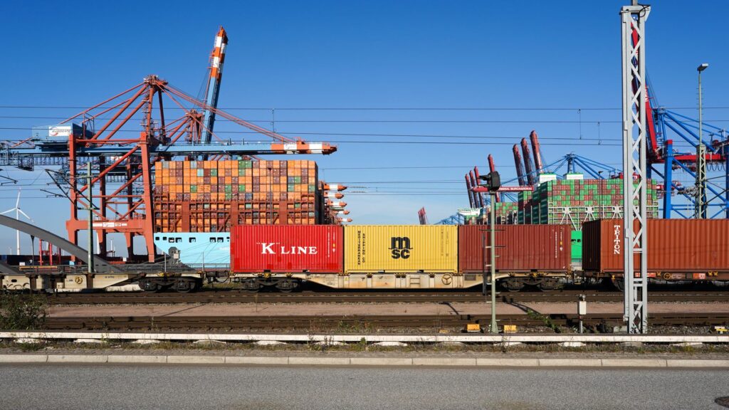
One of Hokkaido’s greatest logistical triumphs lies in the seamless integration among port, rail, and road systems. At key terminals such as Tomakomai—the island’s busiest commercial port—roll-on/roll-off (ro-ro) ferry basins link directly with major national highways and Japan Railways freight lines. This layout drastically cuts down cargo transfer times, minimizing regional transport’s carbon footprint and streamlining the supply chain.
Transport planners have prioritized accessible intermodal station design, where passengers arriving by ferry can transition immediately to connecting buses or regional trains without stepping outside heavy snow shelters. This structural fluidity is especially critical during winter blizzards, when roads may temporarily turn impassable, forcing the system to rely on the combined resilience of rail and port infrastructure.
The Coastal Road Network and Winter Defense
If the sea forms Hokkaido’s grand outer corridor, the coastal road network represents the connective tissue uniting communities scattered across thousands of kilometers of rugged coastline. Keeping these roads operational through winter demands a massive deployment of civil engineering resources. Road authorities manage fleets of snowplows equipped with GPS technology and high-capacity milling systems operating uninterrupted from the early morning hours.

Along stretches most exposed to whiteouts and powder snow avalanches, roads vanish beneath kilometer-long concrete tunnels and translucent windbreak galleries. These structures not only shield wheeled traffic from the elements but also prevent prolonged closures of routes vital to the insular economy. Smart signage, solar-powered and built with cold-resistant LED panels, guides drivers when visibility drops to mere meters during blinding snowstorms.
Socioeconomic Impact on Fishing Communities
The stability of this multimodal transport network directly impacts the demographic and economic survival of Hokkaido’s fishing towns. Communities like Rumoi or Esashi depend entirely on the efficiency of these routes to market their daily catch of sea urchin, scallops, and salmon. When connectivity fails, economic losses for local cooperatives are immediate, underscoring the strategic importance of public investment in transport infrastructure within depopulated zones.
Beyond commercial freight, these links guarantee access to higher education, specialized medical care, and centralized administrative services for rural residents. Assured mobility curbs youth exodus toward southern metropolises as much as possible, enabling Hokkaido’s traditional coastal culture to maintain generational continuity despite winter geographic isolation.
Practical Guide
Planning a journey or a logistical analysis across Hokkaido’s coastal transport network requires understanding the operational nuances of northern Japan, where meteorological conditions dictate schedules and routes.
- Maritime Route Planning: Major ferry operators such as Tsugaru Kaikyo Ferry and Ferries Sunflower maintain regular year-round connections, but booking weeks in advance is essential when traveling with vehicles during the New Year holidays or the Obon festival.
- Winter Mobility: Choosing to drive a rental car during snowy months (December through March) mandates vehicles equipped with heavy-duty winter tires and four-wheel drive. Local regulations are strict regarding snow chain usage on mountain passes.
- Vehicle Space Reservations: Ferries connecting Hokkaido to smaller islands (Rishiri and Rebun) offer limited private car capacity. Verify available slots directly at the Wakkanai port ticket offices before fixing travel itineraries.
- Intermodal Connectivity: Use regional IC cards (such as Kitaca) compatible with most local trains and buses, though long-distance ferries and secondary routes typically require purchasing physical tickets at counters or automated kiosks.
- Meteorological Tracking: Consult daily bulletins from the Japan Meteorological Agency and Hokkaido Construction Department traffic apps, particularly during blizzard alerts and gale-force wind warnings.
Visual Epilogue: The Last Pier Before the Ice
As evening falls over the northern port of Wakkanai, the day’s final ferry executes its docking maneuver against a pier bathed in diffuse amber light. The dense vapor from diesel engines merges with the freezing breeze sweeping straight from the Sea of Okhotsk, while port workers in reflective thermal gear secure mooring lines with precise, mechanical gestures. There are no outbursts nor speeches in this northern outpost; only the steady sound of waves crashing against breakwaters and the rhythmic blinking of lighthouses guiding navigators through winter dusk. At this exact point where Japanese soil yields to the power of the northern sea, transport infrastructure is far more than concrete and steel—it is the silent testament of human resilience against white nature’s immensity.