The Iron Scar on the Water Border
The territory where the Douro River transitions from a placid stream to a deep gorge carved into granite rock harbors one of the most daring engineering feats in the Iberian Peninsula. The railway line winding between the Castilian plateau and the Portuguese terraces of the Arribes is not merely a means of transport; it is a monument to human obstinacy in the face of imposing frontier geography. For decades, this route has defied impossible gradients through the blasting of tunnels cut by hand and the construction of metal viaducts that seem suspended in mid-air over inaccessible gorges.
Analyzing the genesis of this railway requires looking back to the late 19th and early 20th centuries, when cross-border connectivity was conceived as the definitive engine of economic modernization. However, topograhic reality imposed its own rules. The engineers of the era had to contend with a fragmented terrain where slate and fractured gneiss tested the strength of materials and the safety of workers. Every kilometer of track wrested from the canyon demanded a titanic effort in slope retention and stormwater drainage.
Today, venturing along this railway corridor is an exercise in industrial archaeology and landscape contemplation. Far from the sterile high-speed networks of modern corridors, this journey imposes a slow, almost reverential pace that forces the traveler to tune into the colossal scale of the natural environment. Abandoned stations, draped in wild vegetation, act as mute witnesses to an era when the train represented the sole umbilical cord to the outside world for remote villages nestled between cliffs and centuries-old olive terraces.

Extreme Topography and Gorge Geometry
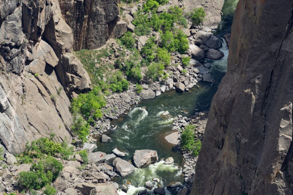
The railway trace runs parallel to the entrenched meanders carved by the Douro along its natural border between Zamora, Salamanca, and the Portuguese districts of Bragança and Guarda. The terrain is characterized by steep slopes that forced engineers to design unique technical solutions, such as very tight radius curves and cyclopean retaining walls built with dry masonry. These walls, executed by local stonemasons with a mastery now nearly extinct, support the platform carrying the ballast and the original steel profiles.
One of the most fascinating aspects of this infrastructure lies in the integration of its metal bridges. Assembled with steel rivets using hot-forge techniques, these structures withstand the extreme thermal stresses of a rigorous continental climate, characterized by scorching summers and persistent winter frosts. The maintenance of these metallic elements requires constant inspections to prevent material fatigue, serving as a constant reminder that public works in rugged environments demand perpetual vigilance.
Tunnel engineering constitutes another foundational chapter in the history of the line. Numerous stretches follow one another seamlessly beneath living rock, bored during an era when dynamite and physical effort were the only available resources. The constant interior humidity has generated mineral formations and stalactites that give the dark subterranean corridors an almost cathedral-like appearance, where the echo of passing convoys resonates as a reminder of mechanical force over geological inertia.
Vernacular Architecture and Terraced Landscapes
The visual impact of the railway is not limited to its steel track, but extends to how it engages with human intervention on the slopes. Along the route, dry-stone agricultural terraces built to support vineyards and olive groves create an aesthetic of stepped farming descending terrace by terrace down to the riverbed itself. This landscape architecture, designed to maximize scarce arable land and retain the thin fertile soil layer, finds its starkest industrial counterpart in the passage of the train.
The local communities inhabiting these valleys structured their subsistence around a self-sufficient economy deeply tied to the canyon’s microclimate. Natural protection against cold plateau winds allowed the cultivation of Mediterranean species deep in the interior heartland. However, secular isolation made the railway line a vital artery for commercial exchange and the transport of agricultural goods to urban markets.
The railway in the Arribes del Duero did not merely connect two geographical points; it stitched together the wounds of a territory fractured by bottomless cliffs, turning the border into an iron bridge over the abyss.
With the progressive rural depopulation of the second half of the 20th century, many of these settlements lost their economic raison d’être. Nevertheless, the persistence of the terraces and the robustness of the railway infrastructure continue to define the visual identity of the region, shaping a cultural landscape where human labor and geological harshness merge into an equilibrium of extraordinary plastic beauty.

Oral Memory and Industrial Archaeology
Recovering the history of this route involves listening to the testimonies of former railway workers and residents who lived through the line’s golden years. Their accounts evoke the daily struggle to keep the track clear of rockfalls following winter storms, as well as the community life revolving around mixed freight and passenger trains. Those trains transported everything from olive oil and wine to mail and farming tools, serving as a true local public service.
The preserved railway facilities—ranging from water tanks for vintage steam locomotives to switchman shacks—constitute a valuable heritage of industrial archaeology. Unlike major metropolises where industrial heritage is frequently swallowed by urban development, here structures remain intact in their isolation, exposed to the weather and the slow process of reintegration into the natural environment.
Mechanical signaling, manual switches, and ancient Morse telegraph systems still visible in some buildings demonstrate the technological complexity of an era when traffic safety depended strictly on human skill and rigor. Studying these elements allows for an understanding of the evolution of railway safety in topographically complex terrain.

Sustainability and the Revival of Slow Rail Tourism
In the current context of seeking alternatives to mass tourism, the border Douro corridor emerges as an undisputed benchmark for slow rail tourism. Valuing these historical infrastructures not only contributes to the economic revitalization of depopulated rural areas but also fosters a respectful and reflective approach to natural and cultural heritage.
Projects aimed at recovering specialized tourist trains allow visitors to experience firsthand the scale of 19th-century civil engineering without altering the fragile ecological balance of the surrounding natural park. Sustainable rail mobility thus stands out as the premier tool for discouraging private vehicle use in environmentally sensitive protected areas.
Likewise, the integration of hiking trails running parallel to the railway—leveraging old service roads and fisher paths—facilitates a fully immersive experience. Walkers can alternate walking sections along canyon viewpoints with journeys aboard historic convoys, fully grasping the monumental scale of the Luso-Spanish landscape.

Practical guide
- How to get there: Primary access to the region is from Salamanca or Zamora via private vehicle, due to current limitations in regular passenger services along certain sections of the cross-border line. Using Madrid or Valladolid airports for international connections is recommended.
- Best time to visit: The spring months (April to June) and autumn (September to November) offer moderate temperatures and optimal plant landscapes. Summer features extreme temperatures that make prolonged hikes difficult during central daylight hours.
- Accommodation: Lodging is concentrated in small, rehabilitated rural houses in villages such as Miranda do Douro, Fermoselle, or Bermillo de Sayago. Advance booking is strongly advised given the region’s low hotel capacity.
- Local transport: Exploring the viewpoints of the Arribes del Duero requires a private car or hiring authorized local guides specializing in active tourism.
- Safety tips: Hiking routes along river cliffs lack protective fencing in many sections. Technical mountain footwear, sufficient water provisions, and strict adherence to protected natural park guidelines are highly recommended.
When the sun sets over the Douro gorges and golden reflections ignite the slate of the terraces, the landscape regains a timeless dimension. In that profound silence, broken only by the murmur of water and the swooping flight of raptors, the indelible trace of the collective effort that raised this railway line endures. These are not merely dead tracks and iron bridges oxidized by mist, but the tangible testimony of an era when human ingenuity dared to negotiate on equal terms with the unfathomable roughness of the earth.
Traveling through this Iberian enclave is, ultimately, an act of resistance against oblivion. It reminds us that major infrastructure projects did not measure their value exclusively in immediate economic balances, but in their capacity to weave communities together and make the inaccessible navigable. And as the wind continues to stir ancient olive trees over slate abysses, the heartbeat of that old train will continue to echo deep within the soul of the borderland landscape.