


Introduction to the Lofoten Traverse at the Threshold of the Arctic
The Lofoten archipelago, situated off northwestern Norway and sculpted by the relentless advance and retreat of glaciers over millennia, represents one of the most challenging and visually striking environments for sea kayaking on a global scale. Here, dark granite peaks rise directly from the cold, crystal-clear waters of the Norwegian Sea, creating a labyrinth of fjords, narrow channels, and open sea where weather conditions can shift from absolute calm to gale-force winds in a matter of minutes. Undertaking an autonomous long-distance expedition along this wall of stone demands not only refined paddling technique, but also a profound understanding of local oceanography, tidal dynamics, and rigorous logistical planning.
Unlike other coastal routes in Northern Europe, Lofoten exposes the navigator to exceptionally violent tidal currents, particularly in narrow straits such as the renowned Raftsund channel or the vicinity of the infamous Moskstraumen. This report examines with technical rigor and a journalistic perspective the critical elements required to plan, execute, and successfully complete an expedition of this magnitude, offering a mental and practical route map for advanced marine adventurers and expeditioners.
The Geography of Stone Walls: Sub-Arctic Geology and Oceanography
To understand the complexity of navigating Lofoten, it is essential to analyze its geological substrate. The rocks comprising these islands belong to the Lofoten Igneous Complex, dating to the Precambrian, and consist primarily of highly erosion-resistant granites and gabbros. This composition explains the vertical walls of up to one thousand meters that drop sheer into the water, generating an underwater canyon effect where fjord depths can exceed three hundred meters just offshore. This submerged alpine relief acts as a giant funnel for ocean currents originating from the Gulf Chain and lunar tides.
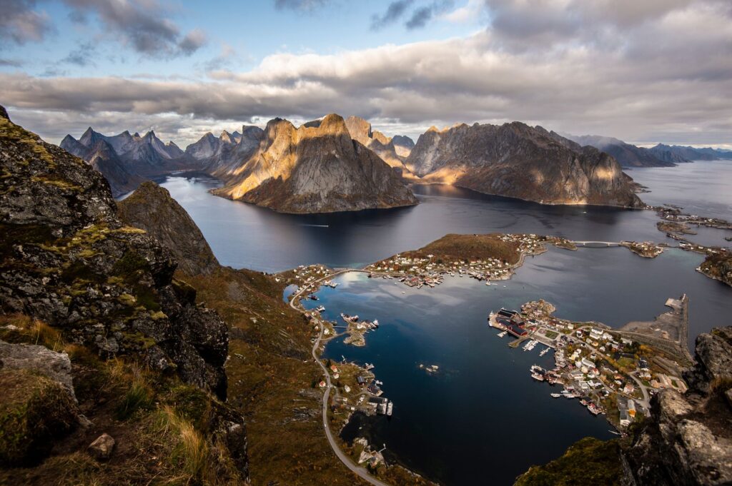
The interaction between these water masses and submarine topography produces complex dynamic phenomena. Tidal currents can exceed six knots in bottlenecks connecting the Vestfjorden with the open sea. For a kayaker loaded with two weeks of camping gear, paddling against a tidal current of this magnitude without precise schedule planning equates to standing still or, worse yet, being dragged toward dangerous breaking surf against inaccessible cliffs.
Nautical Planning and Navigation Systems in the Polar Circle
Preparing an autonomous expedition in northern Norway begins months before touching the water. The first pillar is detailed cartographic study, combining official nautical charts from the Norwegian Hydrographic Service with satellite navigation tools. The magnetic compass retains its utility, but magnetic declination at these high latitudes demands constant corrections, and proximity to the magnetic north can destabilize digital compasses unless properly calibrated with terrestrial visual references.
Likewise, the management of food autonomy and fuel defines the success of the route. Lofoten features small fishing communities where basic provisions can be replenished every few days, but stretches such as the western coast of Moskenesøy or the outer islands of Værøy and Røst present dozens of kilometers of inhospitable coastline without road access or safe shelter. Therefore, each kayak must carry waterproof dry bags with freeze-dried rations, water purification systems—although mountain streams are generally pure, avoiding areas with agricultural or sheep runoff is vital—and sufficient fuel for cooking in high-wind conditions.

The true nautical expedition in the Arctic measures its success not in distance covered, but in the precision with which one reads the signals of the sky, water, and stone before the sea asserts its authority.
Extreme Meteorology and Navigation Windows in the Norwegian Sea
The climate of Lofoten is heavily influenced by the Gulf Stream, which grants these sub-arctic islands unusually mild winter temperatures for their latitude, yet also generates notable atmospheric instability. Atlantic fronts advance rapidly from the west, bringing deep low-pressure systems that unleash horizontal rain, snow, or hail, accompanied by wind gusts roaring down glacial valleys, a phenomenon known locally as williwaws.
The use of specialized meteorological models, such as those provided by the Norwegian Meteorological Institute via the Yr.no platform, is mandatory. However, the experienced expeditioner knows that digital forecasting must be cross-referenced with direct observation of the barometer, the formation of lenticular clouds over the peaks, and the behavior of seabirds. Knowing how to identify a twelve-to-twenty-four-hour calm window to cross stretches exposed to open sea, such as the passage between Austvågøy and the Vesterålen islands, makes the difference between a fluid traverse and a high-sea rescue situation.
Cold-Water Paddling Technique and Safety Equipment Management
Navigating waters whose surface temperature rarely exceeds twelve degrees Celsius in the dead of summer demands a rigorous safety protocol. The use of a breathable membrane dry suit with latex gaskets is non-negotiable; an accidental immersion without adequate thermal protection leads to incapacitating hypothermia in less than fifteen minutes. Furthermore, each boat must be equipped with front and rear waterproof bulkheads, perimeter safety lines, a manual bilge pump, a spare paddle secured to the deck, and a satellite communication system or marine VHF radio.

Solo and group rescue techniques—such as the paddle-float self-rescue or the assisted T-rescue—must be practiced regularly in real surf conditions before launching the expedition. The swell in Lofoten is typically short and cross-chop, driven by interference between ocean swell and local wind waves, requiring excellent center-of-gravity control and an active posture in the kayak.
Marine Fauna and Respect for the Fragile Sub-Arctic Ecosystem
Along the route, the kayaker shares the aquatic environment with a rich biodiversity including Atlantic puffin colonies, white-tailed sea eagles, grey seals, and occasionally pods of orcas and humpback whales entering the fjords in search of herring schools. The water-level perspective offered by the kayak allows for an intimate visual approach, but expedition ethics dictate maintaining a respectful distance to avoid altering wildlife behavior.

Similarly, the fragile arctic tundra blanketing the flat areas where campsites are pitched is extremely sensitive to human passage. The growth of lichens and mosses takes decades, making strict adherence to Leave No Trace principles mandatory: utilizing portable stoves instead of campfires, packing out all organic and inorganic waste, and breaking camp while leaving the terrain in precisely the condition it was found.
The fragility of the arctic landscape reminds the traveler that absolute respect for the environment is not an optional ethical preference, but the sole guarantee of survival and continuity for future expeditions.
Practical guide
Best time for the expedition: The optimal months are June and July, when the midnight sun phenomenon provides continuous daylight for twenty-four hours, offering scheduling flexibility to exploit optimal tidal windows. August is also viable, though Atlantic storms begin to intensify.
Permits and regulations: Norway operates under the right of public access to nature (Allemannsretten), which permits respectful camping on unfarmed land for a maximum of two nights in the same spot. However, lighting campfires in forested or shrub-covered areas is strictly prohibited between April 15 and September 15.

Access logistics: The usual starting point for this north-to-south route is the town of Svolvær or the fishing village of Å, accessible via ferry from Bodø or by flying into Leknes airport. Renting or transporting specific expedition sea kayaks with adjustable skegs or rudders is strongly recommended.
Mandatory technical equipment: Expedition sea kayak with waterproof compartments, dry suit, buoyancy aid with rescue harness, marine VHF radio, satellite communication device (such as a Garmin InReach), nautical compass, laminated paper charts, and a bilge pump.
The Final Pulse of the Journey: Silence, Perpetual Light, and the Arctic Horizon
Upon reaching the southern tip of the archipelago, where the islands fade into solitary reefs beneath the golden, oblique light of the midnight sun, the traverse acquires its most intimate dimension. After weeks of steady physical exertion, microscopic reading of tides, and direct coexistence with the raw and dazzling beauty of the Polar Circle, the silence of the sea returns the expeditioner to a profound sense of mental clarity. The kayak glides smoothly over the mirror-like surface of a final fjord, while the last granite peaks recede wrapped in mist, sealing an experience where marine adventure transforms into a deep understanding of wild territory.


