Navigating the Haida Gwaii Archipelago: Maritime Expedition Guide to the Pacific Northwest Ocean Wilderness
A rigorous guide to nautical logistics, reading tidal currents across the Hecate Strait, environmental stewardship, and sea kayak expeditioning through the Gwaii Haanas Wilderness Reserve.
Emerging from the depths of the Pacific Ocean more than one hundred kilometers off the mainland coast of British Columbia, the Haida Gwaii archipelago stands as one of the most dynamic, wild, and demanding maritime environments in the Northern Hemisphere. Formerly known as the Queen Charlotte Islands, these more than one hundred and fifty landmasses form an oceanic frontier dominated by temperate rainforests, fjords carved by ancient glaciation, and some of the richest marine biodiversity on Earth. However, for the expeditionary mariner, Haida Gwaii is not a conventional travel destination; it is a highly complex coastal ecosystem where North Pacific weather demands absolute respect and flawless technical preparation.
Exploring this territory by sea, particularly within the southern region protected as Gwaii Haanas National Park Reserve and Haida Heritage Site, requires a profound understanding of ocean dynamics. The combination of prevailing headwinds, tidal ranges exceeding seven meters, and violent currents makes this region an ultimate test of self-sufficiency. This report covers the technical, logistical, and navigational demands required to plan and execute a coastal expedition by sea kayak or small craft through the waters of Haida Gwaii, where alpine topography drops directly into the Pacific continental shelf.
The Northern Pacific Labyrinth: Geography and Ocean Dynamics
The geographical structure of Haida Gwaii is primarily split between two major islands—Graham to the north and Moresby to the south—surrounded by a dense network of islets, narrow passages, and deep inlets. While the western coast of the archipelago plunges steeply toward the Pacific abyssal plain, taking the full brunt of open ocean swells, the eastern coast borders the Hecate Strait. This body of water is famous among international nautical charts for its shallow average depth and extraordinarily rapid meteorological shifts.
The Hecate Strait acts as a giant funnel. When low-pressure systems originating in the Gulf of Alaska collide with currents moving up from the south, the water trapped within the shallow strait reacts by producing short, steep, and confused seas. This bathymetric profile means that navigation around Haida Gwaii cannot rely on superficial estimates, but rather on the constant interpretation of nautical charts and local tide tables.
Water Physics: Tidal Currents and the Hecate Strait Barrier
The decisive factor in route planning and paddling schedules across Haida Gwaii is the tide. In narrow inter-island channels—such as Skidegate Inlet or Burnaby Narrows (Naa-ts’iih)—the tide does not merely rise and fall vertically; it generates swift oceanic rivers running at speeds of up to eight knots. Attempting to paddle against this volume of water is physically impossible for any human-powered expedition.
The critical technical maneuver involves calculating the exact moment of slack water, the brief window of relative calm between ebb and flood tides. Arriving at a narrow pass just ten minutes late can mean encountering standing waves, whirlpools, and overfalls caused by wind-against-current conditions. The interaction between southeasterly gales and an ebbing tide creates treacherous chop, requiring expedition teams to master current atlases and maintain disciplined early morning launch schedules.
Self-Sufficiency Logistics: Gear for Expedition Sea Kayaking
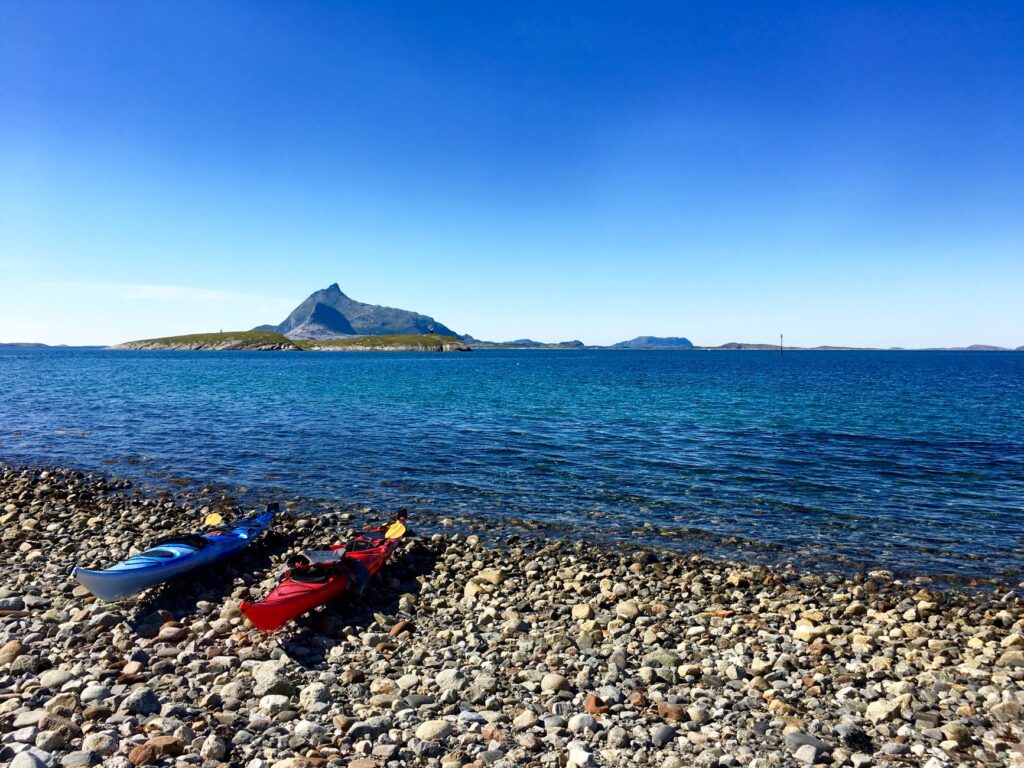
A maritime expedition in Haida Gwaii involves spending weeks far beyond the reach of resupply points, medical assistance, or cellular coverage. Equipment selection must meet the highest standards of durability and waterproof integrity. The sea kayaks used are typically expedition single or double sea kayaks built from high-density polyethylene or fiberglass/Kevlar composites, measuring at least five meters in length with fully sealed, watertight bulkheads.
Breathable Membrane Drysuits: Water temperatures rarely exceed ten degrees Celsius, making a full drysuit with latex neck and wrist gaskets a mandatory piece of survival gear, not merely a comfort item.
Communication and Positioning Systems: Waterproof handheld marine VHF radios, Personal Locator Beacons (PLB or Garmin InReach), and GPS units pre-loaded with high-resolution topographic and vector nautical charts are essential.
High-Tide Anchoring and Beach Tie-Downs: Due to extreme tidal ranges, kayaks must never be left near the water’s edge. Vessels must be hauled well above the high spring tide mark and tied down securely to forest tree lines.
Water Filtration Systems: Although wilderness fjords feature abundant mountain streams, the runoff contains high concentrations of tannins and organic matter, requiring micro-fiber glass filters paired with activated carbon cores.
«In the Hecate Strait, the ocean does not forgive improvisation; the tide dictates when you move, when you rest, and when the only sensible decision is to remain securely anchored on dry land.»
Traverse Routes: From Moresby Camp to SGang Gwaay
The classic, most technically demanding expedition route involves descending the eastern coast of Moresby Island, starting at Moresby Camp and culminating at SGang Gwaay (Anthony Island) at the southern tip of the archipelago. This route spans more than two hundred kilometers of winding navigation through a maze of fjords and exposed outer islands.
The initial leg traverses the relatively sheltered channels of Darwin Sound, where calm waters allow teams to establish their paddling cadence and refine deck stowage. However, as the route moves south past Burnaby Island, insular protection diminishes. Cape Saint Anthony and the approaches to Houston Stewart Channel require crossing waters exposed directly to open Pacific ocean swells. Here, long-period oceanic waves crash against sheer basalt cliffs, generating severe wave refraction and clapotis that demand tight group formations and precise compass bearings.
Meteorological Reading and Natural Harbors in Exposed Fjords
Weather patterns in the Pacific Northwest are driven by the steady progression of frontal systems associated with subarctic low-pressure cells. In Haida Gwaii, advection fog is a frequent occurrence during summer months. It forms as warm, moist air moves across the cold waters of the Alaska Current, reducing visibility to less than fifty meters within minutes.
Navigating blind among submerged reefs and dense bull kelp forests requires proficiency in dead reckoning and compass navigation, calculating ground speed against current drift and stroke cadence. When southeasterly gales approach—often bringing wind speeds exceeding forty knots—paddlers must know the location of emergency haul-outs in advance. These sheltered coves, protected by gravel bars or rocky reefs, provide the only safe landing spots for pitching camp above the high tide line, sheltered within dense stands of Sitka spruce and western red cedar.
Haida Cultural Legacy: Watchmen Protocol and Coastal Archaeology
The maritime identity of Haida Gwaii is inseparable from the history of the Haida Nation, whose civilization has inhabited these islands for over twelve thousand years. Historically, the Haida were master shipwrights, carving massive ocean-going war canoes from single red cedar trunks capable of carrying dozens of crew members across open ocean waters to Alaska and Vancouver Island.
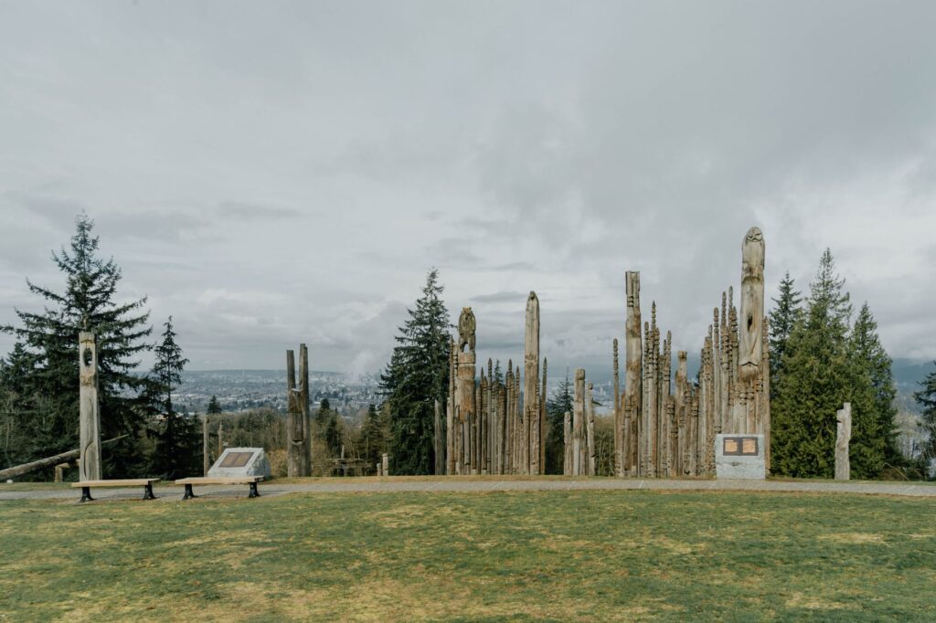
Today, sea travel through Gwaii Haanas is managed cooperatively with the Haida Nation through the Haida Watchmen program. These seasonal guardians reside during summer months at historic village sites including K’uuna Llnagaay (Skedans), T’aanuu Llnagaay (Tanu), and SGang Gwaay. Approaching these cultural sites by water requires contacting the Watchmen via marine VHF radio prior to landing. Standing before ancient cedar longhouse ruins and weathering mortuary poles emerging from the coastal forest edge offers a profound historical perspective on the sustainable bond between human culture and marine ecology.
Wildlife Management and Conservation in Gwaii Haanas
The cold, oxygen-rich waters surrounding Haida Gwaii support one of the dense marine biomasses on the planet. Deep-water upwellings bring nutrients to the surface, feeding extensive forests of giant kelp (Macrocystis pyrifera) that serve as nurseries for hundreds of fish species and marine mammals. For expedition kayakers, wildlife encounters must be handled with strict discipline.
Humpback whales, killer whales, and Steller sea lions share these channels with paddlers. Maintaining respectful distance is mandatory to avoid disturbing their natural feeding behaviors. On land, Haida Gwaii black bears (Ursus americanus carlottae)—a unique subspecies featuring larger body mass and stronger jaws adapted for crushing intertidal shellfish—require the strict use of bear-proof food canisters. These containers must be stowed far from sleeping tents in intertidal zones below the high-water line where scents will not draw animals into campsite areas.
«The convergence of ancient temperate rainforest and open ocean creates a landscape of monumental fragility, where human presence must remain as fleeting as the wake left by a kayak paddle.»
Practical Planning Guide: Permits, Navigation Windows, and Safety
Executing an independent expedition to Haida Gwaii demands months of advance preparation and strict compliance with federal and local indigenous regulations. Below are key requirements for planning a safe and legal journey:
Recommended Expedition Windows
The optimal paddling season runs from late May through early September. June and July offer the longest daylight hours and lower frequencies of heavy rainfall, though thermal afternoon northwest winds can be powerful during these months.
Mandatory Permits and Orientation
Entering Gwaii Haanas National Park Reserve requires advance reservation through Parks Canada and mandatory completion of the Gwaii Haanas Orientation session, conducted in Skidegate or Sandspit. All visitors must carry printed, signed entry permits at all times during the trip.
Access and Equipment Transport
The primary access points to the archipelago are Sandspit Airport (YZP) on Moresby Island or the BC Ferries vehicle ferry connecting Prince Rupert to Skidegate on Graham Island. Transporting expedition kayaks and gear to backcountry launch sites like Moresby Camp is arranged via local 4×4 shuttle operators or licensed water taxis.
Essential Maritime Safety Gear
Satellite Messenger (Garmin InReach / SPOT / PLB): Device capable of transmitting real-time GPS tracking and emergency SOS distress signals.
Hand Bilge Pump and Paddle Float: Critical equipment for executing self-rescues and sea re-entries in open water.
Canadian Hydrographic Service (CHS) Nautical Charts: Official paper charts #3807, #3808, #3809, and #3853 printed on waterproof synthetic material.
Sea Anchor / Drogue: Used to stabilize kayak drift and maintain bow alignment when caught in heavy headwinds or open water crossings.
Environmental Ethics & Leave No Trace
Due to the sensitivity of the intertidal and forest ecosystems, cutting live timber is strictly prohibited. Campfires are only permitted below the high-tide line using sun-dried driftwood, ensuring that incoming high tides erase all ash residues. All waste must be packed out completely without exception.
Navigating the sea roads of Haida Gwaii is an experience that goes beyond physical endurance. It is an immersion in the primary forces of the natural world, where the rhythm of the tides, the permanence of basalt cliffs, and the wind through ancient cedars remind the voyager of human scale in the vastness of the wilderness.