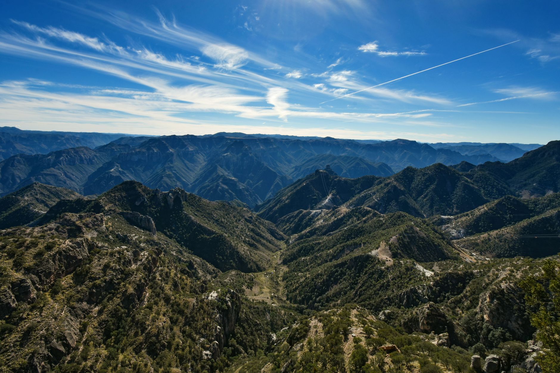
More than two thousand meters above sea level in the rugged expanse of the Sierra Tarahumara, the air carries the scent of dry pine, resin, and mineral dust. The train whistle cuts through the canyon silence with a prolonged echo that reverberates off volcanic rock walls carved over millions of years. This is not merely a tourist excursion, but the last remaining long-distance passenger railway line in Mexico: the Chihuahua al Pacífico Railroad, historically known as El Chepe. This railway stands as a monumental technical achievement that defied physics and topography to forge a permanent link between the northern inland plateau and the fertile coastal plains of Sinaloa.
Officially inaugurated along its complete route in November 1961, following over nine decades of stalled projects, corporate bankruptcies, civil conflicts, and immense geotechnical challenges, the Chepe is among the most complex infrastructure projects in Latin America. Across its 653 kilometers of single-track line, the route crosses 37 major bridges and 86 tunnels bored directly through bedrock, negotiating an altitude change from nearly 2,500 meters at its highest mountain pass down to sea level in the agricultural heartland of Los Mochis. To understand this railway is to step into the living history of North American transport connectivity and to witness the delicate interplay between modern engineering, Indigenous heritage, and extreme geography.
The Vision of a Transcontinental Route: Ambition and Gold Fevers
The origin of the Chihuahua al Pacífico Railroad was not initially rooted in national integration, but in a grand global trade vision. In the late 19th century, American engineer and dreamer Albert Kimsey Owen envisioned the shortest possible rail corridor to link the eastern United States with the Pacific Ocean. Topolobampo Bay, in the state of Sinaloa, provided a deep, sheltered natural harbor that could significantly shorten transpacific shipping routes to East Asia compared to the established overland route to San Francisco.
Owen imagined a utopian industrial settlement on the Sinaloan coast, but he quickly discovered that the formidable barrier of the Sierra Madre Occidental required an unprecedented financial and technical commitment. During the presidency of Porfirio Díaz, early concessions were granted to British and American consortiums, including the Kansas City, Mexico and Orient Railway. However, sheer vertical cliffs, granite rock, and sudden flash floods in deep ravines bankrupted successive investors. The outbreak of the Mexican Revolution in 1910 brought construction to a complete halt, leaving the line split into two isolated segments: one climbing slowly from the Pacific coast and the other crawling across the Chihuahuan plateau.
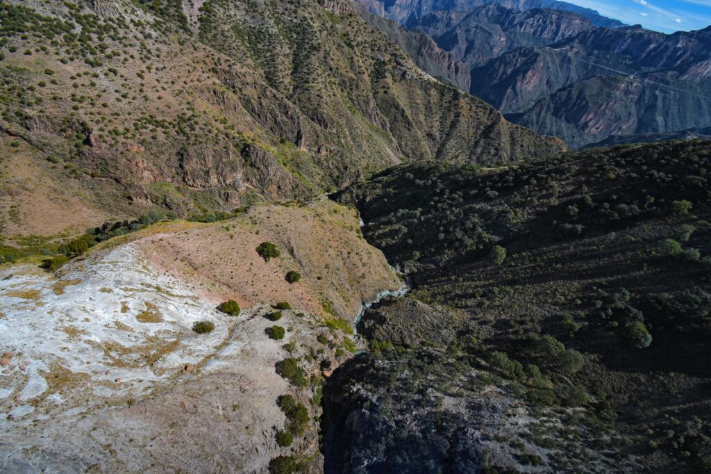
Conquering the Sierra Tarahumara was not merely a feat of dynamite and steel, but a triumph of human perseverance over one of the most formidable natural barriers in the Americas.
It was not until the mid-20th century that the Mexican government recognized the strategic necessity of the line for regional development and assumed direct responsibility for the project. Under the direction of the Ministry of Communications and Transportation, lead engineers such as Mario Campos spearheaded the completion of the central mountain segment between Creel and San Rafael—the most perilous and technically demanding section of the entire line.
Anatomy of an Engineering Feat: Bridges, Tunnels, and La Laja Loop
From a geotechnical perspective, the mountain section of the Chepe line remains a masterclass in civil engineering. To overcome extreme elevation differences without exceeding the maximum 2.5% gradient required for safe train operations, engineers implemented complex spiral alignments. The most famous example is the celebrated La Laja Loop, a complete helical loop where the track curves over itself on an ascending spiral, gaining elevation steadily while the train passes directly above the tunnel from which it has just emerged.
The bridges along the line are structural highlights of steel truss and reinforced concrete construction. Notable among them are the El Cinto bridge, stretching over 250 meters, and the Jesús García bridge, which spans the Septentrión River gorge at a dizzying height. These structures were engineered not only to support heavy rolling stock, but also to withstand seismic activity along the Gulf of California fault system and violent seasonal flash floods caused by winter snowmelt and the summer Mexican monsoon.
The Copper Canyon System: A Geological Marvel
The Copper Canyon network (Barrancas del Cobre) is not a single canyon, but a sprawling system of at least seven major gorges that together cover an area four times larger and significantly deeper in places than the Grand Canyon of the Colorado River in Arizona. Formed by ancient tectonic faulting and continuous river erosion by watercourses such as the Urique, Batopilas, and Sinforosa, these chasms define the regional climate and landscape.
The railway skirts the high rims of these chasms, offering passengers dramatic shifts in scenery over the course of a single day. At higher elevations, dense forests of pine, oak, and madrone thrive in a cool temperate climate that sees heavy snowfall between December and February. As the line descends into the lower canyon floors, the vegetation abruptly transforms into dry tropical scrub, featuring giant cacti, banana groves, and subtropical temperatures.
The Rarámuri Heartland: Culture, Cosmology, and Resilience
The mountainous terrain traversed by the Chepe is the ancestral homeland of the Rarámuri (Tarahumara) people, one of North America’s most resilient indigenous communities. World-renowned for their exceptional long-distance running capabilities—the word Rarámuri translates to ‘those who walk well’ or ‘light-footed runners’—they have inhabited the high plateaus and canyon floors for centuries, maintaining a way of life deeply attuned to natural cycles.
- Seasonal Migration: The Rarámuri practice seasonal transhumance, moving down to warmer canyon bottoms during the cold winter months and returning to high-altitude homesteads in summer to cultivate corn, beans, and squash.
- Traditional Crafts: At key stations such as Creel, Divisadero, and Bahuichivo, Rarámuri artisans offer hand-woven pine-needle baskets (guares), carved wood craftwork, and vibrant traditional textiles.
- Regional Connectivity: For local communities, the train has long served as a crucial lifeline, providing access to essential medical services, schooling, and commerce in the urban centers of Chihuahua and Los Mochis.
The arrival of the railway transformed the socioeconomic dynamics of the region. While creating avenues for trade, it also presented long-term challenges regarding cultural preservation in the face of tourism expansion. Current regional management emphasizes sustainable development that respects the land rights and autonomy of traditional Rarámuri settlements.
Modern Passenger Operations: Chepe Express vs. Chepe Regional
Today, operations on the line are divided into two distinct services managed by Ferromex, catering to different travel requirements across the region.
Chepe Regional: The Essential Social Transit
The Chepe Regional preserves the historical public transit role of the line. Stopping at more than 15 intermediate stations and local rural halts, this service is utilized primarily by local residents, teachers, medical personnel, and agricultural workers. Featuring subsidized fares for local citizens, it offers an authentic view of mountain rail transit and operates along the entire route between Chihuahua City and Los Mochis.
Chepe Express: Premium Scenic Rail Travel
Launched in 2018 to meet international standards for scenic passenger rail, the Chepe Express is a modern train tailored specifically for the dramatic canyon corridor between Creel and Los Mochis. Offering Executive, First, and Tourist Class accommodations, the train features a two-story dining car (Urike) serving regional gastronomy, a bar car with observation lounge areas, and floor-to-ceiling panoramic windows.

Riding this mountain passenger line is far more than a transport journey between two cities; it is an immersive exploration of North American geography and civil engineering heritage.
Key Stations and Itinerary Planning
To fully appreciate the diversity of the terrain, travelers should break their journey into segments with multi-day stays at primary station stops. A Chepe Express ticket allows up to two intermediate stops at no extra charge, provided itineraries are specified at the time of booking.
Creel: Gateway to the High Sierra
Situated at an altitude of 2,340 meters, this former timber town serves as the primary hub for outdoor exploration in the upper sierra. From Creel, visitors easily access Lake Arareko, the volcanic rock formations of the Valley of the Mushrooms and Frogs, and the Cusárare waterfall. It also acts as the starting point for journeys into the northern reaches of the mountain range.
Divisadero and Posada Barrancas: The Canyon Rim Viewpoint
Positioned at the highest point of the rail line directly overlooking the canyon system, this station provides panoramic views where the Urique, Tararecua, and Del Cobre canyons intersect. The area features the Copper Canyon Adventure Park, home to long zip-line courses, a three-kilometer aerial cable car, and dramatic cliffside hiking trails.
Bahuichivo and Cerocahui: Historic Valleys and Vineyards
From Bahuichivo station, a winding mountain road leads down into the fertile valley of Cerocahui, founded by Jesuit missionaries in the 17th century. Known for its microclimate suitable for wine production, Cerocahui is the gateway to the Gallego Lookout, which offers an 1,800-meter vertical drop overlooking the historic mining village of Urique and its river far below.

El Fuerte: Colonial Architecture on the Coastal Plain
As the rail line leaves the dramatic granite gorges behind, it enters the state of Sinaloa and reaches El Fuerte, a designated Pueblo Mágico. Founded in 1564, this colonial town retains elegant 18th and 19th-century architecture, restored historic haciendas, and a rich culinary tradition centered around freshwater river fishing along the Fuerte River.
Practical Planning, Seasons, and Logistics
Planning a trip along the Chihuahua al Pacífico Railway requires advance coordination due to high demand and limited seat capacity on premium services.
- Best Times to Travel: Autumn (September to November) is optimal, as monsoon rains leave the canyons lush and waterfalls flowing at full volume. Spring (March to May) brings clear skies and comfortable temperatures. Winter (December to February) brings scenic snowfall to the high-altitude passes, though night temperatures frequently drop below freezing.
- Air and Ground Connections: Primary gateway airports include General Roberto Fierro Villalobos International Airport in Chihuahua (CUU) and Federal del Valle del Fuerte International Airport in Los Mochis (LMM), both offering daily domestic flights to major hubs like Mexico City, Guadalajara, and Monterrey.
- Booking Recommendations: Reservations for the Chepe Express should be confirmed months ahead for travel during peak periods such as Easter week, mid-summer, and the winter holidays. Train schedules should always be double-checked directly on the official rail operator platform prior to travel.
The Enduring Legacy of an Iconic Railway
In an era dominated by high-speed air transportation, the Chihuahua al Pacífico Railroad stands as a testament to the art of slow overland travel. Beyond its massive steel bridges and deep rock tunnels lies a rail line that bridges two distinct geographical and cultural worlds. From the high arid plateaus of the Mexican interior to the warm coastal plains of Sinaloa, El Chepe remains, six decades after its completion, the vital lifeline of the Sierra Tarahumara and one of the world’s truly great railway journeys.