Introduction to the Ultimate Pyrenean Traverse
The Pyrenean High Route, universally known by its French acronym HRP (Haute Randonnée Pyrénéenne), is not a standardized waymarked trail, but rather an alpine high-altitude line conceived by veteran mountaineer Georges Véron in the 1960s. Unlike the GR 10 or the GR 11 trail, which predominantly run along the northern and southern foothills respectively, the HRP weaves continuously along and across the Franco-Spanish border. It is a route of thoroughly alpine character, designed for experienced hikers seeking the purest, wildest, and most vertical essence of the range.
Spanning approximately 800 kilometers, depending on chosen variants, and featuring a cumulative positive elevation gain exceeding 40,000 meters, this traverse demands absolute mastery of navigation, proficiency in progressing over loose rocky terrain, and solid physical and mental endurance. It is not merely about walking, but about reading the landscape, interpreting the shifting high-mountain weather, and accepting self-sufficiency as a daily standard throughout the weeks the full expedition lasts.
The HRP represents the pinnacle of long-distance trekking in Western Europe, an itinerary where the mountaineer becomes the true architect of their own path.
Geography and Spirit of the High Route
The geographical profile of the Pyrenees forms a formidable natural barrier between the Iberian Peninsula and the rest of continental Europe. The HRP takes full advantage of this circumstance by remaining in the upper tier of summits, frequently summiting cols that exceed 2,500 and even 3,000 meters in altitude. From the starting point on the beach of Hendaye on the Bay of Biscay to the final arrival at the Mediterranean Sea in Banyuls-sur-Mer, the landscape undergoes a radical and fascinating transformation.

In the western valleys, Atlantic influences imbue the environment with lush beech forests, intensely green meadows, and a robust hydrological network. As the route advances toward the central heart of the cordillera —where giants such as Vignemale, Monte Perdido, Maladeta, and Pica d’Estats rise— vegetation gives way to bare rock, residual glaciers, lingering snowfields, and turquoise glacial lakes. Finally, in the eastern sector, the landscape acquires a more arid Mediterranean character, where Scots pines, slate, and sun-drenched valleys announce the proximity of the journey’s end.
Planning and Seasonality in High Altitudes
The temporal window to undertake the entire HRP is strictly limited due to winter snow lingering on high-altitude cols. As a general rule, the optimal period extends from early July to mid-September. Outside these months, crossing high passes such as the Roland Breach or the Bachimaña tarns without specific mountaineering gear —such as crampons and ice axes— entails an unacceptable level of risk.
Planning this expedition requires meticulous analysis of cartography and resupply points. Unlike other European trails equipped with hotels or staffed refuges every few kilometers, the HRP frequently traverses remote areas where the only alternatives are high-mountain wild camping or unstaffed bivouac huts. Backpack weight becomes the critical factor for survival and comfort, forcing trekkers to apply strict gear optimization policies.
It is essential to constantly consult local weather reports from Météo-France and AEMET. Rapidly developing summer thunderstorms are common from noon onward during the peak summer months, bringing electrical activity, hail, and abrupt temperature drops that can severely compromise safety on exposed ridges and passes.
The Western Sector: From the Cantabrian Sea to High Valleys
The first stretch of the HRP, running from Hendaye to the Lescun circus or the Somport pass, traverses the Basque and Navarrese Pyrenees, progressively entering Béarnese and Aragonese territory. Although altitudes are not comparable to those of the central sector, slippery grass slopes, dense forests, and constant humidity demand significant technical and navigational effort.
In this initial section, the trail winds through modest Atlantic mountains before grazing emblematic massifs like Lakora and Table of the Three Kings. Coexistence with extensive livestock farming, including horses and cattle, is a constant feature in the high pastures. Stops in traditional mountain huts and small villages allow hikers to provision themselves with local produce such as ewe’s cheese and understand the deep cultural ties binding both sides of the border.

The true measure of a mountain is not taken by its altitude above sea level, but by the depth of the silence that inhabits its most remote passes.
The Central Sector: The Realm of Giants and Glaciers
The heart of the HRP extends from the Aspe Valley to the Canigó massif. It is here that the route displays its full alpine splendor and maximum technical demands. The great milestones of the mountain range follow one another: the Pyrenees National Park in France and Ordesa and Monte Perdido National Park in Spain, alongside nature reserves of immeasurable ecological value.
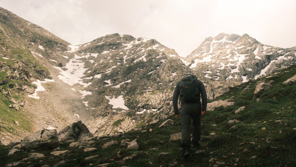
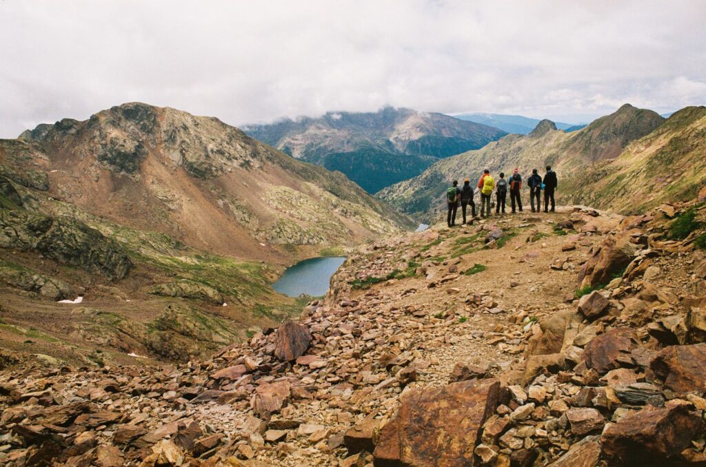
Throughout this stretch, hikers must face exposed sections, unstable scree slopes, and snowfield traverses that can persist even in August. Ascending or contouring iconic summits requires absolute concentration. Places like the Gavarnie cirque, Vignemale —with the Oulettes de Gaube glacier—, or the Coronas tarns under the shadow of Maladeta demand respectful reverence toward a natural environment as majestic as it is fragile.

The Eastern Sector: Toward the Vastness of the Mediterranean
Once past Ariège and the Andorra region, the Eastern Pyrenees offer gentler yet extensive terrain. Granite ridges give way to valleys dominated by glacial lakes such as Colomers or Amitges in the Catalan sector, and black pine and fir forests on the French slope of Cerdagne and Conflent.
The final stretch of the HRP is presided over by the imposing silhouette of Canigó, considered Catalonia’s sacred mountain. From its summit, the view already encompasses the Roussillon plain and the Mediterranean Sea, glittering on the horizon like a reminder of a goal achieved. The final descent toward Banyuls-sur-Mer winds through terraced vineyards and Mediterranean scrubland, providing a stark contrast to the perpetual snows and snowfields of the central sector.
Camping regulations in this final stretch are particularly restrictive due to the proximity of nature reserves and protected areas, making it mandatory to plan final stages by staying in staffed refuges or authorized zones to avoid fines and preserve the fragile coastal ecosystem.
Logistics, Equipment, and Trail Safety
Facing the Pyrenean High Route requires carefully refined equipment. Tents must be three-season models, capable of withstanding strong winds and heavy rain. A three-layer clothing system is non-negotiable, always including a high-quality waterproof membrane and a lightweight down jacket for cold nights at altitude.
Regarding hydration and nutrition, carrying water purification tablets or an advanced filtration system is fundamental, as high-altitude stream water can be contaminated by livestock grazing. Freeze-dried meal rations combined with nuts, energy bars, and local products purchased in villages ensure the necessary caloric intake, which usually ranges between 3,500 and 4,000 calories per day during peak activity.
Practical Information for the Expeditionary
- Recommended Season: July 1 to September 15. Outside this window, high mountains require complete winter equipment.
- Documentation and Permits: Valid ID or passport. Strictly respect National Park regulations (camping is prohibited or regulated with strict nighttime hours in Ordesa and Pyrenees National Parks).
- Cartography: Detailed topographic maps (French IGN and Spanish IGN/Editorial Alpina) at 1:25,000 scale, plus GPS devices with loaded tracks.
- Connectivity: Mobile phone coverage is nonexistent or highly intermittent in numerous valleys and deep gorges along the route.
- Access Transport: Hendaye features a train station and nearby international airport in Biarritz; Banyuls-sur-Mer offers excellent rail connections toward Perpignan and Barcelona.
In the solitude of the high route, every step is a lesson in humility and every summit reached is a triumph shared with the vastness of the horizon.
Visual and Ethical Closure of the Expedition
Completing the Pyrenean High Route leaves no mountaineer indifferent. It is not a trophy to hang on a wall, but a profound experience of communion with the natural environment. Upon contemplating the waters of the Mediterranean from the cliffs of Banyuls after weeks of uninterrupted effort, the traveler grasps the true dimension of the Pyrenees: an indomitable mountain range that, despite its apparent accessibility, preserves its wild character intact for those who choose to traverse it on foot, respecting its rhythms, its rules, and its unfathomable beauty.