Introduction to the Istanbul Strait: The World’s Crossroads
Few geographical features concentrate as much history, commerce, and logistical complexity as the Bosphorus Strait. Spanning a mere thirty kilometers in length and varying in width from 700 to 3,500 meters, this natural waterway separates the European and Asian continents while serving as the sole navigable outlet from the Black Sea to the Sea of Marmara and, by extension, the Mediterranean. For the more than sixteen millions residents of Istanbul and the millions of travelers crossing annually, this channel is not merely a scenic landmark, but a daily challenge in intercontinental mobility.
Managing transport across this corridor requires meticulous coordination between traditional maritime infrastructure and contemporary engineering megaprojects. From the commuter boats that have operated for over a century to the automated railway lines plunging deep beneath the seabed, the Bosphorus represents a unique case study in the design of metropolitan and long-distance transport networks. Understanding its operation requires examining both its physical arteries and the travel patterns that sustain the economic and social life of the Turkish metropolis.
The Maritime Backbone: Bosphorus Ferries and the Şehir Hatları System
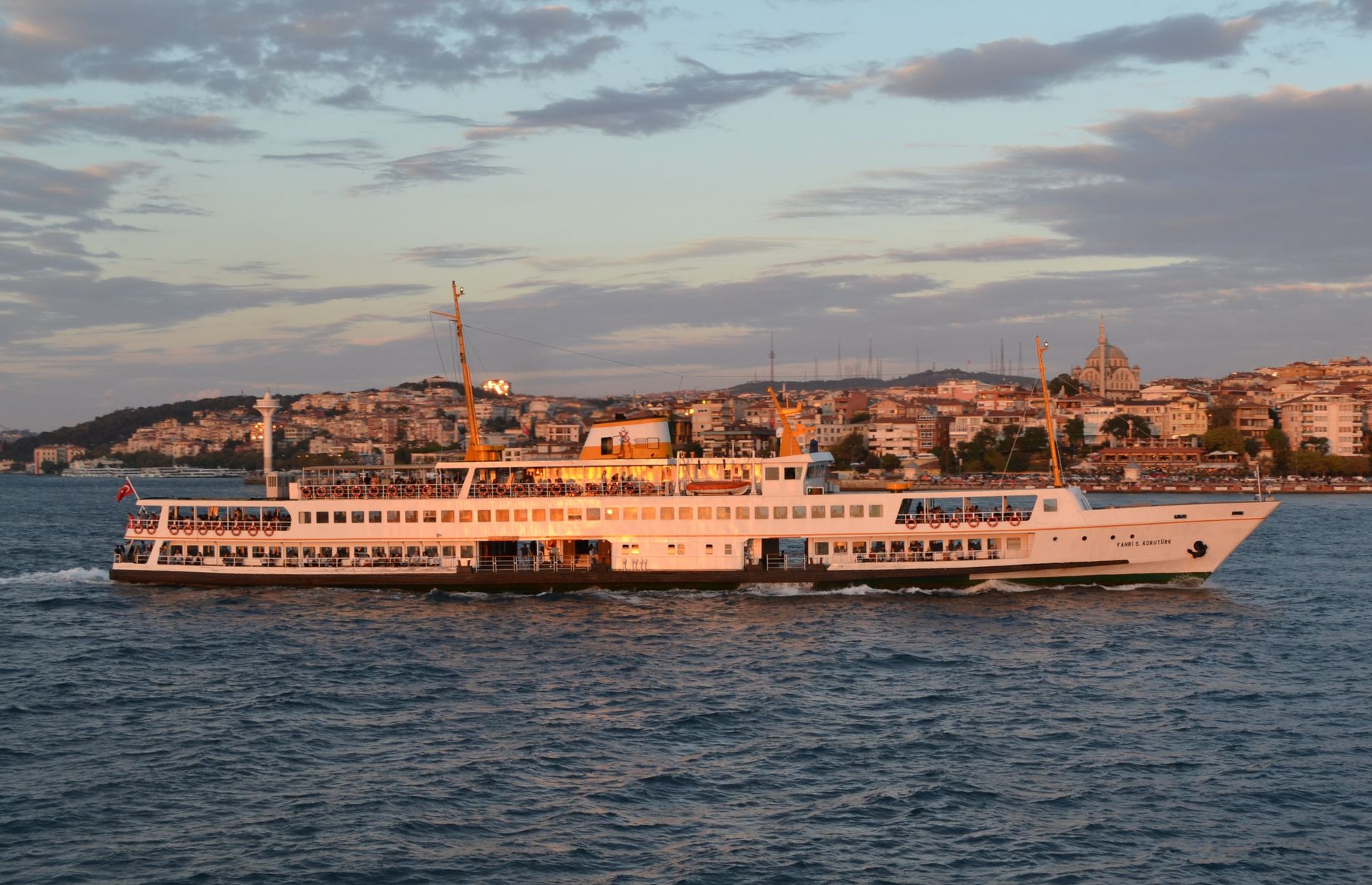
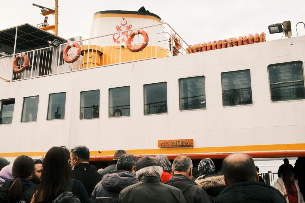
Long before the first bridge was ever planned over the water, the waters of the Bosphorus were plied by wooden vessels propelled by oars and sails. Today, the public ferry service, known as Şehir Hatları, keeps that tradition alive while adapting to modern high-capacity transport standards. These vessels are far from mere tourist attractions; they are an indispensable part of the city’s integrated public transport network, relied upon daily by workers, students, and residents who prefer the punctuality and calm of the sea over congested surface highways.
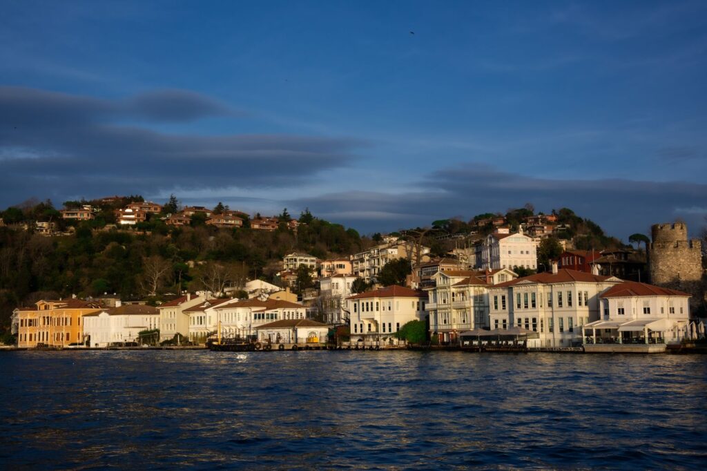
The maritime routes regularly connect historical piers on the European side—such as Eminönü, Karaköy, and Beşiktaş—with the Asian enclaves of Üsküdar and Kadıköy, while also serving picturesque fishing villages further north near the Black Sea confluence. These journeys allow passengers to enjoy privileged views of traditional Ottoman waterfront mansions, known as yalis, while experiencing a sustainable mobility model that significantly reduces surface traffic congestion.
Engineering Megaprojects: The Suspension Bridges Dominating the Skyline
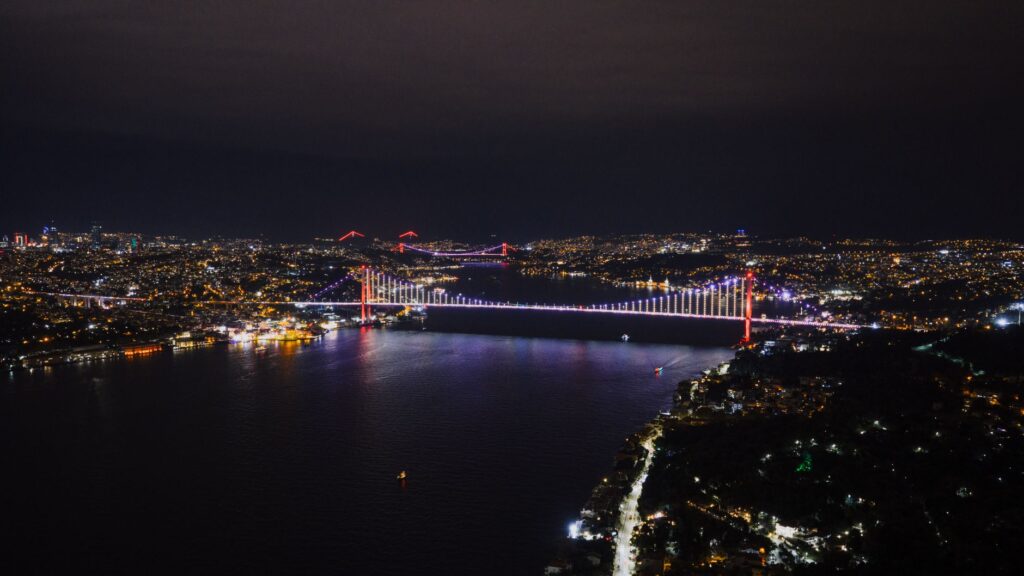
The twentieth century radically transformed the strait’s connectivity with the construction of major highway infrastructure. The first to materialize was the Bosphorus Bridge (officially renamed the 15 July Martyrs Bridge), inaugurated in 1973. This steel suspension structure linked Europe and Asia by road for the first time, enabling a continuous flow of commercial and private vehicles that had previously depended exclusively on car ferries.
Facing exponential growth in the vehicular fleet and demographic pressures, the 1980s saw the birth of the Fatih Sultan Mehmet Bridge further to the north. Decades later, the inauguration of the Yavuz Sultan Selim Bridge added a third high-capacity route specifically designed to divert heavy freight traffic and large trucks away from the central urban core. These three structures stand as milestones of international civil engineering, designed to withstand gale-force winds, unpredictable marine currents, and intense seismic activity.
Marmaray: The Railway Tunnel Uniting Two Continents Beneath the Waters
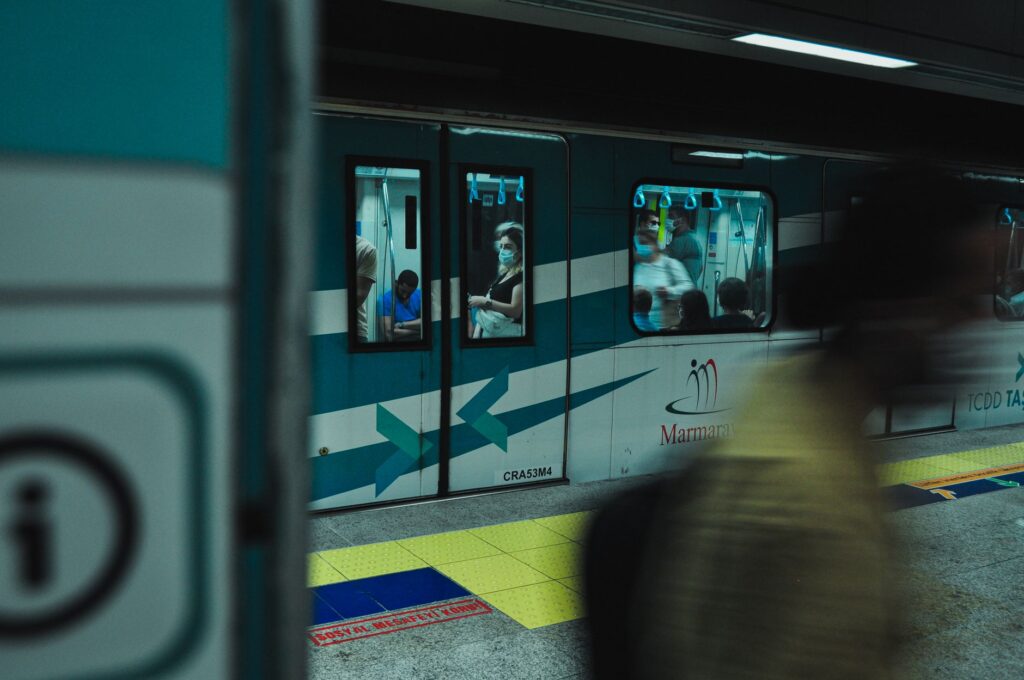
One of the most impressive technical achievements in contemporary regional transport is the Marmaray project. This commuter rail system includes a submerged tube tunnel resting on the seabed of the Bosphorus, constructed some sixty meters deep to ensure stability against earthquakes. The infrastructure connects the railway networks of the European and Asian sides, allowing passenger trains to cross from one continent to the other in just four minutes.
Executing this project forced engineers to resolve enormous technical challenges, ranging from high salinity and underwater currents to the discovery of significant archaeological finds during land excavations, which temporarily delayed construction but enriched the city’s historical heritage with the uncovering of the Byzantine Port of Theodosius. Today, Marmaray is the backbone of rapid mobility in Istanbul, transporting hundreds of thousands of daily users and drastically reducing reliance on private road transport.
The Role of the Eurasia Tunnel: Subterranean Road Connectivity for Light Vehicles
Complementing the Marmaray rail system, the Eurasia Tunnel (Avrasya Tüneli) was opened to vehicular traffic to ease saturation on the suspension bridges. This double-deck tunnel pierces the seabed at great depth, connecting the Kazlıçeşme district on the European side and Göztepe on the Asian side in a travel time of under fifteen minutes under normal driving conditions.
Unlike the bridges, use of this tunnel is strictly restricted to passenger cars and minibuses, prohibiting heavy trucks and buses to preserve structural safety and traffic flow. The infrastructure features advanced artificial ventilation systems, high-efficiency LED lighting, and strict emergency response protocols, becoming a benchmark for urban underwater tunnel management in high-density zones.
The Bosphorus Strait proves that geography is not an insurmountable boundary for transport, but rather a catalyst for engineering innovation and metropolitan integration.
Bus Networks, Metrobuses, and Fare Integration via the Istanbulkart
No analysis of the Bosphorus transport system would be complete without mentioning the surface bus network and, most notably, the Metrobüs system. This bus rapid transit service operates on a dedicated lane traversing the city from west to east, crossing the Bosphorus Bridge with priority access. Although operating at peak capacity during rush hours, the Metrobüs guarantees commercial speeds far superior to conventional traffic caught in daily gridlock.
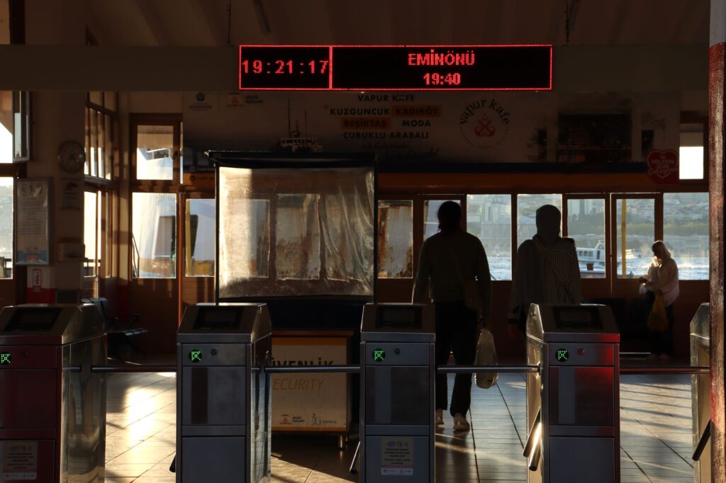
The glue holding this complex multimodal network together is the Istanbulkart, a contactless stored-value card enabling unified payment across metros, trams, funiculars, ferries, city buses, and commuter trains. This integrated fare system not only facilitates mobility for citizens and foreign visitors alike but also optimizes boarding times across all stations and piers throughout the metropolitan area, drastically reducing the need for physical ticket windows.
Travel Planning: Practical Tips for Navigating Across the Bosphorus
For travelers encountering Istanbul’s transport network for the first time, the key to success lies in planning and selecting the appropriate mode of transport according to the time of day. Peak hours—typically between 07:30 and 09:30 in the morning, and 17:30 and 20:30 in the evening—transform access points to suspension bridges and metro lines into zones of high congestion. Therefore, using underground lines like Marmaray or maritime ferries is strongly advised to avoid unforeseen delays.
Acquiring an Istanbulkart at major stations or authorized kiosks upon arrival in the city is essential, along with loading sufficient credit. Official public transport mobile apps provide real-time information regarding frequencies, delays, and service status, although GPS signals may experience interference in deep tunnel sections. Additionally, travelers should note that access to certain toll infrastructures or specific services requires differential fares automatically deducted from card balances at turnstile checkpoints.
Socioeconomic Impact and Sustainability in Corridor Management
The continuous development of the Bosphorus transport network responds to both economic necessity and environmental imperative. A metropolis divided by water faces the constant risk of social and labor fragmentation if physical connections are neither efficient nor affordable. Local authorities’ commitment to promoting electric public transport, improving intermodal connectivity between boats and trains, and discouraging private vehicle use in historic centers has helped mitigate the ecological impact of urban growth.
However, challenges persist. Population growth in peripheral districts and international tourism pressures demand constant investment in preventive maintenance, technological modernization of railway signaling, and expansion of ferry fleets. The corridor’s future will depend on maintaining a sustainable balance between preserving the strait’s valuable historic landscape and meeting the unavoidable demand for modern, fast, and safe mobility.
Conclusion: A Permanent Bridge Between Cultures and Geographies
The transport system crossing and surrounding the Bosphorus Strait is far more than an amalgamation of roads, railways, and maritime routes. It is the vital pulse of a unique city where East and West, past and future converge. From the timeless calm of a sunset ferry ride to the millimetric precision of a train crossing the Marmaray tunnel beneath the seabed, the experience of moving through this intercontinental corridor reflects human capability to turn geographical obstacles into opportunities for encounter and development.
Traveling between continents across the Bosphorus is a daily experience for millions, reminding us that physical borders can be dissolved through intelligent, well-integrated transport infrastructure.
Essential Practical Information for Travelers
- Transport Card: The Istanbulkart is mandatory and can be purchased from vending machines using cash or credit cards. It is reusable and allows multiple passengers under specific reloading conditions.
- Ferry Schedules: Şehir Hatları ferries typically operate from 06:00 to 23:00 hours, with reduced frequencies during weekends and the winter season.
- Subterranean Connectivity: The Marmaray train operates at roughly 5 to 15-minute intervals, connecting Halkalı on the European end to Gebze on the Asian side.
- Luggage Restrictions: During morning and evening rush hours, traveling with bulky luggage on the Metrobüs and crowded metro lines is discouraged due to high passenger occupancy.