Introduction to the Maritime Labyrinth of the Arctic Circle
The Lofoten archipelago, located well above the Arctic Circle in Nordland county, Norway, is not merely a geographical feature carved by ancient glaciers, but a territory whose survival and dynamism have historically depended upon maritime routes. While the European route E10—known as King Olaf’s Road—crosses the archipelago from east to west via suspension bridges and undersea tunnels, the true pulse of the region beats within its ferry connections. These vessels are neither mere tourist attractions nor relics of the past; they constitute the backbone of public transport, connecting isolated fishing communities, transporting essential goods, and offering travelers an unparalleled perspective of vertical rock faces plunging directly into the Norwegian Sea.
Planning a journey across these navigation routes requires understanding the complex interplay between tides, the unpredictable weather of the North Atlantic, and the seasonal schedules operated by transport companies such as Torghatten Nord and Boreal. Unlike urban or deep-draft ferries in the Mediterranean, the vessels operating in Lofoten and its continental connections are mixed roll-on/roll-off ferries (bilferge) designed to withstand adverse weather conditions, capable of transporting foot passengers, private vehicles, motorhomes, and freight trucks alike. Analyzing this transport system reveals how Northern Europe manages mobility in extreme geographies, guaranteeing territorial cohesion without sacrificing environmental sustainability.
The Gateway: The Skutvik – Svolvær Route
For many travelers and freight operators entering the archipelago from the south, the ferry journey between Skutvik, in the continental region of Hamarøy, and Svolvær, the commercial and cultural capital of Lofoten, represents the definitive threshold of entry. This crossing of approximately two hours traverses the Vestfjorden, a body of water renowned both for its biological richness—including stable populations of orcas and sperm whales—and its ferocity when western winds lash the Norwegian coast. Boarding at Skutvik requires strict punctuality, and during the peak summer months of high tourist demand, advance booking of vehicle space through official digital platforms is practically mandatory to avoid delays of several hours.
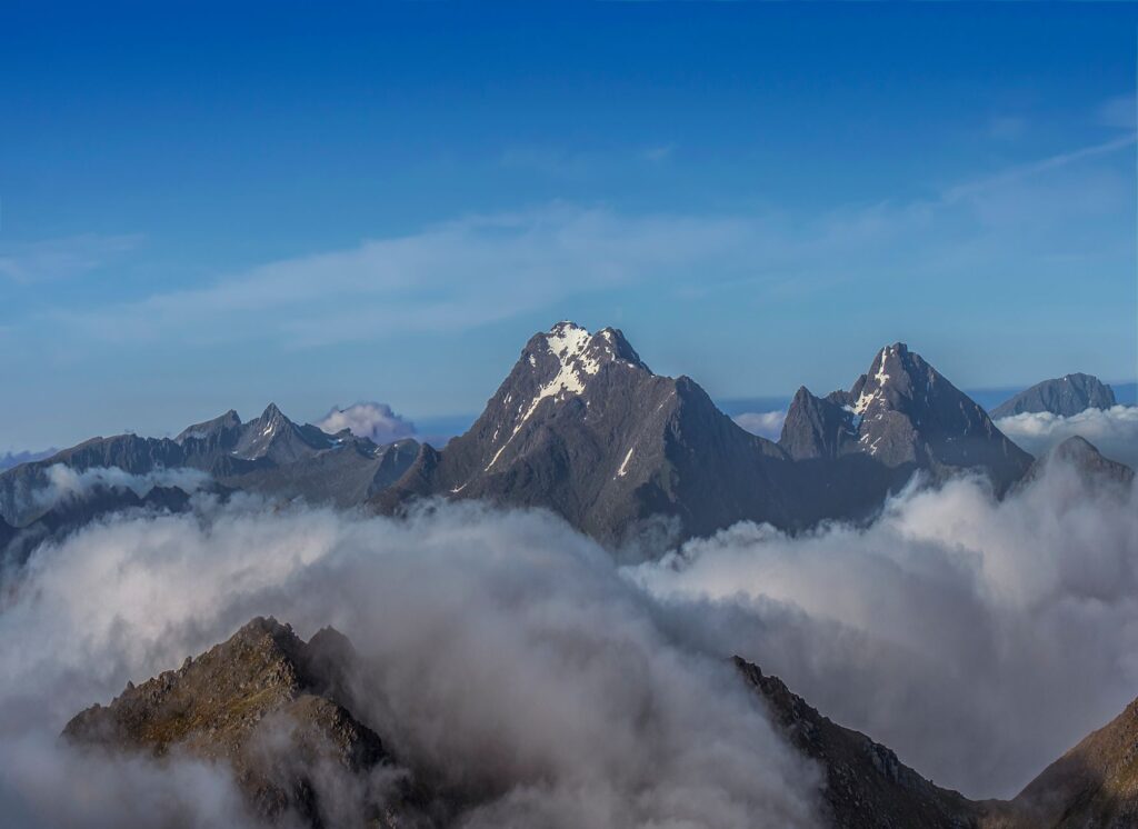
During the crossing, passengers can watch as the continental profile of the Hamarøy Alps slowly fades away while the so-called ‘Lofoten Wall’ (Lofotveggen) emerges on the horizon—a jagged alpine mountain range stretching over one hundred kilometers. This maritime approach offers a spatial comprehension that the E10 highway can never replicate: the sensation of smallness before the immensity of the Arctic landscape. Inside the passenger lounge, amenities are functional yet spartan, featuring informational panels on sea conditions, coffee machines, and areas adapted for passengers with reduced mobility, reflecting Norway’s commitment to universal accessibility even on the most remote routes.
The Historical Link: Bodø – Moskenes
If the Skutvik route connects northern Nordland, the direct link between the coastal city of Bodø and the port of Moskenes at the southwestern tip of Lofoten is the undisputed main artery of the archipelago. With a duration ranging from three and a half to four hours, depending on weather conditions and intermediate stops, this crossing navigates the most open part of the Vestfjorden. Bodø, accessible via the national railway network (Nordlandsbanen) and its international airport, acts as the major multimodal hub where trains from Trondheim converge with travelers heading north.
The port of Moskenes, located just a few kilometers from the picturesque fishing village of Reine, receives several high-capacity ferries operated by Torghatten Nord daily. Arrival in Moskenes is breathtaking: the ship slips between rocky islets before docking at a pier surrounded by granite peaks exceeding one thousand meters in height. It is essential for travelers utilizing this route to consult weather forecasts (Yr.no) and maritime traffic alerts in advance, as winter storms or autumn gale-force winds can suspend departures without prior notice, drastically altering itinerary plans.
The Inner Crossing: Bodø – Værøy and Røst
Beyond the main islands of the archipelago, the insular municipality of Værøy and the remote archipelago of Røst represent the extreme frontier of tourism and human life in the Norwegian Sea. The ferry departing from Bodø and making stops at these peripheral islands before continuing to Moskenes is much more than a means of transport: it is a vital public service guaranteeing supply, medical care, and connection to the mainland for communities of barely a few hundred permanent residents. This journey, which can last up to five hours in adverse conditions, is celebrated for crossing waters where ocean currents generate the famous Maelstrom phenomenon (Moskenstraumen), described by Edgar Allan Poe and Jules Verne as a marine abyss capable of devouring ships.

For the contemporary traveler, visiting Værøy and Røst by ferry demands logistical patience and schedule flexibility. Navigation frequencies decrease considerably outside the summer season, and cancellations due to open-sea swells are frequent. However, those who accept this logistical challenge are rewarded with a pristine natural environment, millions of seabirds nesting on vertical cliffs—including puffins and cormorants—and an atmosphere of absolute isolation that contrasts sharply with the busier areas of eastern and northern Lofoten.
Local Connectivity: The Melbu – Fiskebøl Shuttle Ferry
At the northern end of the archipelago, the Hadselfjorden strait separates the islands of Hinnøya and Hadseløya from the island of Austvågøy. The ferry route between Melbu and Fiskebøl operates as a fast and constant link that complements the road infrastructure of the E10 and the Hadsel Bridge. With a duration of barely twenty-five minutes and frequent hourly departures during most of the day, this service is heavily utilized both by local residents commuting for work and by freight transporters and tourists exploring the Vesterålen and Lofoten regions in combination.
Maritime transport in northern Norway is not a mere tourist formality, but a logistics ecosystem fine-tuned with millimeter precision where nature relentlessly sets the rhythm of daily life.
The operational simplicity of this route contrasts with the complexity of open-sea crossings. Passengers can remain in their vehicles during the short journey or go up to the upper deck to contemplate the floating salmon farms and the geological formations of the Hadsel coast. The management of this line demonstrates the efficiency of the Norwegian subsidized public transport model, where insular connectivity is considered a fundamental right equivalent to the maintenance of continental land roads.

The Minor Fjord Route: Local Ferries and Passenger Boats
In addition to large vehicle ferries, Lofoten boasts a complementary network of passenger vessels and fast ferries (hurtigbåt) connecting localities inaccessible by road or offering scenic shortcuts of high landscape value. Among them, the summer connection crossing the famous Trollfjord stands out—a two-kilometer-long sea arm flanked by rock walls over a thousand meters high where larger commercial ships barely have room to maneuver.
These minor routes are often operated by lighter, faster vessels optimized for foot passengers and cyclists riding the national coastal cycling route. Planning these journeys requires consulting local schedules (available on the regional transport platform *Reis Nordland*), as many of these lines operate exclusively between June and August, drastically reducing frequencies or suspending service during the long, dark Arctic winter.
Logistics and Planning: Fares, Reservations, and Accessibility
Traveling on Lofoten ferries requires rigorous planning methodology, far removed from the improvisation typical of urban travel. Ferry fares in Norway are regulated and calculated based on vehicle length, the number of passengers on board, and the distance of the specific route. In recent years, the Norwegian government has implemented fare reduction policies (and in some cases zero-fare structures) for certain insular ferries to alleviate the cost of living for local residents, although major tourist links such as Bodø–Moskenes maintain pricing structures based on seasonal space scarcity.
It is essential to make vehicle reservations months in advance when traveling between June and August, using official applications or the websites of the awarded operators. Likewise, arriving at the boarding port at least forty to sixty minutes before the scheduled departure time is strongly advised. Staging lanes on the piers are strictly prioritized among pre-booked vehicles, residents with subscription cards, and unreserved passengers waiting on standby. Failing to follow these logistical guidelines can mean being left behind on solid ground, forcing a complete rethinking of the travel itinerary.

Safety, Weather, and the Seasonal Factor
The Norwegian Sea and the Vestfjorden are marine environments of great complexity and potential danger. Safety aboard Norwegian ferries meets the highest international maritime navigation standards (SOLAS convention), and crews receive continuous training in rescue, damage control, and evacuation in cold waters. However, the traveler’s responsibility begins with prevention: consulting the official weather forecast and paying attention to warnings issued by port authorities is an essential requirement before initiating any maritime movement.
During winter, the reduction of daylight, gale-force northwest winds, and snowstorms (snøstorm) radically transform the travel experience. Many routes reduce frequencies to the bare minimum, and timetables become highly flexible due to preventative cancellations. Conversely, the Arctic summer offers twenty-four hours of sunlight (midnight sun), allowing nighttime crossings with exceptional visibility and a luminous tranquility that defines the unique aesthetic of northern Norway.
Sustainability and the Future of Arctic Navigation
In line with the ambitious environmental targets of the Norwegian government and the maritime transport decarbonization directive, ferry routes in northern Norway are undergoing unprecedented technological transformation. Operators such as Torghatten Nord have progressively introduced vessels powered by electricity via high-capacity batteries and liquefied natural gas (LNG) hybrid systems, drastically reducing carbon dioxide emissions and acoustic impact on fragile marine ecosystems in the fjords.

The energy transition in Arctic seas demonstrates that maintaining vital connectivity in extreme geographies is possible without compromising the purity of the natural landscapes that attract millions of visitors.
This technological evolution not only benefits the local environment but also significantly enhances the passenger experience, eliminating the deafening roar of traditional diesel engines on outer decks and allowing silent contemplation of the marine landscape. For the conscious traveler, choosing routes operated by low-emission ships reinforces a commitment to responsible tourism respectful of the archipelago’s fragile ecological balance.
Conclusion: The Journey as a Destination in Lofoten Waters
Exploring the Lofoten Islands through their ferry network radically transforms the nature of contemporary travel. In an era dominated by the immediacy of commercial flights and high-speed highways, northern Norway’s maritime routes compel the traveler to slow down, submit to the natural rhythms of tides and weather, and understand the territory from its original historical perspective: the sea. Whether crossing the indomitable Vestfjorden from Bodø, skirting the vertical walls of the Trollfjord, or linking the insular communities of Hadsel, each crossing offers a lesson in living geography and a privileged window into Arctic maritime culture.
Planning this journey with logistical rigor, respect for safety, and environmental awareness guarantees not only a trouble-free experience but a deep immersion into one of the most beautiful and demanding landscapes on the planet. The waters of Lofoten are not merely a geographical space to be crossed from one point to another; they are the beating heart of an archipelago where land and ocean merge in an eternal alliance.