

Introduction to Aotearoa’s Geographical Challenge
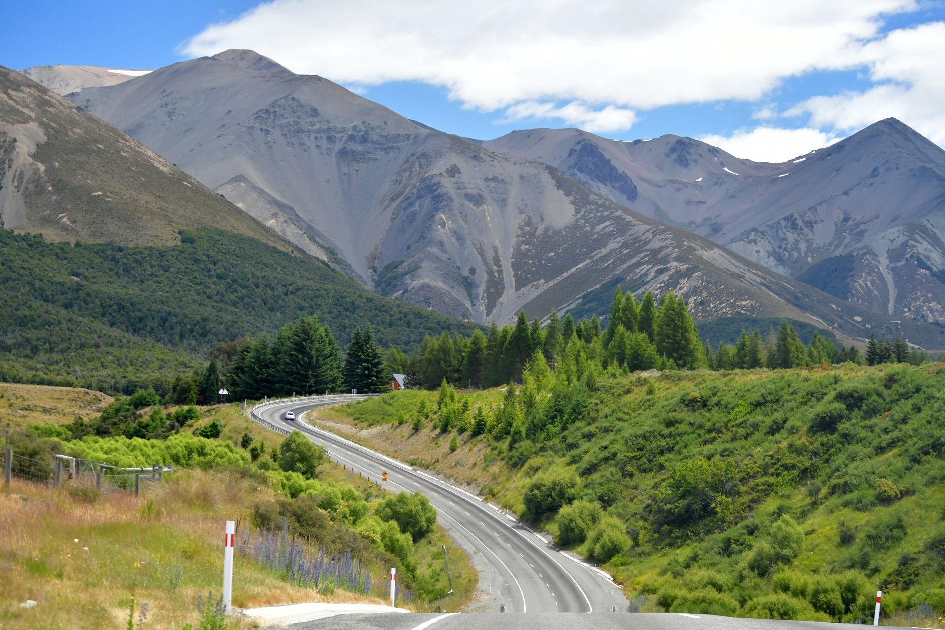
New Zealand’s territory, known ancestrally as Aotearoa, presents one of the most challenging and visually striking topographies on the planet. Composed of two large landmasses—the North Island and the South Island—along with hundreds of smaller offshore islands and atolls, this oceanic archipelago stretches over 1,600 kilometers from north to south. Its spine is dominated by the Southern Alps, a towering mountain range with peaks exceeding 3,000 meters in elevation, while the North Island is characterized by active volcanism and geothermal plateaus. This rugged configuration has historically imposed severe limitations on conventional land travel, turning the development of transport infrastructure into a constant and highly complex engineering endeavor.
Unlike major continental landmasses where railway and road networks expand with relative linearity, the growth of transport in New Zealand has required a highly integrated multimodal solution. Primary highways frequently snake through narrow gorges, cross deep fiord systems, and navigate high mountain passes prone to avalanches and landslides due to the region’s high seismic activity. Connectivity in this extreme environment is not merely a logistical luxury, but the vital lifeline sustaining social cohesion, internal commerce, and the viability of the international tourism industry.
The Backbone of Domestic Aviation: Air New Zealand and Regional Links
Given the fragmentation of the territory and the vast distances separating major urban centers from rural zones, air transport plays an absolutely indispensable role in national mobility. The domestic market is led by the flag carrier, Air New Zealand, whose domestic network connects major international hubs like Auckland, Wellington, and Christchurch with remote landing strips located in provincial airfields.
The regional fleet primarily utilizes turboprop aircraft, such as the ATR 72 and Q300 models, specifically designed to operate on short runways and withstand the unpredictable weather conditions of the Tasman Sea and the South Pacific Ocean. These flights not only transport passengers but act as the primary conduit for the urgent distribution of perishable goods and mail. For isolated communities such as those along the West Coast of the South Island or the far north of the North Island, the scheduled airline service is the sole umbilical cord to advanced healthcare and educational services.
In addition to the national carrier, various charter and bush-flying companies operate light aircraft and helicopters to access mountain valleys inaccessible by road, extensive livestock stations, and fragile endemic flora and fauna conservation zones. These minor operations are vital for environmental management and alpine rescue across the national parks.
The Cook Strait: The Maritime Bridge Between the Two Main Islands
The channel separating the North Island from the South Island, known as the Cook Strait, represents one of the most turbulent and windy maritime stretches in the world. With a minimum width of about 22 kilometers, this body of water is the natural bottleneck of the country’s transport network. To bridge this gap, a continuous service of high-capacity ferries operates, carrying passengers, automobiles, complete freight trains, and large articulated trucks.
The main shipping companies operating this route, Interislander and Bluebridge, connect the ports of Wellington in the north with Picton in the south, navigating through the picturesque waters of the Marlborough Sounds. The crossing takes approximately three and a half hours and offers a stunning visual transition between the bustling political capital and the gateway to the alpine and wine regions of the South Island.
The management of these vessels requires extreme technical precision due to crosscurrents and gale-force winds frequently sweeping down from surrounding valleys. In recent decades, port authorities have invested heavily in modernizing terminal facilities to streamline multimodal transshipment, allowing freight traffic between the two islands to flow with minimal friction.
The Cook Strait is not merely a geographical border, but a testament to New Zealand’s technical capability to keep two radically distinct insular realities united through a high-demand maritime corridor.
The National Road Network: State Highways and Driving in Extreme Terrain
The State Highway Network, administered by the government agency Waka Kotahi NZ Transport Agency, spans more than 11,000 paved kilometers. These routes connect major ports, airports, and population centers. However, due to the scarcity of extensive lowlands, most secondary roads and many sections of the main highways are single-lane in each direction without central dividers.
Driving through New Zealand demands rigorous attention. Roads frequently feature sharp bends, steep gradients, single-lane bridges, and coastal stretches exposed to marine erosion. Compounding this is the mandatory left-hand driving rule—a British legacy—and the constant presence of heavy commercial vehicles and campervans driven by international tourists unfamiliar with local orography.
Government investments have concentrated on building Roads of National Significance, major motorway projects around Auckland, Tauranga, and Wellington designed to alleviate urban congestion and improve road safety, significantly reducing historical crash rates along key logistical corridors.
Passenger and Freight Rail: Between Nostalgia and Heavy Haulage
New Zealand’s railway system, operated largely by the state-owned enterprise KiwiRail, is clearly divided into two sectors: a highly efficient freight transport system and a scenic passenger rail market focused on the domestic and international tourism sector.
In freight, the rail network is crucial for the mass transport of containers from the international ports of Tauranga and Auckland to interior distribution centers, as well as for hauling coal, timber, and dairy products from agricultural regions. Mountainous topography has forced the construction of notable engineering feats, such as the 8.5-kilometer-long Otira Tunnel beneath the Southern Alps and the famous Raurimu Spiral, an ingenious helical loop designed to allow trains to overcome steep elevation changes without exceeding maximum allowable gradients.
Meanwhile, long-distance passenger trains—such as the Northern Explorer (linking Auckland and Wellington), the TranzAlpine (crossing the Southern Alps between Christchurch and Greymouth), and the Coastal Pacific (skirting the east coast of the South Island)—operate less as everyday transport and more as world-class rail experiences. These panoramic trains feature glass-roofed carriages and open viewing platforms that allow travelers to contemplate deep river gorges, temperate rainforests, and glacial plains in absolute comfort.
Urban Transport and Sustainable Mobility in Major Cities
New Zealand’s urban centers have undergone a significant transformation in mobility policies during the 21st century. Cities like Auckland and Wellington, traditionally designed around massive private car usage and low-density suburban sprawl, have heavily invested in modernizing their multimodal public transport networks.
In Auckland, the introduction of the suburban electric rail network and the development of the City Rail Link mega-project—an underground tunnel doubling the capacity of the financial district—have noticeably increased urban rail usage. This is complemented by an integrated network of high-frequency buses (known as rapid transit busways or the Northern Busway) and passenger ferries connecting Hauraki Gulf islands to the central business district.
Wellington, on the other hand, boasts a network of historically converted trolleybuses and a solid commuter rail system linking the capital to the Hutt Valley and the Kapiti Coast, alongside its iconic red cable car connecting the commercial district to the upper botanical gardens.
Port Infrastructure and International Trade
Given that over 99% of New Zealand’s external trade volume is transported by sea, commercial ports are the gateway and exit point of the national economy. The ports of Auckland, Tauranga, Lyttelton (Christchurch), and Port Chalmers (Dunedin) handle millions of TEUs (twenty-foot equivalent units) annually.
The Port of Tauranga has established itself as the country’s largest container port, thanks to deep-dredging investments allowing it to receive New Generation Post-Panamax container ships. This economies-of-scale capacity reduces logistical costs for North Island exporters, enabling dairy products, meat, wine, and timber to reach Asian, North American, and European markets competitively.
Environmental management across these port facilities is extremely rigorous, operating under strict regulations to protect surrounding marine ecosystems, local marine mammal populations, and migratory routes of protected coastal birds.
Practical Information for Planners and Travelers
Planning a trip or a long journey across New Zealand’s transport network requires keeping several fundamental operational variables in mind:
- Advance Booking on Key Routes: Tickets for Cook Strait ferries (Interislander and Bluebridge) and seats on scenic trains (TranzAlpine and Northern Explorer) must be booked months in advance during the peak summer season (December to February).
- Weather Flexibility: Climatic conditions in alpine passes and the Cook Strait can alter regional flight schedules, ferries, and mountain roads without prior notice. It is advisable to allow at least a 24-hour buffer in critical itineraries.
- Smart Transport Cards: In Auckland and Wellington, using rechargeable contactless cards (such as AT HOP in Auckland and Snapper in Wellington) is mandatory or highly advantageous to access integrated urban bus, train, and ferry networks at discounted fares.
- Driving Regulations: Foreign visitors planning to rent vehicles must hold a valid International Driving Permit alongside their original driver’s license in English, or an official sworn translation into English.
Conclusion: Sustainability and the Future of Transit at World’s End
New Zealand’s transport system faithfully reflects the character of its population: pragmatic, environmentally conscious, and deeply shaped by superb geography. As the country moves toward its total decarbonization goals by 2050, mobility infrastructure faces the challenge of electrifying its ferry fleets, urban buses, and commuter trains while maintaining reliability in the most remote areas.
Ensuring this network remains safe, efficient, and ecologically sustainable is the absolute priority of both public operators and private planners. Ultimately, the success of connectivity in New Zealand is measured not solely by the speed with which distances are shortened, but by how the integrity of the pristine landscapes that make this archipelago a unique destination on the planet is preserved.

