From the Rhine Valleys to the Alpine Threshold
The transalpine rail journey connecting central Switzerland with northern Italy does not begin with a dramatic blast of blizzards, but with the quiet murmur of the Rhine in Chur, Switzerland’s oldest documented settlement. Here, beneath the platform canopies where standard-gauge Swiss Federal Railways lines terminate against the narrow-gauge tracks of the Rhaetian Railway (Rhätische Bahn), travelers immediately sense that heading south is less a simple geographical relocation than a vertical ascent through mountain history. Leaving Chur behind, the bright red train slips past the fortress-studded orchards of Domleschg before entering the limestone defiles that guard the Hinterrhein.
At Thusis, roughly seven hundred meters above sea level, the tracks officially join the Albula Railway, opened in 1903 and inscribed alongside the Bernina line as a UNESCO World Heritage site. Beyond this junction, straight tracks cease to exist. The railway surrenders completely to a masterclass of helical tunnels and masonry bridges poised over shale chasms. The valley air dries out and sharpens; broadleaf ash and oak give way to high-altitude conifers lining the cascading waters of the Albula River.
The Audacity of the Albula Gorge and Landwasser Viaduct
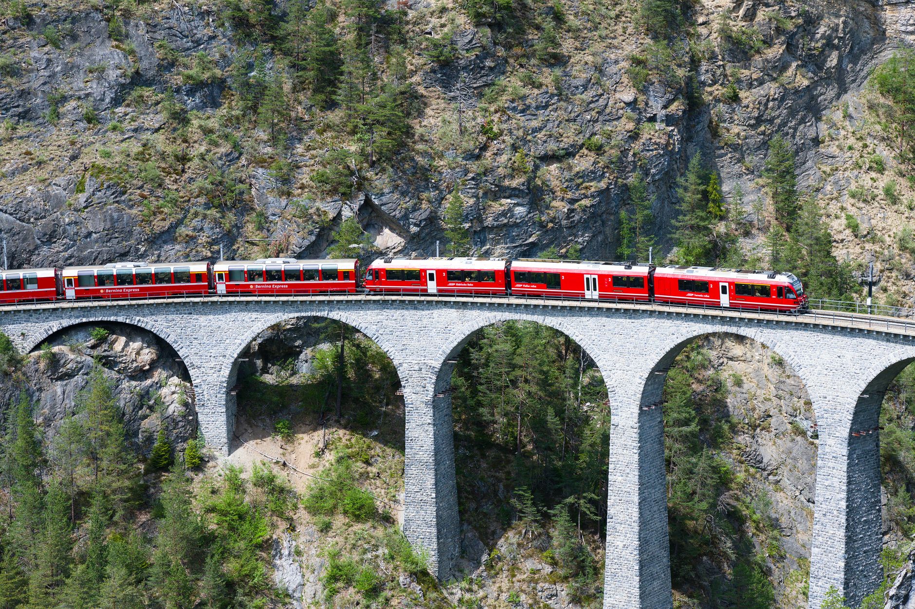
Few monuments of European civic engineering carry the aesthetic gravitas of the Landwasser Viaduct, erected between 1901 and 1902 without reliance on traditional scaffolding rising from the gorge floor. As the train shoots out from a sheer cliff tunnel directly onto six dolomite ashlar arches soaring sixty-five meters above the riverbed, the carriages appear suspended across a void sculpted by millennia of glacial meltwater. The dark limestone piers blend seamlessly into the vertical crags beneath them, proving how early twentieth-century railway engineers sought dialogue with geology rather than ruthless excavation.
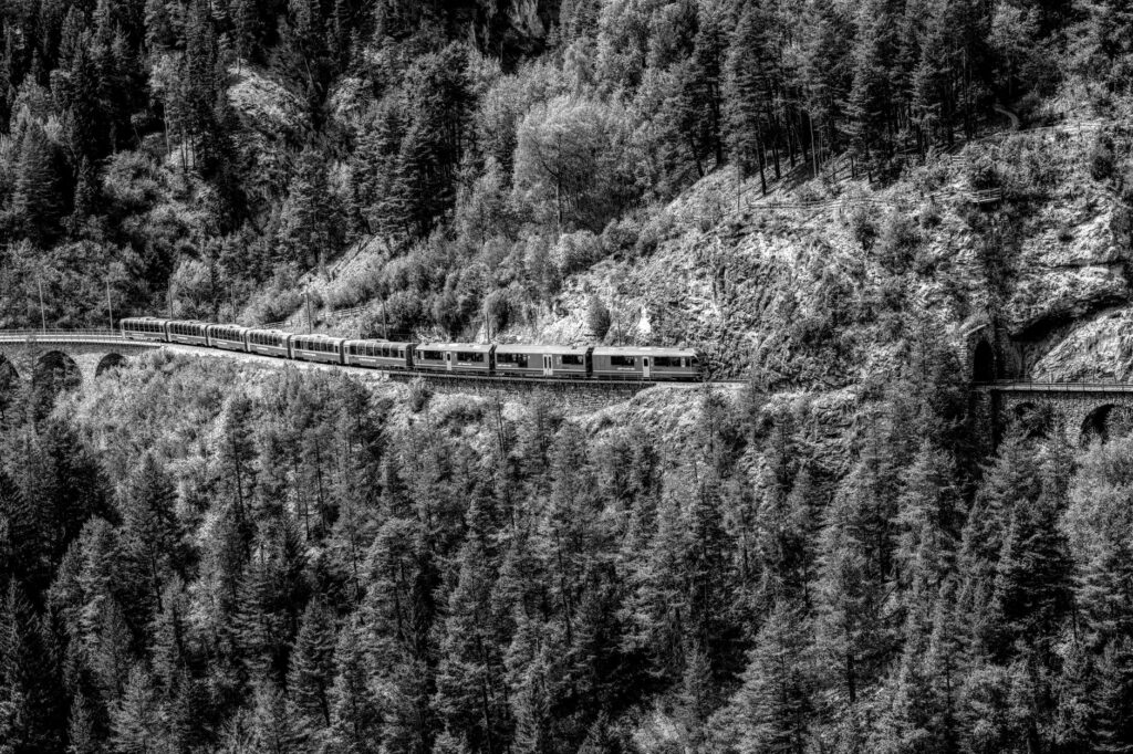
Further up the line between Bergün and Preda, the gradient reaches a formidable thirty-five parts per thousand. To conquer a four-hundred-meter vertical rise over a direct distance of just five kilometers, engineers designed a labyrinth of blind spiral loops deep within the mountainsides. Directional orientation evaporates completely: the Romanesque spire of Bergün church pivots from left to right and eventually appears as a miniature speck deep below, tracing the steel arcs etched inside the mountain. After crossing the historic six-kilometer Albula Tunnel, the line enters the vast, sun-drenched plateau of the Engadin.
The Albula and Bernina lines do not overpower the Alps through brute subterranean excavation, but embrace their contours with artisanal geometric devotion.
Shifting Watersheds: Engadin and the Bernina Massif
Entering the Engadin basin, passengers encounter a broad corridor of crystalline light carved by the Inn River on its long journey toward the Danube. Towns like Samedan and Pontresina showcase classic Engadinesque architecture—thick-walled stone dwellings adorned with intricate sgraffito patterns and deep-set trapezoidal embrasures engineered to capture the winter sun. The forest canopy shifts to golden larch stands, framing direct sightlines to the ice fields of the Bernina Range, the easternmost four-thousand-meter bastion of the Alps.
At Pontresina, the Albula system merges seamlessly into the Bernina Railway, originally built as an independent direct-current line that famously eschewed rack-and-pinion assistance. Relying strictly on wheel-on-rail friction with gradients up to seventy parts per thousand, the Bernina line stands as the steepest adhesion railway in continuous transalpine operation. The train skirts the lateral moraine of the Morteratsch Glacier, whose retreating tongue remains a solemn testament to Quaternary geology. The crackle of overhead catenary wires and the sharp bite of wheel flanges signal the ascent into true high-alpine wilderness.
Ospizio Bernina: The High-Altitude Arctic Divide
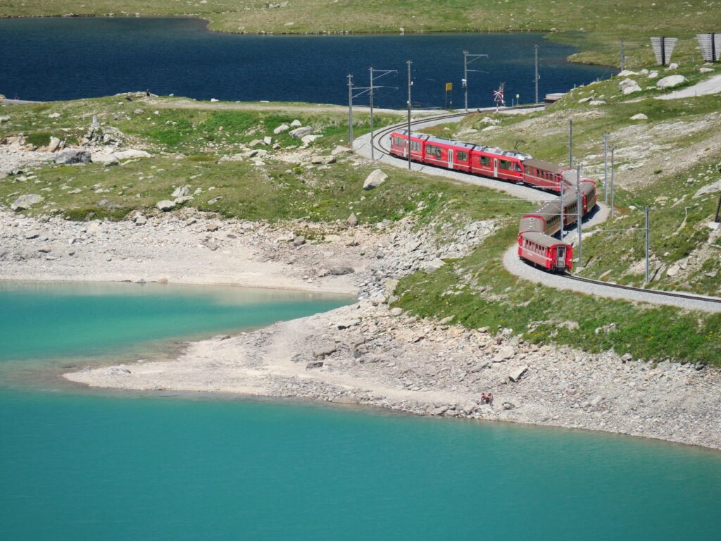
The highest point on the line is reached at Ospizio Bernina station, perched at 2,253 meters above sea level. In this harsh expanse dominated by exposed gneiss, lichen, and permafrost, the train glides along the shores of the Lago Bianco, a glacial reservoir whose turquoise runoff flows all the way to the Adriatic Sea via the Po River system, while adjacent Lej Nair drains northward toward the Black Sea. The landscape here is stark and monumental; trees cannot survive, leaving only the operational railway outposts and the ancient hospice that has sheltered travelers for centuries.
Crossing this ridge represents both a hydrological dividing line and a cultural frontier. While the northern slopes remain rooted in Germanic and Romansh traditions of Graubünden, the southern side feels the gentle thermodynamic pull of warm air masses rising from the Lombard plains. During midwinter, blizzards can envelop the pass in whiteouts, where historic rotary steam snowplows still stand ready on standby to assist modern electric equipment through towering snowdrifts.
The Sheer Descent to Alp Grüm and Val Poschiavo
Past the summit, the line plunges toward the valley through Alp Grüm, a solitary station-lodge set on a balcony 2,091 meters high, inaccessible by road. From its stone terrace unfolds a panorama of the Palü Glacier tumbling down toward its tarn, with the emerald floor of the Val Poschiavo resting eight hundred meters below. To reach it, the tracks must navigate a vertiginous face through tight horseshoe bends engineered with radiuses as tight as forty-five meters.
Descending into Poschiavo is an astonishing feat of kinetic energy management. The train threads reinforced concrete snowsheds and stone galleries, banking back and forth as regenerative dynamic brakes quietly convert gravitational pull into reusable electrical power fed back into the grid. In under thirty rail kilometers, the train drops over eighteen hundred vertical meters without mechanical cogwheels. Barren scree gradually gives way to ancient chestnut groves and terraced pastures bounded by drystone walls, heralding the Italian-speaking enclaves of southern Graubünden.
The Brusio Spiral Viaduct and the Italian Terminus
After skimming the shores of Lake Poschiavo and passing the historic village of Le Prese, the terrain tightens once more near Brusio. To prevent runaway speeds down an unsustainably steep gradient, engineers devised the open-air Brusio Spiral Viaduct—a sweeping, nine-arch loop with a hundred-meter curve radius that allows the train to execute a complete three-hundred-and-sixty-degree circle while losing ten meters of elevation across an open meadow.
Watching the train wrap gracefully around its own stone arches remains an iconic tableau of modern travel. Moments later, the train crosses the Italian frontier at Campocologno, trundling gently past front doors and traversing the Piazza della Basilica in Tirano. In this Valtellina market town, situated at just four hundred and twenty-nine meters of elevation, the air carries notes of roasted espresso, sunbaked terracotta, and Nebbiolo vineyards. The journey concludes amid centuries-old vine terraces, completing one of the most drastic bioclimatic cross-sections reachable anywhere by rail.
Regional Rail Versus the Panoramic Express: Practical Advice
Two distinct operational models serve the Albula and Bernina corridor, catering to different travel styles. The internationally marketed Bernina Express features specialized panoramic cars with domed overhead glazing, audio commentary, and mandatory seat reservations year-round. This service offers effortless sightseeing, though its sealed window glass presents persistent reflections for photography enthusiasts.
Conversely, regular regional trains (marked as Regio or RegioExpress on RhB timetables) run identical routes every hour with traditional carriages featuring drop-down sash windows. Choosing regional services allows travelers to breathe pure alpine air and hear the rushing mountain torrents without glass filters, while offering the flexibility to disembark at trailheads such as Morteratsch, Alp Grüm, or the glacial potholes of Cavaglia without booking penalties.
- Ticketing and Passes: The Swiss Travel Pass, Eurail, and Interrail passes cover all standard regional trains across the route without surcharges; panoramic Bernina Express cars require only an added seat reservation fee.
- Frequency and Connections: Regional services operate on a strict hourly cadence all 365 days a year between St. Moritz or Pontresina and Tirano, linking seamlessly with Trenord services to Milan Central.
- Baggage and Amenities: Modern low-floor trainsets accommodate strollers, mobility equipment, and seasonal outdoor gear including bicycles in summer and skis in winter.
Seasonality, Living Heritage, and the Masonry Legacy
The personality of the line transforms with the calendar. Winter turns the Bernina Pass into an arctic expedition where snow walls dwarf the coaches, providing a staggering contrast to the mild microclimate waiting below in Tirano. Autumn sees the Engadin valley ignite in rich copper and gold as the European larches (Larix decidua)—the only deciduous conifer native to the Alps—shed their needles, while late spring unleashes thundering meltwater over the granite falls of Cavaglia.
More than a vital transport link uniting northern and southern Europe through all weather conditions, the Albula and Bernina lines of the Rhaetian Railway remain an enduring benchmark of landscape integration. Every stone viaduct and hand-chiseled retaining wall reminds us that great infrastructure need not scar the earth, but can instead elevate the natural world into a timeless shared journey.