
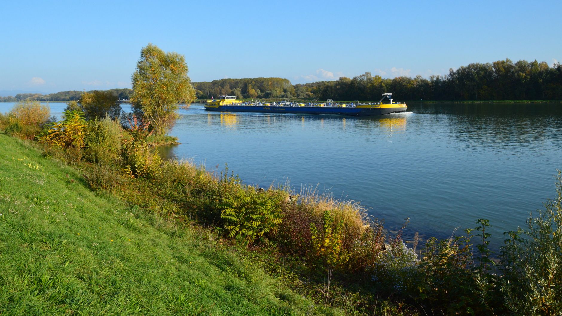

Navigating the Danube River aboard a traditional cargo barge is not an exercise in conventional leisure, but a deep immersion into the most complex logistical artery of Central and Eastern Europe. From its source in the Black Forest to its immense delta emptying into the Black Sea, this nearly three-thousand-kilometer aquatic corridor vertebrates borders, economies, and ancient histories. Far from the artificial glamour of luxury river cruises, the experience of traversing the Danube from the perspective of the merchant navy offers an unrelenting X-ray of modern hydraulic engineering, international transport regulations, and the persistence of riparian communities that depend entirely on the pulse of the current.
This expedition guide analyzes the technical and practical fundamentals necessary to understand deep-draft river navigation, a sector governed by strict safety codes, millimeter-precise locking protocols, and a profound understanding of European hydrography. Through this journey, the specialized traveler decodes the invisible machinery that enables commercial exchange between ten nations, unveiling the operational challenges faced by barge captains in their daily struggle against sedimentation, historical bridges with reduced clearance, and seasonal discharge fluctuations.
The Geopolitics of International Waters: The Regime of the Danube Commission
Understanding navigation on the Danube requires, before setting sail, delving into the complex legal framework governing its waters. Unlike other sovereign rivers, the Danube has been considered international since the Treaty of Paris in 1856. Today, the Danube Commission, headquartered in Budapest, ensures freedom of navigation for all flags under the principle of equal fiscal and operational treatment. However, this theory of free circulation collides with the sovereign reality of each riparian state, which applies specific customs regulations and rigorous border controls, especially in sections marking the boundary between the European Union and non-EU Balkan states.
For river transport professionals, processing nautical documentation is a discipline as demanding as piloting itself. Each vessel must carry the Community Certificate of Recognition, which validates compliance with European safety regulations for inland navigation. Likewise, the crew service record book and specific navigation patents for each sector of the river—such as the Austrian Wachau stretch or the formidable submerged rapids of the Iron Gates—are inescapable requirements. The crew must demonstrate absolute mastery of the police regulations for navigation on the Danube River, known by its French acronym as the RPNRD, which governs everything from nighttime positioning lights to the right-of-way in blind curves.
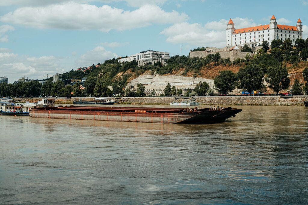
The impact of geopolitical infrastructure also manifests in maintenance and draft disparities between the upper, middle, and lower courses. While Germany and Austria have channeled and regulated much of their territory through complex systems of dams and canals like the Main-Danube Canal, sectors running through Romania and Bulgaria depend heavily on bilateral dredging agreements. The lack of a unified budget for channel maintenance in the lower Danube generates seasonal bottlenecks where fully loaded mineral or grain barges must lighten their tonnage to avoid running aground on the shifting sandbars swept along by the current.
Anatomy of a Cargo Barge: Naval Architecture and Fluvial Habitability
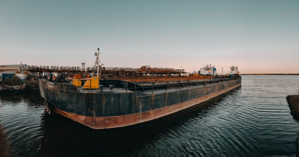
A self-propelled river barge or one pushed by a powerful tugboat is a masterpiece of naval architecture adapted to severe constraints. Unlike ocean-going vessels designed to withstand the violence of waves and saline corrosion, Danubian craft prioritize maximizing beam and length within the dimensional limits of the locks. With lengths typically ranging from eighty to one hundred ten meters and beams of eleven to twelve meters, these vessels are optimized to maximize the block coefficient, allowing the transport of up to three thousand tons of dry or liquid cargo with a draft that rarely exceeds two and a half meters when fully loaded.
Habitability onboard is spartan yet highly functional. Crew accommodations, located aft beneath the wheelhouse, combine compact cabins with common areas where the monitoring of propulsion and navigation systems is centralized. Marine diesel engines, typically eight or twelve cylinders with powers exceeding fifteen hundred horsepower, operate continuously during marathon shifts. The wheelhouse is a display of ergonomic technology: river radar systems adapted to eliminate echoes from riverbanks, high-precision gyrocompasses, autopilots coupled to differential global positioning systems, and multi-channel VHF radios configured specifically for the mobile service of river radiocommunications.

Cargo stability is another critical pillar in daily operations. Hatcheless holds or those protected by sliding hydraulic panels demand millimeter-precise weight distribution. Whether carrying steel coils, bulk fertilizers, or wind turbine components, any cargo shift during navigation can cause a dangerous list. Captains employ onboard stability calculation software before each port call, constantly evaluating bending moments and shearing forces sustained by the structural steel hull when traversing crosscurrent zones or natural rapids.
The Engineering of Water: The Art of Negotiating Danube Locks
No journey down the Danube is complete without mastering the technique of transiting through its major hydroelectric complexes. Along the river, especially in the stretch between the confluence with the Inn River in Passau and the Romanian border, gigantic dams rise to bridge colossal elevation differences via navigation locks. Structures such as Gabčíkovo in Slovakia, or Iron Gates I and II on the border between Serbia and Romania, force barges to operate in a vertical environment of millimeter precision where the margin for error is practically nonexistent.
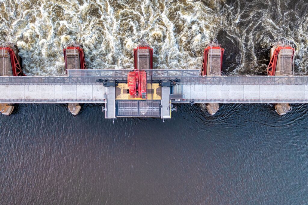
The locking process begins hours before arrival through radio communication with the dam control center. The dimensions of the lock chambers—frequently two hundred thirty meters long by twenty-three wide—occasionally allow the simultaneous transit of multiple units or push trains. However, entry must be executed with controlled inertia, counteracting turbulence generated by the filling or emptying of thousands of cubic meters of water. Deck sailors play a vital role in this phase, throwing mooring lines to floating bollards embedded in the reinforced concrete walls, which rise or descend synchronously with the water level.
Overcoming the elevation drop of the Iron Gates aboard a river convoy is witnessing how human ingenuity has tamed the geological fury most feared by ancient Roman navigators.
The passage through the Iron Gates deserves special mention within Danubian nautical cartography. In this gorge where the Carpathians meet the Balkans, the river narrows dramatically, creating a canyon of vertical walls historically known as the cauldrons or *Kazan*. Formerly, the Sip rapids made this stretch a vessel graveyard due to current violence and submerged reefs. Today, the construction of major dams has flooded the original rapids, but it has generated complex crosscurrents and underwater eddies requiring experts to read wakes and rudder behavior.
Hydrography and Meteorology: Seasonal Reading of River Discharge
The Danube is a mixed-regime river, fed by both alpine snowmelt from its upper basin and rainfall from its tributaries in the Pannonian plain and the Carpathians. This duality causes drastic seasonal variations that absolutely condition cargo barge operations. During spring months, coinciding with snowmelt in the Bavarian and Austrian Alps, discharge experiences sudden spates transforming the river into a monster of turbid, high-velocity waters. In these periods, navigation faces the danger of floating logs and reduced clearance under historical bridges, forcing radar masts and wheelhouses to be lowered.
At the opposite extreme, prolonged summers and recurrent droughts affecting Southern Europe in recent years have turned low water levels into the invisible enemy of river transport. Critical sectors like the Bulgarian-Romanian stretch suffer severe draft restrictions, where historical depth minimums force logistics operators to reduce payload by up to forty percent. Reliance on daily meteorological reports and reference hydrometric stations—such as Kaub on the Rhine or equivalents in Vienna and Budapest—is absolute for calculating the economic viability of each voyage.
Dense fog is another meteorological phenomenon periodically paralyzing commercial traffic in the middle and lower Danube. Especially during autumn and winter, radiation fog banks forming over the Hungarian plain reduce visibility to a few meters. According to international regulations, when visibility drops below safe limits, barges must anchor in authorized parking zones or designated riverbanks, patiently waiting for thermal currents to disperse the haze. This unforeseen interruption tests the management capacity of supply chains operating with just-in-time precision.
Life Onboard: Routines, Provisioning, and Self-Sufficiency
Daily existence on a fluvial cargo barge proceeds at a markedly dichotomous pace: long periods of monotonous contemplation of the riparian landscape interrupted by moments of peak operational tension during port maneuvers, refueling, or nighttime navigation in narrow channels. The standard crew typically consists of a captain, a relief master, two qualified deckhands, and a cook-deckhand. This small community lives together for weeks in a confined space where task division follows strict watchkeeping shifts ensuring uninterrupted vessel operation twenty-four hours a day.
The provisioning of food, potable water, and mechanical spare parts is planned with millimeter precision, taking advantage of brief technical stops in major logistical ports like Linz, Bratislava, Budapest, or Belgrade. Unlike ocean-going vessels, Danubian barges can occasionally dock at rural sidings to receive fresh supplies or conduct personnel rotations via auxiliary boats or land vehicles meeting the convoy at the locks. Waste management onboard is subject to extremely rigorous environmental regulations, strictly prohibiting the discharge of greywater and used oils, which must be pumped into authorized reception facilities at base ports.
Technical self-sufficiency is another indispensable competency for any Danube sailor. Faced with a breakdown in the auxiliary steering system or bilge pumps, external assistance can take hours to arrive in the middle of an isolated river stretch. Therefore, workshops aboard barges are equipped with welding tools, lathes, and essential spare parts to resolve urgent mechanical contingencies, turning the crew into a multidisciplinary team capable of keeping the structure afloat under the most adverse conditions.
Fluvial Economy and Green Transition: The Future of the Danubian Corridor
Within the context of the European Green Deal and the need to decarbonize freight transport, the Danube is undergoing a profound strategic transformation. River transport emits approximately one-fifth of the CO2 per ton-kilometer compared to road transport, making this corridor an irreplaceable ecological alternative for continental trade. However, fleet modernization advances at an uneven pace. While major German and Austrian flag-shipping lines are incorporating hybrid engines, electric propulsion systems, and alternative fuels like liquefied natural gas or advanced biodiesel, a significant portion of the fleet operating on the lower Danube requires urgent technological renovation investments.

Economic challenges also stem from regional geopolitical instability. Conflicts in Eastern Europe and fluctuations in international grain and raw material trade have altered traditional cargo flows. Barges, traditionally specialized in transporting coal, iron ore, and steel products, are now diversifying their holds toward container transport and oversized cargo for renewable energy projects. This diversification requires the adaptation of loading docks and the digitalization of customs processes through European single windows to streamline border transit among riparian countries.
The future of the Danube as Europe’s great liquid highway depends not only on its water discharge, but on the political and economic capacity to integrate its infrastructure into a truly multimodal and sustainable transport network.
Likewise, ecological restoration projects driven by the European Union seek to reconcile commercial navigation with the preservation of fragile ecosystems in the Danube Delta and protected alluvial plains. The creation of fluvial ecological corridors demonstrates that civil engineering and environmental conservation can coexist, provided clear limits are established against aggressive dredging and integrated watershed management is promoted on a transnational scale.
Practical guide
- Documentation and Boarding Requirements: To undertake an observation or journalistic journey aboard a commercial cargo barge on the Danube, it is essential to arrange special permits months in advance with the owning shipping companies, as well as secure repatriation insurance and international medical coverage valid for all traversed riparian countries.
- Best Season for Observation: Late spring (May to June) and early autumn (September to October) offer the most stable weather conditions, avoiding both extreme floods from alpine snowmelt and severe draft restrictions caused by summer droughts.
- Key Logistical Points of Interest: Cities such as Regensburg in Germany, Linz in Austria, Bratislava in Slovakia, Budapest in Hungary, and Novi Sad in Serbia concentrate the highest river traffic activity and offer the most developed port infrastructure for studying logistical operations.
- River Safety Regulations: All observers onboard must strictly comply with the mandatory use of personal protective equipment, including certified life jackets with integrated harnesses, non-slip safety footwear, and approved helmets during deck maneuvers and lock transits.
- Connectivity and Communications: Although mobile phone coverage is generally good across most of the upper and middle course, the steep gorges of the Iron Gates can present dead zones. Portable satellite radio systems are recommended for long-duration expeditions or documentary work in remote areas.
The steady murmur of high-displacement diesel engines, vibrating subtly through the steel plates of the bulkhead, accompanies the traveler during rest hours in the aft cabin. When the barge reduces speed to approach a nighttime lock illuminated by industrial floodlights, the dark water of the Danube reflects the metallic flashes of human infrastructure, reminding us that this river never sleeps. Observing the immensity of the Hungarian plain from the wheelhouse of a river freighter is understanding time on another scale: a cadence measured in knots, locks, and ancient currents silently continuing to shape the geographical heart of Europe.


