

Introduction to Atlantic Isolation and the Seafaring Vocation of the Azores
The Azores archipelago emerges in the middle of the North Atlantic Ocean as a monumental submarine summit, a collection of nine volcanic islands separated by hundreds of nautical miles from the nearest continental landmass. This condition of absolute isolation has historically forged a symbiotic relationship between its inhabitants and the sea, transforming inter-island navigation into a demanding discipline that requires a profound understanding of the marine environment. Unlike enclosed seas or tropical archipelagos protected by coral reefs, Azorean waters are exposed to the fury of Atlantic fronts, the constant roll of deep-sea swells, and a wind regime that can change dramatically within hours. Planning a maritime voyage through these latitudes demands technical rigor, absolute respect for currents, and a vessel adapted to the rigors of open water.
For the contemporary navigator, venturing into the routes connecting islands such as São Miguel, Terceira, Faial, or Flores represents one of the purest challenges remaining in Western exploration. Here, there are no overcrowded marinas or the false security of a gentle, continuous coastline; every insular channel—such as the celebrated channel between Faial and Pico—functions as a natural accelerator of winds and tides where seamanship is constantly put to the test. This report rigorously addresses the logistical, meteorological, and practical aspects fundamental to understanding and successfully executing a nautical expedition through the blue heart of the Portuguese Atlantic.
Oceanic Geography and the Dynamics of Insular Channels
Understanding the hydrography and underwater topography of the Azores is the first inescapable step for any skipper or crew aspiring to navigate its waters. The archipelago is divided into three main groups—the eastern group with São Miguel and Santa Maria; the central group with Terceira, Graciosa, São Jorge, Pico, and Faial; and the western group with Flores and Corvo—separated by abyssal trenches exceeding two thousand meters in depth. This topography interacts directly with the Gulf Stream and high-pressure systems, generating complex local wind patterns known as the shadow effect and channel acceleration.

When dominant westerly or northwesterly winds collide against the imposing volcanic walls of islands like Pico—whose peak reaches 2,351 meters in altitude—violent eddies and descending gusts are produced, capable of surprising even the most experienced vessel leeward of the island. Likewise, the channels separating landmasses act as natural funnels. The Faial channel, for instance, with a width of barely eight nautical miles, concentrates significant tidal currents and cross-seas that demand precise helm control and constant monitoring of onboard electronics.
Atlantic Meteorology: Reading Fronts and the Influence of the High
The climate of the Azores is governed by the dynamics of the famous Azores High, a subtropical high-pressure system regulating the meteorological stability of much of the North Atlantic. However, its position is never static; it oscillates latitudinally throughout the year, allowing the successive passage of cold depression fronts coming from Newfoundland and the North American east coast. For the mariner, this means that weather forecasts beyond forty-two hours must be treated with extreme caution and constantly cross-referenced with onboard barometers and direct observation of the sky.

Navigating the mid-Atlantic is not a matter of conquering waves, but of understanding the unalterable rhythm of pressure systems shaping the oceanic atmosphere.
Winter and autumn storms bring gale-force winds and mountainous seas that completely advise against recreational or light expedition sailing. The optimal seasonal window is concentrated between the months of June and September, when the high-pressure system consolidates over the archipelago, offering prolonged periods of stability, moderate winds from the north or northeast sector, and pleasant temperatures. Nevertheless, even in the dead of summer, the sudden formation of local convective cells can generate intense squalls and localized gusts exceeding predicted strengths, underlining the need to maintain an active and alert crew on deck at all times.
Port Logistics and Recalls in the Central Group
Route planning within the archipelago must be structured while taking into account the availability and technical characteristics of ports of refuge and marinas. Unlike continental Europe, many Azorean ports are artificial breakwaters built against the direct energy of the ocean, meaning that entry with a northern or western swell can become a high-risk technical maneuver due to backwash and breaking waves at harbor entrances.
The Central Group, formed by the islands of Faial, Pico, São Jorge, Graciosa, and Terceira, offers the highest density of operational nautical infrastructure. The marina of Horta, on the island of Faial, constitutes the historical and logistical epicenter of transatlantic and inter-island navigation in the Azores. Its harbor basin, famous for hosting solo sailors from around the world, provides adequate protection, fuel, potable water, and specialized technical services. Departing from Horta toward Madalena port in Pico or toward the coastal fajãs of São Jorge involves short but intense voyages, where departure times must be rigorously synchronized with tide tables and nighttime visibility.
Safety Onboard, Communication Equipment, and Self-Sufficiency
The remoteness of the Azores from peninsular maritime rescue centers compels crews to maximize safety protocols aboard any expedition vessel. Each voyage requires an exhaustive inventory going beyond legal minimums: self-inflating liferafts with oceanic-category emergency rations, 406 MHz emergency position-indicating radio beacons (EPIRBs) operational in frequency, satellite communication systems for continuous reception of GRIB weather reports, and safety harnesses with double tethers rigorously homologated for nighttime use and heavy seas.

Likewise, energy and freshwater management require millimeter precision. Although the islands possess abundant freshwater resources on land, autonomy during oceanic hops between insular groups—such as the journey of over one hundred and fifty miles between the Central Group and the Western Group of Flores and Corvo—demands functioning watermakers, efficient solar panels or marine wind generators, and a strict fuel reserve for motor propulsion in case of prolonged calms or unforeseen mechanical emergencies.
Environmental Impact and Responsible Navigation in Cetacean Sanctuaries
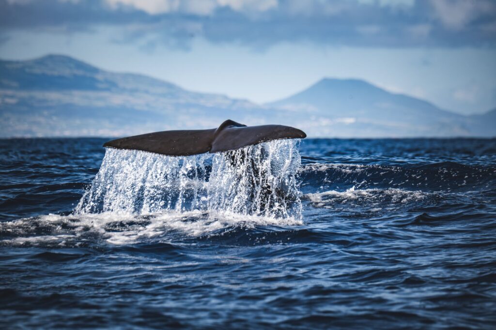
The deep waters surrounding the Azores archipelago constitute one of the most important cetacean sanctuaries on the planet, hosting resident and migratory populations of sperm whales, baleen whales, pilot whales, and various dolphin species. Navigating this privileged environment entails an inescapable environmental responsibility for sailboat and motor vessel skippers alike. Portuguese and international legislation establishes very strict regulations regarding minimum approach distances to animals, the prohibition of crossing pursuit paths, and the obligation to maintain reduced speeds in areas of high biological density.
Propeller use represents a direct threat to marine wildlife, making the installation of propeller guards and permanent bow watch indispensable technical measures in modern expedition boating. Expedition members must assume they are temporary guests in the habitat of large marine mammals, and that absolute respect for scientific observation protocols and marine ecotourism is the sole guarantee for preserving the ecological integrity of these isolated insular ecosystems.
Practical Information for Planning the Nautical Expedition
To successfully materialize a maritime voyage in the Azores archipelago, it is essential to coordinate a series of preliminary logistical aspects guaranteeing the technical and legal viability of the project:
- Recommended Time Window: From mid-June to late September, a period during which the Azores High is most stable and the frequency of violent cold fronts decreases.
- Documentation and Permits: Mandatory port clearance dispatch with the local Port Captaincy at each island change, presentation of crew list, valid vessel insurance, and updated seaworthiness certificate.
- Cartography and Electronic Navigation: Indispensable use of updated official nautical charts (in both paper and digital format), redundant GPS systems, and raster cartography of Portuguese hydrography.
- Strategic Base Ports: Marina de Horta (Faial) for major repairs and provisioning; Marina de Ponta Delgada (São Miguel) for the eastern group; and the port of Lajes das Flores for the jump to the western group.
- Personal Equipment: Breathable and waterproof offshore technical clothing, nautical boots with natural rubber non-slip soles, waterproof individual lighting systems, and survival suits if operating in advanced outer routes.
Conclusion: The Enduring Value of Classical Seamanship in the Atlantic
The Azores continue to be a bastion of authenticity for navigators seeking to challenge the Atlantic beyond commercial routes and mass tourism. The voyage between their volcanic coasts grants no quarter to improvisation; it demands humility before the magnitude of the ocean, rigor in executing maneuvers, and profound respect for the natural cycles governing this remote corner of Macaronesia. At the end of the passage, when the dark profile of an island emerges through the mist and wave crests, one understands that the true value of the maritime expedition lies in the human capacity to dialogue with wind and currents, keeping alive the timeless tradition of great oceanic exploration.


