
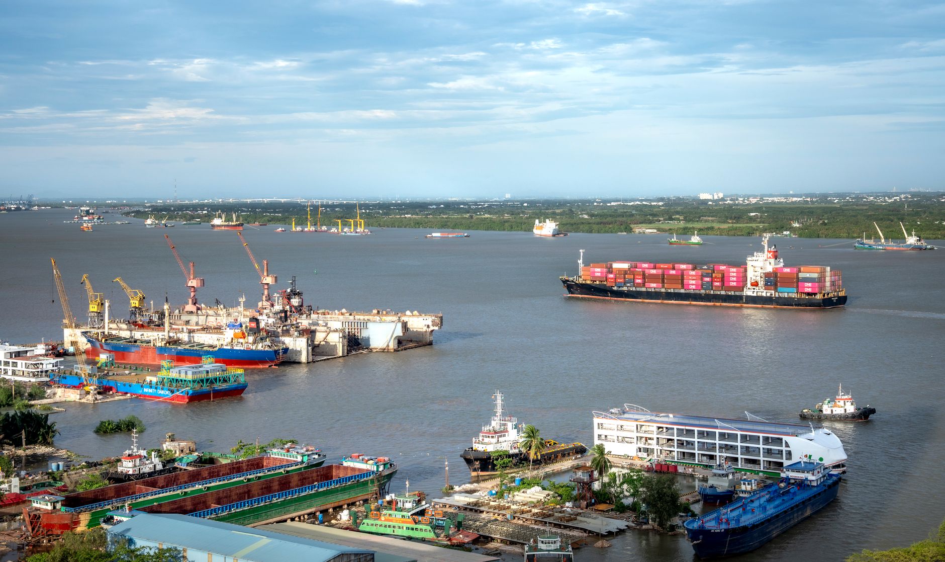
Introduction to Indochina’s Aquatic Colossus
The Mekong River is far more than one of the planet’s most voluminous hydrological arteries; it represents the backbone of mobility, cross-border commerce, and the economic survival of millions across Southeast Asia. From its source in the high altitudes of the Tibetan Plateau to its expansive delta in Vietnam, this ancient channel has historically served as the region’s primary natural highway. Today, amid an era of aggressive infrastructure modernization, the Mekong’s river connectivity is undergoing a profound transformation driven by the urgent need to balance commercial development with ecological preservation.
Spanning over four thousand kilometers, the river crosses or borders China, Myanmar, Laos, Thailand, Cambodia, and Vietnam. This geopolitical plurality turns river navigation into an intricate logistical puzzle where divergent national interests, disparate international regulations, and a constant struggle to maintain navigable channels against monsoonal variations and upstream hydroelectric dams converge.
Fluvial Geography and Seasonal Flow Dynamics
Understanding the viability of transport along the Mekong requires examining its extreme hydrological variability. During the rainy season, typically spanning from May to October, water volumes surge dramatically, causing annual floods that reshape the riverbed’s bathymetry. These constant shifts compel port authorities and vessel operators to continuously update navigational aids and conduct ongoing dredging operations to ensure the safety of commercial freight and passenger transit.
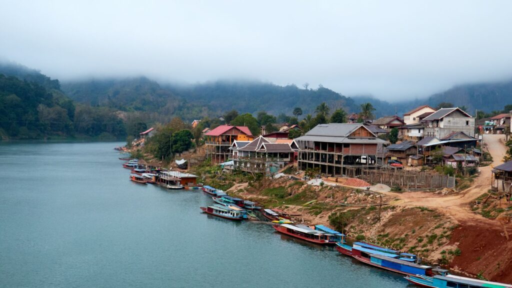
Conversely, the dry season drastically reduces water levels, particularly in the northern reaches flowing through Laos and northern Thailand. In these areas, natural rapids, rocky outcrops, and shifting sandbars turn the transit of deep-draft vessels into a test of high-precision seamanship. Local captains, true experts in reading currents and turbulence, must balance instrumental navigation with generational empirical knowledge to safely maneuver through the river’s most treacherous stretches.
The Evolution of Port Infrastructure and International Routes
Over the past two decades, the Greater Mekong Subregion cooperation framework has driven significant investments in upgrading riparian logistics nodes. Key ports such as Chiang Saen in Thailand, Luang Prabang and Pakse in Laos, and Phnom Penh in Cambodia have substantially enhanced their cargo handling capacities and passenger reception facilities. These installations no longer operate as traditional riverbanks; instead, they function as multimodal platforms bridging river transport with transnational highway networks.

Selective channel dredging and the removal of rocky obstacles along the border convergence of China, Laos, Thailand, and Myanmar have enabled the establishment of international commercial routes navigated by larger freight vessels. However, this industrialization of the river has sparked intense debates among riparian communities and environmental experts, who warn of the irreversible impacts that artificial channel modifications inflict on aquatic ecosystems and local fisheries.
Intermodal Integration: Linking the River to New Rail Networks
One of the most fascinating aspects of contemporary connectivity within the Mekong basin is its articulation with newly minted high-speed railway corridors and transnational highways. The inauguration of the Laos-China railway, connecting Kunming to Vientiane, has radically altered the internal continental logistics map. Goods and travelers who traditionally relied exclusively on slow coastal barges or secondary roads now benefit from efficient transfer points between rail and river.
This intermodal synergy optimizes regional supply chains, facilitating the transport of agricultural goods, minerals, and manufactured products from landlocked areas to maritime ports in the Vietnamese delta and the Gulf of Thailand. Nevertheless, scheduling synchronization, customs inspections at river and land border crossings, and disparities in cargo-handling technology standards continue to pose significant bottlenecks that local administrations strive to resolve through bilateral and trilateral agreements.
Passenger Navigation and River Tourism Experiences
Beyond its strictly commercial and logistical functions, the Mekong remains an exceptional stage for exploratory travel and river tourism. Traditional wooden slow boats continue to operate on iconic routes such as the journey between Huay Xai and Luang Prabang in Laos. These voyages offer travelers a privileged window into the daily lives of rural communities dwelling along the banks, where the river functions simultaneously as a communication route, floating market, and social gathering space.
Navigating the Mekong is not simply moving from one point on a map to another, but immersing oneself in a current where time seems measured by the rhythm of seasonal floods and agricultural cycles along the banks.
At the opposite end of the tourism spectrum, the Mekong Delta in Vietnam hosts upper-tier cruise vessels traversing smaller canals and tributaries. These itineraries combine contemporary comfort with a rigorous exploration of local culture, visiting traditional floating markets such as Cai Rang, artisanal coconut-processing workshops, and agrarian communities specializing in intensive rice and tropical fruit cultivation.
Environmental Challenges and the Impact of Upstream Dams
The long-term viability of river connectivity in the Mekong faces an existential threat stemming from the massive construction of hydroelectric dams in Chinese territory and along the middle course in Laos. These megaprojects alter natural hydrological regimes, retain fertile sediments indispensable for agriculture in the lower delta, and sever migratory fish routes critical to the food security of over sixty million people.

Water retention and artificial fluctuations in water levels severely complicate commercial and recreational navigation, triggering unexpected grounding incidents and forcing river operators to constantly readjust schedules and maximum allowed drafts. The Mekong River Commission (MRC) plays a pivotal role in monitoring these impacts, though the absence of binding compliance mechanisms limits its authority to curb unilateral dam projects.
Navigation Safety and River Diplomacy
Managing an international corridor shared by six sovereign states requires robust diplomatic and police cooperation mechanisms. Joint patrols coordinated among China, Laos, Myanmar, and Thailand in the river’s upper reaches aim to combat smuggling and illicit trafficking while safeguarding merchant crews against historical security incidents that once undermined trust in the route.

Similarly, environmental emergency response protocols—such as spill containment or passenger vessel accidents—demand seamless coordination among river traffic control centers across different countries. The standardization of navigation licenses, nighttime signaling, and VHF radio communication systems are areas where technical cooperation has advanced notably in recent years, though significant regulatory discrepancies persist among national legal frameworks.
Practical Information for Travelers and Logistics Researchers
For those interested in exploring the Mekong or studying its transport infrastructure firsthand, several operational recommendations validated by local operators and navigation authorities should be considered:
- Seasonal Planning: Avoid the peak dry months (March to April) when planning travel through northern sections in Laos, as draft restrictions frequently force the suspension of regular passenger services.
- Documentation and Visas: River border crossings, such as Chiang Khong to Huay Xai, offer visa-on-arrival facilities, but travelers are advised to carry local currency (Kip or Baht) alongside pristine US dollars to avoid administrative delays or surcharges.
- Onboard Safety: When utilizing public rural passenger boats, verify the availability of life jackets and avoid overloading luggage, particularly during periods of strong monsoonal currents.
- Digital Connectivity: Mobile phone and internet signals fluctuate in narrower river canyons; downloading offline maps and updated local ferry schedules prior to departure is strongly recommended.
Conclusion on the Future of the River Corridor
The Mekong’s transport and connectivity network stands at a historical crossroads. While pressure to transform the river into an industrial freight highway intensifies, voices advocating for its ecological and cultural integrity demand more sustainable development models. The survival of this river corridor as a pathway for life and regional understanding will depend upon the capacity of riparian governments to harmonize economic growth with respect for the fragile natural balances of the basin.
The future of the Mekong will not be decided in naval engineering offices, but at the negotiating table where the geopolitics of water recognize that a living river is the most valuable logistical asset a nation can preserve.