On paper, Ipís is a district of the Goicoechea canton in San José province, sitting at roughly 1,325 metres above sea level with a little over 26,000 residents. That administrative entry says little about what a visitor finds on arrival: a hillside strip where the city is no longer entirely city and the countryside is not yet entirely countryside, and where coffee, streams and new pavements coexist in a balance best explored on foot.
This itinerary is not about the grand viewpoint or the weekend panoramic drive. It is a slow, verifiable walk through a district on the capital’s edge that helps explain how Costa Rica’s urban fringe is organised: buses that climb and descend, corner shops that double as information desks, and a network of neighbourhood roads that preserves the area’s farming memory.
A hillside district on the map of Goicoechea
Goicoechea is one of the cantons that make up the metropolitan heart of San José, and Ipís is one of its districts. Its moderate altitude and position on the inner slope explain much of its character: frequent morning mist, mild afternoons and a humidity that shows on walls and in the vegetation of front gardens. Anyone arriving from central San José notices the change of scale within a few kilometres: fewer tall buildings, more one- and two-storey houses, more trees over the pavements.
The district is best understood as part of an urban continuum rather than an isolated village. Ipís connects with neighbouring districts of Goicoechea and with the capital’s road network, and its daily life depends on that relationship: people commuting down to work in San José, students travelling up and down every day, small businesses serving the local population. That edge condition is precisely what makes the walk interesting.

Why coffee still explains the landscape
The recent history of much of Costa Rica’s central plateau can be told through coffee, and Ipís is no exception. Although the district no longer depends exclusively on farming, the crop is still present in gardens, plots and small parcels, and its footprint is visible in the topography: rows of shrubs on slopes, shade trees planted between them, and roads that adapt to the relief rather than imposing themselves on it.
For the visitor, the practical consequence is simple: the landscape being walked through is productive, not decorative. Hedgerows, living fences and the streams that cross the district serve concrete purposes of drainage and soil protection. Walking with that reading in mind changes the experience: it stops being a stroll between houses and becomes a lesson in applied geography.
In Ipís, the urban edge is not viewed from a lookout point: it is crossed on foot, between coffee groves, pavements and streams that still set the rhythm of the district.
What you see on foot: stages of a full-day route
The route is organised into three stages that can be completed in a day without rushing. The first runs through the most consolidated part of the district, where shops, the church and services are concentrated. It is the orientation stage: useful for getting your bearings, buying water and understanding how local transport works.
The second stage heads into the neighbourhood roads that climb towards the higher parts of the district. Here asphalt gives way to secondary lanes and the landscape opens towards coffee groves and streams. The third stage returns to the urban core by a different route, so the walk does not repeat the same path. The logic is circular and flexible: each section can be shortened or extended depending on energy and weather.

From the district centre to the upper roads
The opening section helps identify the basic landmarks: bus stops, corner shops, the square and the entrances to secondary roads. It is worth stopping at local businesses before climbing, because services thin out in the upper areas. The gradient is moderate at first and steepens as you advance.
The return along the stream
Descending by an alternative route reveals the system of streams that crosses the district, many of them channelled or lined with riverside vegetation. This is the part of the walk that best explains the relationship between relief, water and human settlement. Watch your footing, especially after rain.
Local transport: getting around without a car
The metropolitan bus network connects Ipís with central San José and with other districts of the canton. For those arriving from Juan Santamaría International Airport, the usual sequence is to reach the capital first and then take public transport towards Goicoechea. Taxis and ride-hailing apps operate in the district, although availability drops at night and in the higher sections.
For the walk, the recommendation is to start early, wear shoes with good grip and plan the return before dark. Pavements are not continuous in every section and some secondary roads have no shoulder. Signage is limited, so it helps to have the route downloaded on your phone and to ask residents when in doubt.
Accessibility and pace: what to know before climbing
The terrain is the main constraint on the route. Gradients are constant and the surface is uneven in several sections, demanding moderate effort even over short distances. People with reduced mobility will find the central part of the district easier, where streets are paved and shops and services are close at hand; the upper roads present more barriers.
- Shoes with grippy soles and light layers of clothing.
- Enough water: shops become scarce as you move away from the centre.
- Sun protection and insect repellent, especially on sections beside vegetation.
- A return plan settled before starting the descent.
Communities, small businesses and responsible tourism
Tourism in Ipís is neither a mass phenomenon nor supported by infrastructure designed specifically for visitors. That is both its limitation and its value. Anyone walking the district encounters everyday life that does not revolve around the traveller, and that condition calls for a careful attitude: buy from local businesses, respect private property, do not enter coffee groves without permission and keep your voice low in residential areas.
A responsible relationship with the communities along the route means understanding that the district is not a stage set. The people who live there use the same roads as the visitor, and coexistence depends on simple gestures: giving way, asking before taking photographs and leaving no waste behind. The benefit of tourism, where it exists, is measured in the local economy rather than in visitor numbers.
The best viewpoint in Ipís is not a point marked on a map, but the understanding that every neighbourhood road belongs to those who live along it every day.
Heritage and context: what the district says about Costa Rica
Ipís is part of the history of San José’s urban expansion and of the transformation of the central plateau into a territory of services and housing. Its heritage is not concentrated in grand monuments but in the sum of scattered elements: houses from different periods, retaining walls, crossroads and a church that serves as a community reference. Reading the district requires attention to those details rather than a search for a monumental ensemble.

That fragmentary character is also a warning for the visitor: there are no verifiable sources that would allow dates or authors to be attributed to many elements of the urban landscape without specific research. This route therefore proposes observation and asking, rather than assumption. Conversation with residents, always respectful, is the best tool for understanding the place.
Practical guide
When to go: the dry season on Costa Rica’s Pacific slope, roughly from December to April, offers better conditions for walking. In the rainy season, set out early and plan the return before the afternoon rains.
Getting there: from central San José, public transport connects with the districts of Goicoechea. Taxis and ride-hailing apps operate, with lower availability at night. Juan Santamaría International Airport lies outside the capital and requires a prior transfer into the city.
What to bring: water, grippy shoes, sun protection, insect repellent and the route downloaded. Cash for small businesses, since not all accept cards.
Time needed: a full day allows the three stages to be done at an easy pace. Half a day is enough for the central area and one section of the upper roads.
Warnings: pavements are not continuous, signage is sparse and the surface can be uneven. Do not enter coffee groves or private property without permission.
The end of the walk: a photograph you do not look for
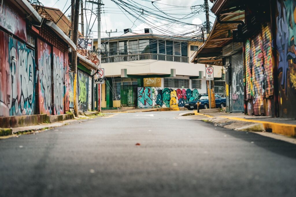
At the end of the descent, when the district shows its shops and bus stops again, the image that sums up the route appears: a sloping street, a wall covered in vegetation, an older resident sitting at the door of a house. It is not a prepared postcard or a signposted viewpoint. It is the everyday landscape of Ipís, which exists regardless of who visits and which is only understood once it has been walked.