
Between the Red Sea and the Dead Sea, in southern Jordan, stands one of the most captivating archaeological wonders on Earth. Petra, the ancient Nabataean capital, was carved into the rose-red sandstone over two thousand years ago. Today, its monumental facades, water channels, and royal tombs continue to astonish those who walk through the narrow Siq gorge. But behind the postcard image lies a constant effort to preserve a unique legacy against erosion, flash floods, and the pressures of tourism.
This report explores how conservation, landscape, and memory intertwine at a site that was once a crossroads for caravans and is now a symbol of Jordan’s cultural wealth.
A crossroads in the desert
Petra was not always a tourist destination. Over two thousand years ago, the Nabataeans, a semi-nomadic people, settled in this valley surrounded by mountains and turned it into a thriving commercial hub. Its strategic location, between Arabia, Egypt, and Syria-Phoenicia, allowed them to control the routes for myrrh, frankincense, and spices. The city, half-built and half-carved into the rock, became an example of engineering and art.
The Nabataeans not only carved tombs and temples; they also developed a sophisticated water management system that enabled them to prosper in an arid environment. Channels, cisterns, and dams diverted seasonal rains, ensuring supply throughout the year. That mastery of water was key to their splendor and is today one of the values UNESCO highlights for conservation.
UNESCO’s Outstanding Universal Value assessment identifies four criteria that justify Petra’s World Heritage status. Criterion (i) recognizes the dramatic rock-cut temple and tomb facades approached via the natural winding cleft of the Siq as a unique artistic achievement. Criterion (iii) underscores the extensive archaeological remains that bear exceptional testimony to the now-lost Nabataean civilization from the fourth century BC to the first century AD. Criterion (iv) highlights the fusion of Hellenistic architecture with Eastern tradition, marking a significant meeting of East and West at the turn of the first millennium. These criteria are not merely academic labels; they form the legal and ethical framework that guides every conservation decision made at the site.
The entrance: the Siq
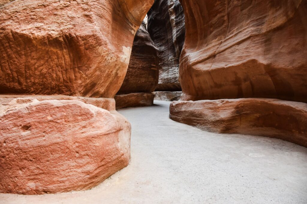
The main access to Petra is the Siq, a natural gorge over a kilometer long and only a few meters wide. Its walls, of reddish sandstone, rise up to 80 meters and filter the sunlight, creating a play of shadows that anticipates the grandeur of the Treasury (Al-Khazneh). This canyon is not only a geological wonder but also a feat of engineering: the Nabataeans used it to channel water into the city and to control the passage of caravans.
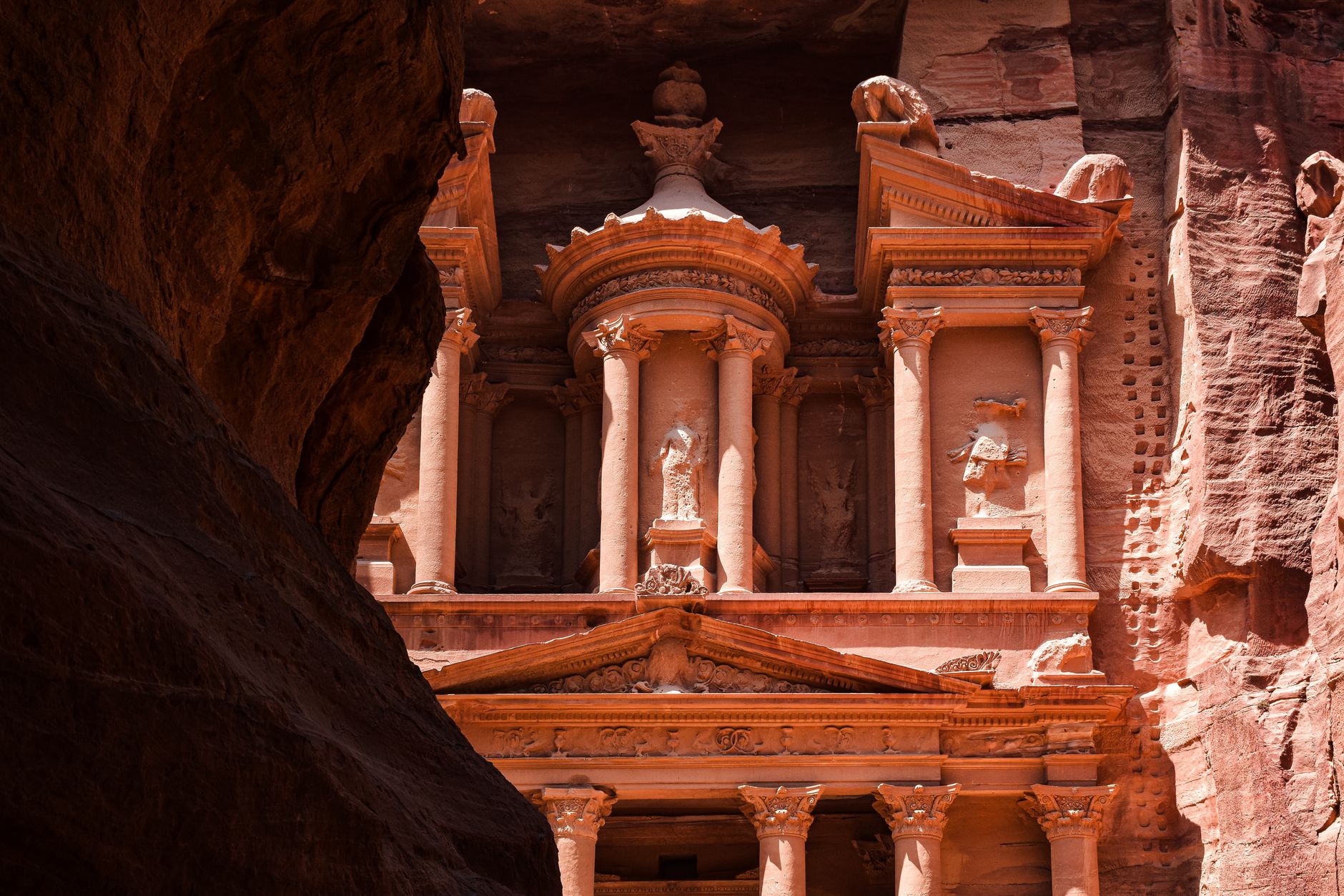
Walking through the Siq is an overwhelming experience. With each step, the rocks reveal traces of ancient channels and ritual niches. At the end, the Hellenistic facade of the Treasury emerges like a mirage, carved with a precision that still astonishes archaeologists.
The Siq also represents one of the most significant conservation challenges at Petra. Its narrow profile makes it vulnerable to flash flooding along Wadi Musa, particularly if the ancient Nabataean diversion system is not continually monitored, repaired, and maintained. The same water channels that once sustained the city must now be managed to protect it, a delicate balance between preserving ancient infrastructure and preventing modern damage.
Sculpted architecture: a fusion of East and West
Petra is an exceptional testimony to the meeting of Eastern traditions and Hellenistic architecture. Its monuments combine Nabataean elements with Greek and Roman influences. The Treasury, with its Corinthian columns and pediment, is the most iconic example, but not the only one. The Royal Tombs, the Monastery (Ad-Deir), and the Theater, carved into the rock, showcase the skill of Nabataean stonemasons.
UNESCO notes that this architectural ensemble represents a unique artistic achievement and an outstanding testimony to a vanished civilization. The tombs, temples, and high places of sacrifice reveal the religious and social complexity of the Nabataeans, who worshipped deities such as Dushara and Al-Uzza.
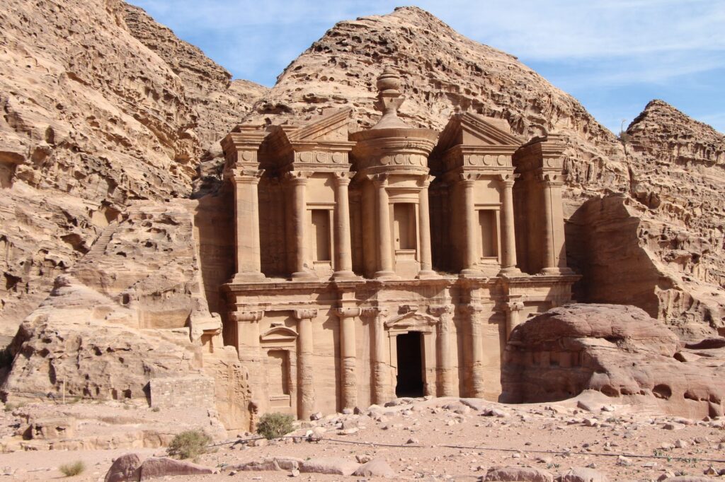
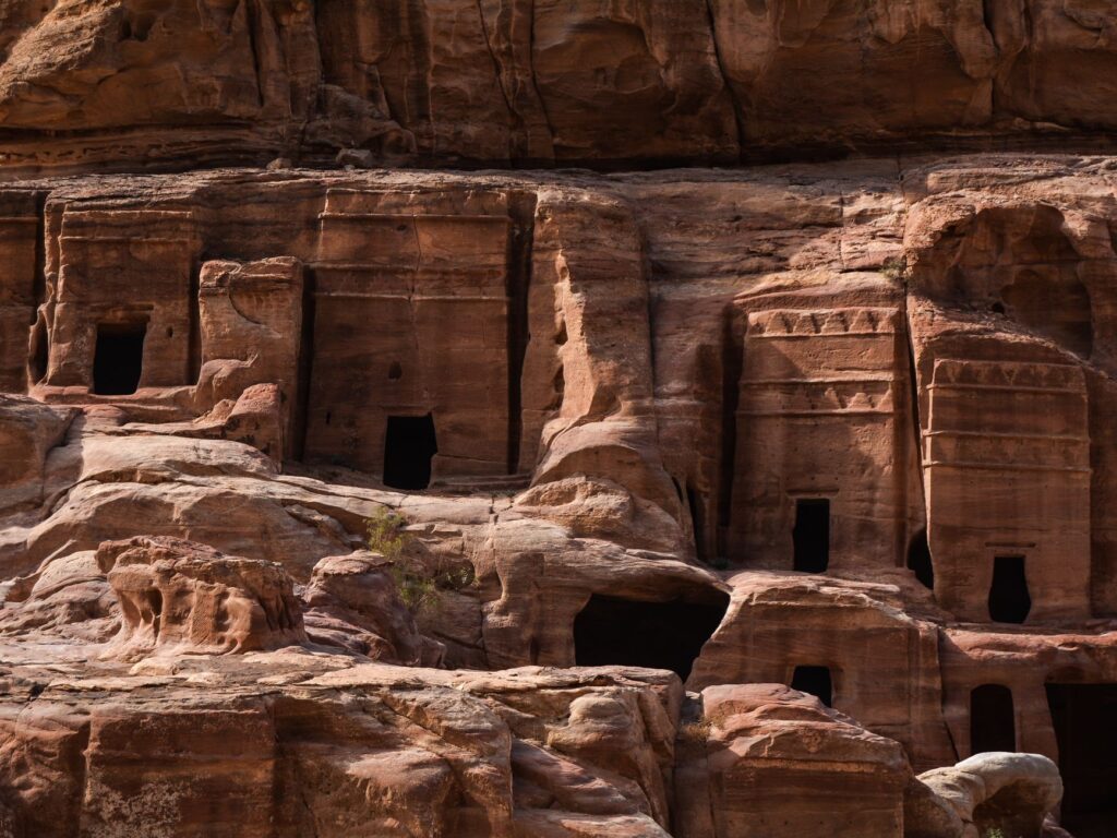
The so-called royal tombs, including the Urn Tomb, the Palace Tomb, and the Corinthian Tomb, stand as particularly refined examples of this fusion. The Urn Tomb, with its massive scale and elevated courtyard, was later repurposed as a Byzantine church, demonstrating how the site’s monuments were adapted across centuries. The Deir, reached after a long climb, rivals the Treasury in grandeur and offers a quieter, more contemplative encounter with Nabataean craftsmanship. Each facade tells a story not only of artistic ambition but of a culture that absorbed and transformed external influences into something entirely its own.
Petra’s greatness lies not only in its facades but in the wisdom of a people who turned the desert into a home.
The hydraulic system: engineering for life
One of the least visible but most fascinating aspects of Petra is its water network. The Nabataeans built more than 200 cisterns, along with channels, tunnels, and diversion dams. This system allowed them to store winter rainwater and distribute it throughout the city. Without it, life in this arid environment would have been impossible.
Today, the remains of that infrastructure are a reminder of human adaptability. They are also a conservation challenge: flash floods, like those that occurred in past decades, can damage channels and structures if not properly maintained.
The water system extended far beyond the city center. Remnants of channels and tunnels have been documented in the surrounding landscape, including the outlying caravan staging posts at Barid (Little Petra) to the north and Sabra to the south. These satellite settlements also contained tombs, temples, water cisterns, and reservoirs, forming a network that supported both permanent settlement and the movement of goods. Understanding this broader hydraulic landscape is essential for effective conservation, as damage to any part of the system can have cascading effects on the whole.
Conservation: between erosion and tourism
Petra’s sandstone is beautiful but fragile. Wind, rain, and desert salt slowly erode the facades. Additionally, the increase in tourism since its inscription as a World Heritage Site in 1985 has intensified pressure on the site. The Siq, the main access route, becomes congested in high season, and the humidity generated by visitors can affect the rocks.
Jordanian authorities, along with UNESCO and other organizations, are working on management plans that balance conservation with the visitor experience. Land-use regulations have been established, water flows are monitored, and some Bedouin communities have been relocated to reduce impact. Sustainability is the core of these strategies.
The institutional framework for Petra’s protection is complex and multi-layered. Under Jordanian national law, responsibility for antiquities sites lies with the Department of Antiquities, a separate entity under the Ministry for Tourism and Antiquities. The property itself is a protected area within the Petra Archaeological Park, managed by the Ministry of Tourism and Antiquities. However, responsibility for overall planning and implementation of infrastructure projects rests largely with the Petra Regional Authority, originally the Petra Regional Planning Council, now expanded to cover the social and economic wellbeing of local communities. This distribution of responsibilities reflects the dual nature of Petra as both an archaeological treasure and a living region with legitimate development needs.
Regulations and policies developed under the Petra Archaeological Park Operating Plan cover infrastructure projects including electrification, water recycling farming projects, visitor facilities such as park lighting, tourist trails and interpretive signage, restaurants and shops, community recreation areas, and public events within the park. The long-term challenge is to create a framework for sustainable development and management practices that protect the property from visitor pressure while enhancing revenues from tourism that contribute to the economic and social viability of the region. This is not a simple task, as every new facility or service must be weighed against its potential impact on the integrity of the site.
Natural decay of the sandstone architecture poses a long-term threat to the authenticity of the property. Stabilization work on freestanding monuments, including the Qasr al Bint temple and the vaulted structure supporting the Byzantine forecourt to the Urn Tomb Church, was carried out prior to inscription. Such interventions require specialized skills and careful planning, as poorly executed repairs can cause more harm than the natural processes they aim to mitigate. The resettlement of the Bdul (Bedouin) tribe and their livestock away from their former seasonal dwellings in the Petra basin to a new village at Umm Sayhun was aimed in part at arresting erosion caused by grazing animals reducing ground cover. This relocation remains a sensitive topic, balancing conservation imperatives with the cultural rights and livelihoods of communities whose connection to the area spans generations.
The landscape: much more than a backdrop
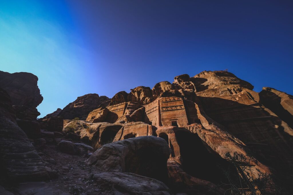
Petra cannot be understood without its surroundings. The mountains that encircle it, with their passes and canyons, are part of the experience. The red sandstone landscape, dotted with tombs and monuments, is an indivisible whole. UNESCO emphasizes that the integrity of the site includes both the structures and the landscape that contains them.
Exploring the surroundings reveals less crowded places, such as the Monastery, reached after climbing 800 steps, or natural viewpoints that offer panoramas of the valley. Every corner tells a story of adaptation and creativity.
The property spans over 26,000 hectares, encompassing not only the famous monuments but also the broader archaeological landscape. Within this area, remains from multiple periods coexist: the Neolithic settlement at Beidha, the Iron Age settlement on Umm al Biyara, the Chalcolithic mining sites at Umm al Amad, and the Crusader fortresses of Habis and Wueira. The foundation of the mosque on Jebel Haroun, traditionally regarded as the burial place of the Prophet Aaron, adds a layer of religious significance that extends beyond the Nabataean era. This palimpsest of civilizations, layered across the same dramatic terrain, is what makes Petra’s landscape so much more than a scenic backdrop. It is an archive written in stone and sand, and its conservation requires an understanding of all the periods it represents.
Beyond the facades: Nabataean daily life
Although the tombs and temples capture attention, Petra was a living city. Archaeologists have found remains of houses, markets, baths, and even a theater. The Nabataeans were not only traders; they also cultivated terraced land and produced pottery and metals. Their society was complex and sophisticated.
Hellenistic influence is reflected in urban planning: the colonnaded street, the nymphaeum, and the triple arch are examples. After annexation by the Roman Empire in 106 AD, Petra continued to flourish until an earthquake and shifting trade routes led to its decline. It was forgotten for centuries until its rediscovery in 1812 by Swiss explorer Johann Ludwig Burckhardt.
The archaeological record at Petra extends well beyond the Nabataean period. Byzantine remains include a triple-apsed basilica church and the church created within the Urn Tomb, evidence of the site’s continued importance under Christian rule. The colonnaded street, triple-arched entrance gate, theater, nymphaeum, and baths demonstrate the extent to which Graeco-Roman civic planning was adopted and adapted. These layers of occupation, from prehistoric times through the medieval period, bear exceptional testimony to the successive civilizations that left their mark on the Petra area. For conservators, this means that every intervention must consider not just the most visible Nabataean monuments but the full chronological depth of the site.
Practical guide
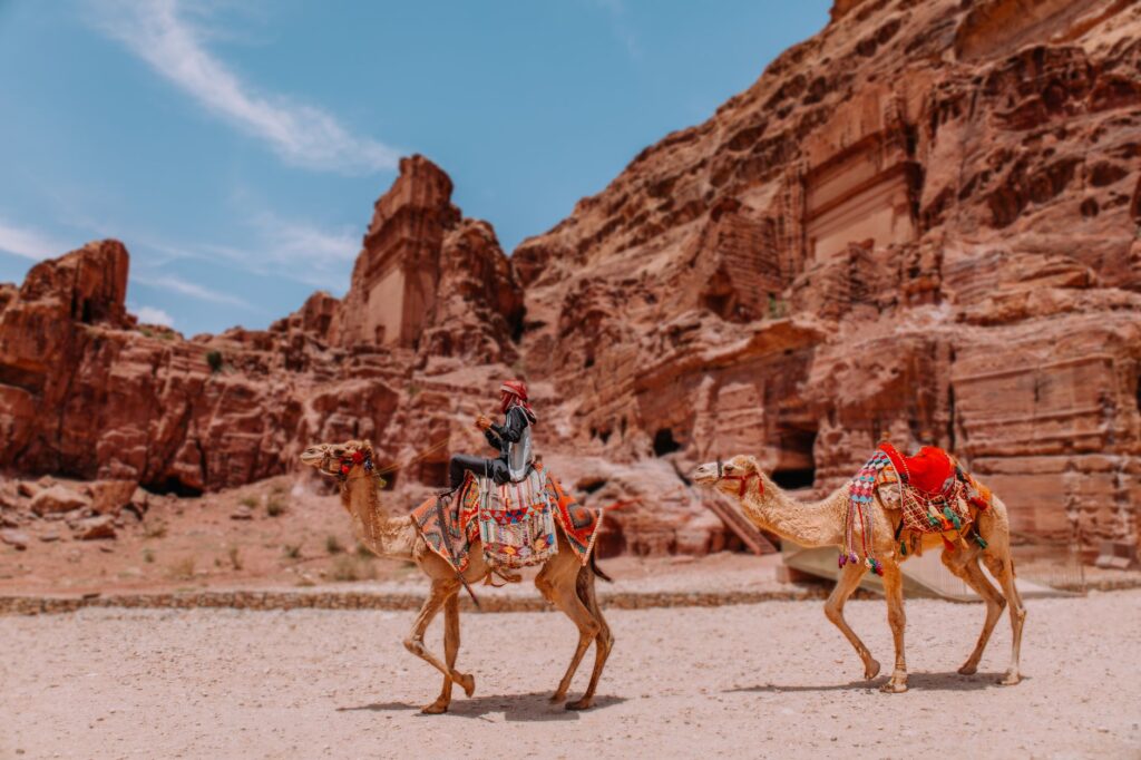
To visit Petra, planning is essential. The site is open daily, though hours vary by season. It is advisable to arrive early to avoid crowds and heat. The main access is through the visitor center, from where you walk to the Siq. There are internal transport options, such as carriages or camels, but it is important to agree on the price beforehand.
The climate is desert: very hot summers and cold winters. Bring water, sunscreen, and comfortable shoes. The site is enormous, so allow at least a full day, preferably two, to explore it calmly. There are one-, two-, or three-day tickets; the two-day ticket allows you to visit the Monastery and other distant points.
For a deeper experience, consider hiring a local guide. The Bedouins of the area, many of them former cave dwellers, offer tours that combine history and living culture. Remember that Petra is a sacred place for many; respect the rules and do not touch the structures.
Visitors should also be aware that the site’s infrastructure is under continuous development. Proposed projects within the property boundaries have included electricity supply and substations, a community and visitor center, an outdoor theater for community events, picnic areas, a camping ground, and a new restaurant near the Qasr al Bint temple. While these facilities aim to improve the visitor experience and support local communities, each has the potential to impact the integrity of the property, and their implementation is subject to careful review. Understanding this context can enrich a visit, transforming it from a simple sightseeing excursion into an encounter with a living conservation effort.
At sunset, when the groups leave, Petra’s magic intensifies. Shadows lengthen the facades, and silence invades the valley. It is the ideal moment to reflect on the fragility of this legacy and the responsibility to preserve it for future generations.