
The Kornati archipelago, located in the central Dalmatian region of Croatia, represents one of the most unique navigation challenges in the Mediterranean basin. Comprising 89 islands, islets, and reefs scattered across an area of just 320 square kilometers, this limestone labyrinth demands meticulous technical planning. Unlike continental coastlines, here the navigator faces an environment stripped of natural fresh water and arboreal vegetation, where reading the submerged relief and understanding local meteorology are the only tools to ensure a safe and successful crossing.
Exploring the Kornati by sea kayak is not merely a recreational activity; it is an expedition of endurance and technical precision. The absence of modern infrastructure in most of the National Park forces expeditioners to operate under a regime of strict autonomy. This report breaks down the critical components for navigating this desert of salt and rock, from managing dominant winds to the logistics of supplies in an environment where silence is only interrupted by the Adriatic crashing against the cliffs of the outer rim.
Karst Geomorphology: Navigating Between Crowns and Abysses
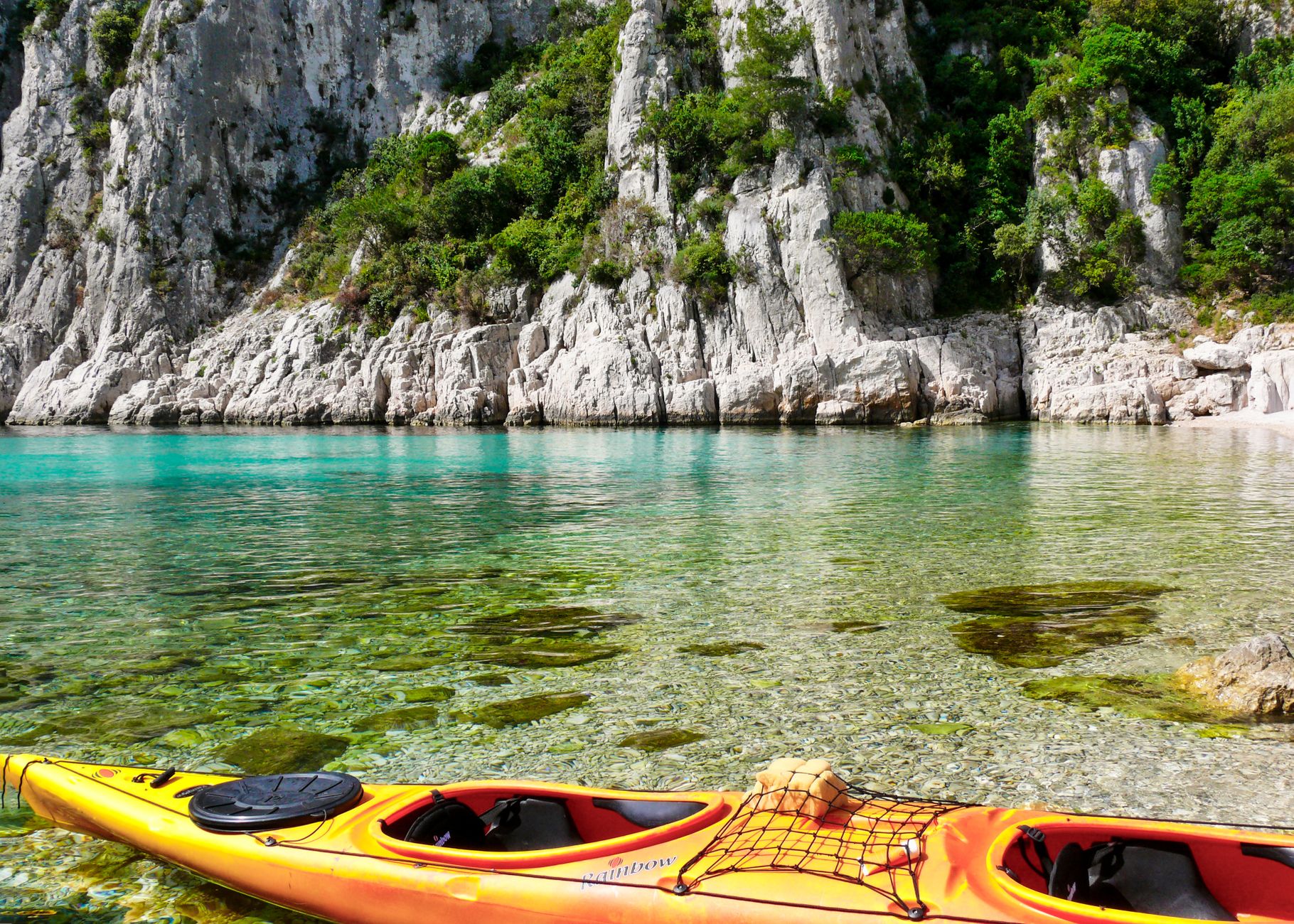
The geological structure of the Kornati is the result of millennia of karstic processes that have sculpted a lunar landscape. For the paddler, this translates into an extremely jagged coastline where linear distances are deceptive. The most spectacular phenomenon is the krunama or crowns—vertical cliffs that plunge into the sea on the southwestern face of the outer islands, such as Mana or Piškera. These walls, reaching up to 80 meters above sea level and dropping another 90 meters underwater, create a technical navigation environment where wave reflection—the clapotis effect—can destabilize even experienced paddlers.

Navigating beneath these crowns requires constant vigilance of sea conditions. The long-fetch swell of the Adriatic hits the vertical stone and returns with nearly the same energy, creating a pattern of crossed and confused waves. It is imperative that the navigation gear includes expedition kayaks with a minimum length of 5 meters, capable of maintaining heading in rough sea conditions and with sufficient volume to house the necessary survival equipment for several days without resupply.
«In the Kornati, the stone does not just surround the navigator; it dictates the rhythm of the paddle and the safety of landing in a world without natural harbors.»
Visibility in these waters is exceptional, often exceeding 20 meters, allowing for a direct reading of the seabed. However, this clarity can be treacherous, hiding the true depth of narrow passages between islets, known locally as prolazi. The Proversa passage, which separates the Kornati from the island of Dugi Otok, is a critical navigation point where currents can reach 4 knots, demanding vigorous paddling technique and precise synchronization with tide tables, even if the latter are less pronounced than in the Atlantic.
Adriatic Meteorology: The Rule of the Bora and the Jugo
Safety in the archipelago depends directly on the ability to interpret barometric changes and cloud formation over the Velebit mountains on the mainland. The most feared wind is the Bora, a catabatic northeasterly wind that descends violently from the coastal peaks. Although the Kornati offer some protection due to their orientation, gusts can filter through the channels between islands with enough force to capsize a loaded vessel. The appearance of white «cap» clouds over the mainland mountains is the definitive signal to seek immediate shelter.
On the other hand, the Jugo is a southeasterly wind, warm and humid, bringing a long and heavy swell. Unlike the Bora, the Jugo develops gradually but generates groundswell conditions that make landings in south-facing coves dangerous. During a multi-day crossing, it is essential to have a weather radio receiver or satellite communication devices, as mobile phone coverage is non-existent in the most remote sectors of the park.
The third actor in this scenario is the Maestral, a summer thermal wind blowing from the northwest. While it is usually predictable and helps mitigate extreme heat, it can intensify in the afternoon, making northward progress difficult. An efficient navigation strategy in the Kornati involves starting the day at dawn, taking advantage of the morning calm, and planning to cross the most exposed channels before the Maestral reaches its peak intensity around 2:00 PM.
Logistics of Autonomy: The Challenge of Water and Heat
One of the most common mistakes in planning an expedition to the Kornati is underestimating the aridity of the terrain. There are no freshwater sources on the islands. Historically, shepherds and fishermen relied on cisterns that collected rainwater, many of which are now contaminated or dry. A paddler must carry a minimum of 4 to 5 liters of water per day of the journey. This adds considerable weight to the kayak, affecting its center of gravity and maneuverability.
Supply storage must be handled using dry bags distributed evenly between the bow and stern compartments. The diet should prioritize high energy density foods with low hydration requirements. Furthermore, the Adriatic sun is relentless; the reflection off the white limestone rock and crystal-clear water doubles UV radiation exposure. The use of technical clothing with UPF50+ protection, wide-brimmed hats, and constant hydration are non-negotiable protocols to avoid heatstroke in an environment where shade is a non-existent luxury.
The Architecture of Silence: The Legacy of Dry Stone Walls
Despite its desolate appearance, the Kornati have been shaped by human hands for centuries. The suhozidi, or dry stone walls, cross the islands from coast to coast, creating a geometric network that served to delimit the properties of the Murter shepherds. These walls, built without a single drop of mortar, are a testament to human tenacity and a crucial visual reference for land orientation. Navigating along these stone lines allows one to understand the social organization of an archipelago that, though permanently uninhabited, remains alive in the memory of its owners.

From the kayak, one can observe small stone houses, or stanovi, clustered in protected coves like Vrulje or Gujak. These structures represent the minimum architecture necessary for survival. Many of these coves now serve as mooring points for sailors, but for the kayaker, they represent the opportunity to find level ground for a bivouac, always respecting the strict National Park regulations that prohibit wild camping and lighting fires.
Environmental Management and Expeditionary Ethics
The National Park status of the Kornati imposes a series of ethical and legal responsibilities on the navigator. The ecosystem is extremely fragile; the Posidonia oceanica meadows on the seabed are the lungs of the Adriatic and are protected. The kayak, having a minimal draft, is the ideal vessel to explore these areas without damaging the bottom, but special care must be taken when landing to avoid eroding the banks or disturbing local fauna, which includes colonies of peregrine falcons and various reptile species adapted to aridity.
Waste management is absolute: everything that enters the archipelago must leave. The Leave No Trace policy is strictly enforced. Due to the lack of garbage collection services, the expeditioner must compact their waste and transport it back to the mainland. This discipline not only protects the environment but also preserves the sense of isolation and purity that defines the experience of navigating the Kornati.

«True mastery at sea is not measured by speed, but by the ability to merge with the environment without upsetting its ancient balance.»
It is mandatory to purchase park entry permits in advance. The funds collected are used for the conservation and surveillance of the area. Park rangers regularly patrol the waters, and failure to comply with overnight stay or navigation rules can result in severe penalties. Planning must include reserving spots in authorized areas for nightly rest, often near the few seasonal taverns that operate during the summer months.
Practical Guide
- Best Time: From May to June and from September to early October. July and August feature extreme temperatures and excessive motorboat traffic.
- Essential Gear: Expedition sea kayak (minimum 5m), spare paddle, high-visibility life jacket, bilge pump, spraydeck, deck compass, and nautical maps at a 1:25,000 scale.
- Permits: It is mandatory to buy an entry ticket for Kornati National Park. It is recommended to buy it online or at the Murter offices before departing, as the price on board is significantly higher.
- Access Points: The most logical route starts in Murter or on the island of Dugi Otok (Sali). Crossing the Murter channel requires caution due to ferry traffic.
- Safety: Always report your route plan to port authorities or the park’s visitor center. VHF Channel 16 is the standard for maritime emergencies.
- Supplies: Stock up on all water and food on the mainland. In the archipelago, there are only a couple of small shops with high prices and limited stock during high season.
- Technical Navigation: Stay away from motor yacht and tourist cruise routes, especially in the narrow Proversa passages.
The Return to Calm: The Value of Isolation
Upon completing a traverse through the Kornati, the perception of time and space is transformed. The constant exercise of reading currents, managing physical effort, and living with the austerity of the karst landscape generates an intimate connection with the marine environment. The reward is not just the conquest of distance, but access to corners of stark beauty where man is only a temporary observer.
The visual closure of this expedition usually occurs at sunset, when the limestone of the islands turns a deep orange before merging with the dark blue of the Adriatic. In that moment of stillness, far from trade routes and urban noise, the kayaker understands that the true luxury of the Kornati lies not in what they offer, but in what they lack: the absence of noise, the lack of artifice, and the absolute presence of a nature that refuses to be tamed. It is, ultimately, a journey toward the essence of navigation.