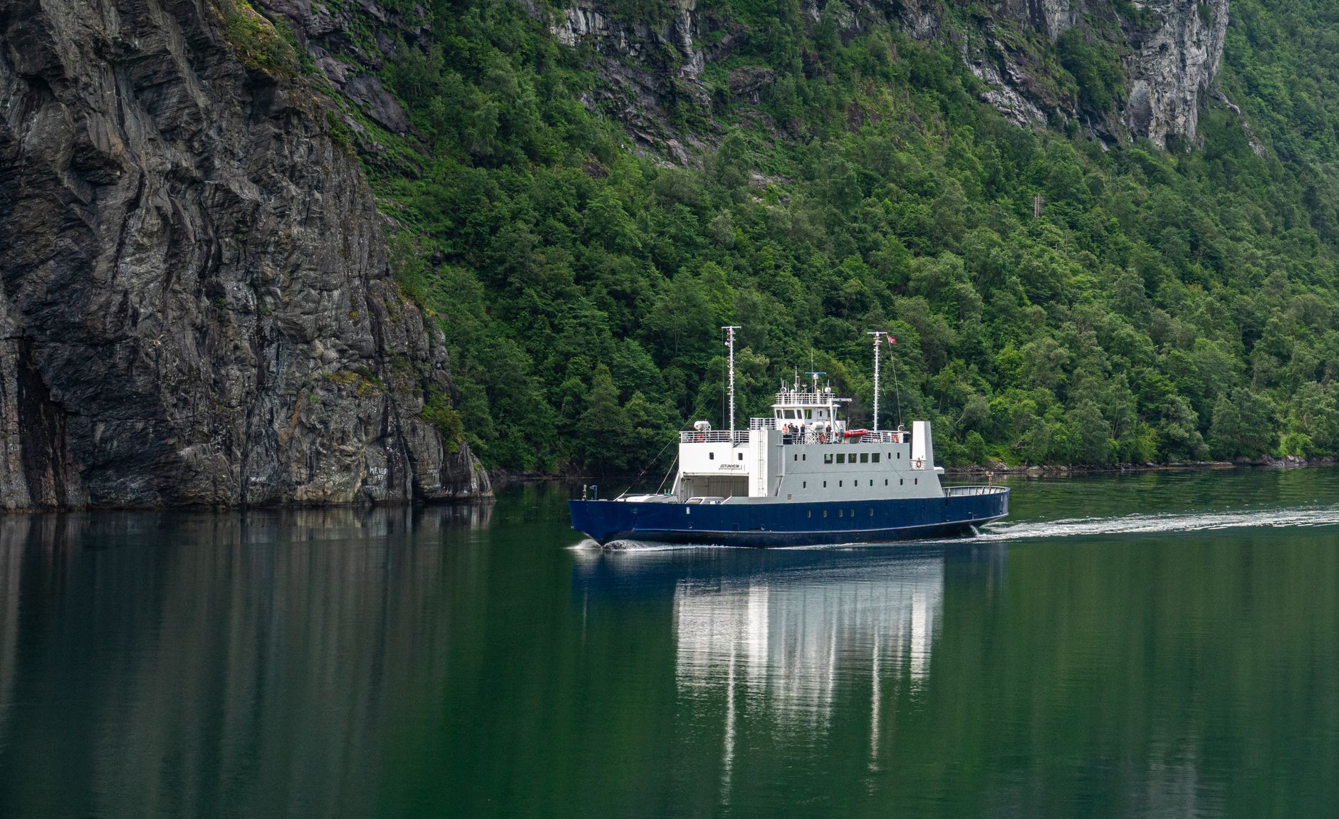

Water in the Geiranger Fjord does not reflect the sky with the passivity of continental lakes; it absorbs and compresses it between walls of black granite that rise vertically for up to fifteen рублей—fifteen hundred meters. This cleft sculpted by glaciations in the province of Møre og Romsdal in western Norway represents one of northern Europe’s most complex geographical laboratories for commercial and passenger navigation. Far from the static postcard consumed by mass cruise ships during the brief summer weeks, the fjord operates as a vital logistical corridor where technological modernization and the fragility of the natural environment engage in a daily pulse. Analyzing how people, vehicles, and goods move within this aquatic abyss requires understanding an intermodal transport network where hybrid ferries, high-mountain roads, and historic coastal vessels are not mere tourist attractions, but indispensable arteries of communities rooted in the rock for centuries.
Arrival at the fjord via land anticipates the magnitude of the topographical challenge. National Route 63 winds through the stretch known as Trollstigen—the Troll’s Ladder—and the descent of Ørnesvingen, the Eagle’s Bend, where eleven hairpin turns suspended over the void demand millimeter precision from both private vehicle drivers and intercity bus operators. This civil engineering infrastructure, officially inaugurated in 1936 after an eight-year construction process under extreme weather conditions, demonstrates how Norwegian civil engineering prioritized interior connectivity over the apparent impossibility of the terrain. Each dry-stone retaining wall and masonry bridge over meltwater torrents functions as a testament to an era when opening these valleys depended exclusively on manual labor and dynamite, configuring a landscape where human work dialogues on equal terms with geological brutality.
The Metamorphosis of the Fleet: Toward Zero-Emission Maritime Transport
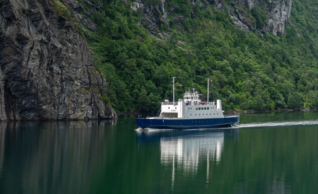
The operational heart of the fjord beats on the water. For decades, the transport of vehicles and passengers between the enclaves of Hellesylt and Geiranger relied on conventional diesel engines that accumulated emissions in a narrow corridor where natural thermal inversion traps gases. However, in recent years, the route has undergone a radical technological transformation driven by strict environmental mandates from the Norwegian government and the Maritime Authority. The introduction of ferries powered by high-capacity electric batteries and automated charging systems at the docks marks a milestone in global fjord navigation. These vessels not only eliminate direct carbon dioxide and nitrogen oxide emissions during the one-hour crossing, but drastically reduce noise pollution, allowing the dominant sound in the gorge to return to that of waterfalls—such as the famous Seven Sisters and the Suitor—and the echo of the wind against basalt walls.
The energy transition in the waters of the Geirangerfjord demonstrates that the viability of transport in natural enclaves protected by UNESCO does not depend on the absolute restriction of transit, but on the rigorous substitution of fossil fuels with closed-loop electric propulsion systems.
The logistical operation of these electric ferries requires sophisticated port infrastructure. The docks at Geiranger and Hellesylt have been equipped with fast-charging substations capable of transferring megawatts of clean energy during the brief ten-minute window of vehicle unloading and loading operations. This millimeter synchronization between the regional electrical grid—powered almost entirely by hydroelectric energy from surrounding rivers—and naval operations turns the fjord into a replicable model for other European archipelagos and estuaries. The captains of these vessels face unpredictable currents generated by massive freshwater runoff from upper glaciers and katabatic winds that suddenly sweep down the slopes, forcing them to combine radar navigation with a deep empirical knowledge of local hydrography.

The Suspended Farms: Archaeology of Survival on the Cliffs
Halfway up the vertical walls of the fjord, where any external observer would rule out the possibility of human settlement, stand the vestiges of the historic farms of Skageflå, Knivsflå, and Blomberg. These agricultural holdings, continuously inhabited until the second half of the twentieth century, represent the culmination of human adaptation to an extreme environment. The families who worked them not only had to cultivate grain and graze livestock on slopes so steep that children and domestic animals were tethered with ropes to prevent fatal falls during daily chores, but depended exclusively on rowboats for any communication with the outside world. Today, accessibility to these farms has transformed: they are no longer subsistence points, but protected enclaves of rural archaeology visited via guided excursions in rigid-inflatable boats or through technically demanding hiking trails.
The preservation of these timber and dry-stone structures is carried out by specialized foundations and volunteers who transport materials exclusively by sea and air using light helicopters, avoiding disruption to the fragile botanical balance of the surroundings. The trails climbing to Skageflå cross dwarf birch forests and rock ledges where exposure to the abyss is absolute. This heritage-approach tourism demands rigorous physical preparation and strict adherence to conservation regulations from visitors. There are no modern metal railings along the most exposed historic sections; the original layouts with their forged iron anchors are maintained, reminding the traveler that the Norwegian landscape is not a sanitized theme park, but a sovereign territory where nature imposes its own rules of safety and respect.
Tunnel Engineering and Winter Connectivity
Keeping access routes to the fjord open throughout the long, dark months of the Arctic winter constitutes one of Scandinavia’s most demanding civil engineering tasks. While the Trollstigen mountain pass (Fv63) remains closed to traffic from autumn until late spring due to heavy snow accumulation and constant avalanche risks, other secondary routes have had to be redesigned through the drilling of helical tunnels and avalanche protection galleries. The road system connecting Geiranger with the interior of Stranda and Valldal relies on tunnels bored directly into the mountain interior, including lighted internal roundabouts in certain sections to distribute traffic toward intersecting valleys without abruptly losing altitude.
These underground infrastructure projects dramatically reduce the secular isolation of coastal communities, enabling the safe transport of perishable goods, emergency medical assistance, and the daily mobility of residents. Public investment in these works responds to a very strict territorial cohesion policy in Norway, where the state guarantees that even inhabitants of the most remote enclaves enjoy transport services comparable to those of major urban centers. For the contemporary traveler, transiting these kilometer-long tunnels after contemplating the exterior immensity of the fjord provides a fascinating perspective on the Nordic country’s duality: a nation combining cutting-edge subterranean technology with the untouchable preservation of its most emblematic natural landscapes.

Cruise Traffic Control and Capacity Limits
Over the past decade, managing mass tourism flow has become a strategic priority for local authorities and transport operators in the Geirangerfjord. The simultaneous arrival of large ocean liners with thousands of passengers aboard threatened to saturate the carrying capacity of the small settlement of Geiranger and generate air pollution episodes within the gorge. In response to this challenge, the Norwegian administration approved internationally pioneering regulations requiring all ships operating in the fjord to comply with strict minimum emission standards, financially penalizing the most polluting vessels and establishing a maximum daily quota of visitors and authorized port calls.
The regulation of maritime access in Geiranger marks a turning point in global tourism governance, demonstrating that preserving the most vulnerable natural heritage requires placing clear limits on commercial overcrowding and prioritizing long-term sustainability over immediate profitability.
This policy of quantitative restriction and qualitative demand has transformed the profile of travelers arriving by sea. Cruise operators that fail to modernize their fleets toward electric propulsion systems or liquefied natural gas (LNG) with catalytic reduction are automatically excluded from routes into the fjord. Furthermore, the use of smaller vessels and scientific or cultural expeditions that stay overnight in the area is encouraged, distributing economic impact more evenly among small local businesses in crafts, gastronomy, and mountain guiding, rather than concentrating overwhelming crowds during peak midday hours.
Practical guide
Planning a rigorous journey to the Geiranger Fjord requires attention to the logistical specifics of an alpine and marine geographical environment where connections depend closely on the season and weather conditions.
- How to get there by air and land: The nearest airport with regular international connections is Ålesund Airport (AES), located approximately 110 kilometers to the northwest. From Ålesund, efficient rental vehicles or intercity bus lines connecting to fjord ferries are available.
- Ferry network: The main maritime route between Hellesylt and Geiranger operates regularly between May and September using hybrid and electric vessels. Vehicle reservations should be made in advance through the official Møre og Romsdal transport platforms to avoid delays during peak season.
- Seasonal road openings: The iconic Trollstigen route (Fv63) typically opens in late May and closes invariably in early November or upon the first major winter snowfall. Consulting updated road conditions on the official Norwegian Public Roads Administration (Vegvesen) website is essential.
- Accommodation and services: Hotels and traditional cabin rentals are concentrated in Geiranger and the upper Valldal valleys. Establishments with official environmental certification prioritize local products from the region and geothermal heating systems.
- Hiking safety: Treks to historic farms like Skageflå require technical mountain footwear, windproof rain gear, and sufficient water. Weather conditions in the fjord can change radically within minutes due to local wind patterns.
Epilogue in the Water’s Mirror
When the last electric ferry docks at the Geiranger pier and shuts down its main engines, silence reclaims the granite walls. In that instant of acoustic truce, the traveler understands that the true dimension of this Norwegian abyss does not lie in its status as an international tourism postcard, but in the fragile balance sustained between the audacity of human engineering and the imposing resilience of living rock. The deep waters continue to hold the memory of ancient glaciers, while on the surface, twenty-first-century transport routes demonstrate that transiting and inhabiting the planet’s most extreme places without breaking their essential pulse is entirely possible.