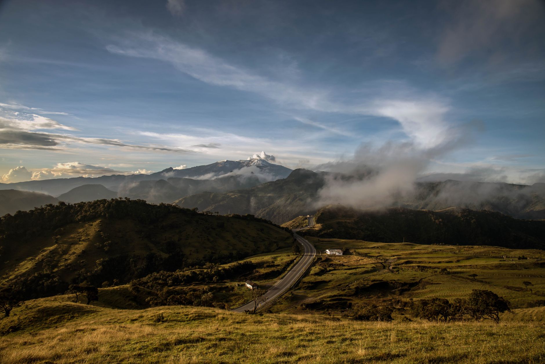

Manizales sits on a ridge of Colombia’s Central Cordillera at around 2,100 metres, facing the Nevado del Ruiz volcano and a system of streams that descend towards the Magdalena and Cauca valleys. That location explains much of its character: a temperate, steep city where water is not a backdrop but a living infrastructure that shapes street layouts and the farming calendar of its surroundings.
Within the nature and oceans category, this place offers a particular reading: there is no sea, but there is a high-altitude aquatic ecosystem linking páramos, cloud forests, rivers and streams to the daily life of more than 400,000 inhabitants. Understanding that connection is the best way to visit Manizales with judgement and low impact.
A geography written in slope
First-time visitors notice that Manizales is not a flat city. Streets rise and fall along the ridge, and viewpoints towards the Ruiz or the valley are part of the urban landscape. Being a city hung on a hillside forces a different way of thinking about water: runoff is fast, springs are close, and vegetation plays a buffering role that is not always obvious at first glance.
The immediate surroundings combine dense urban areas with strips of forest and farmland. Coffee, present on the middle slopes, coexists with fragments of Andean forest and with streams that cross neighbourhoods and rural districts. That mix is the key to the coffee cultural landscape the region shares with other departments and which Unesco recognises as heritage.
In Manizales, water is not contemplated: it is managed. Every stream crossing the city reminds us that the mountain and the water supply are part of the same system.
Páramos and cloud forests: the water factory
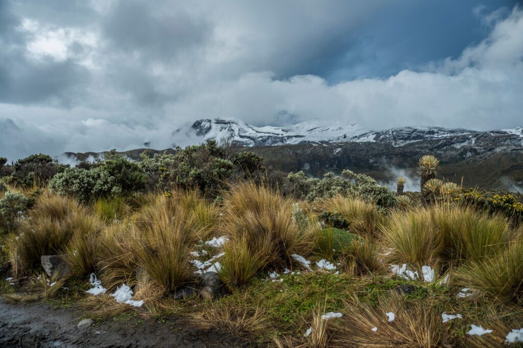
Above 3,000 metres, the landscape changes. Frailejones, peatlands and páramo grasslands hold the humidity of the clouds and release it slowly into the streams. This mechanism, which scientists describe as hydrological regulation, sustains the water supply for much of Colombia’s Andean region.
Cloud forests occupy an intermediate band and perform a similar function: they capture moisture from the clouds that catch on the vegetation and return it to the soil. Around Manizales, these ecosystems coexist with farming and with protected areas that seek to conserve springs.
For visitors, the lesson is simple: the water that comes out of the tap in the city has travelled a long and fragile path. Understanding that path changes the way one looks at the landscape and values the protected areas that make it possible.
The Ruiz and the memory of the mountain
The Nevado del Ruiz is Manizales’s visual reference. Its silhouette appears on clear days and its history is part of the region’s collective memory. The 1985 eruption, which severely affected Armero, marked a turning point in volcanic risk management in Colombia and in the relationship between Andean cities and their surroundings.

Today, the volcano is also an object of study and observation. Geological services and local universities monitor its activity, and public information allows residents and visitors to understand the context of an active cordillera. That coexistence of scenic beauty and geological risk is one of the keys to interpreting the territory with rigour.
What can be observed without altering the environment
Low-impact visiting in Manizales means choosing the right settings. Urban viewpoints, interpretive trails and coffee farms working with conservation criteria offer a reading of the landscape without the need to cover great distances.
- Birdwatching in forest strips and crop edges, with local guides and without sound playback that alters species behaviour.
- Walks on marked trails, respecting closures for restoration or risk.
- Visits to coffee farms that explain water and soil management.
- Tours of urban streams that have been recovered as environmental education spaces.
In all cases, the recommendation is the same: stay on the trails, leave no waste and do not feed wildlife. The mountain is not a decorative stage; it is a system that responds.
Coffee, water and community
Coffee is the crop that has most shaped the region’s identity. On the middle slopes of Caldas, farms combine shade, water and family labour. Many have adopted soil conservation and spring management practices, aware that bean quality also depends on the health of the ecosystem.

That relationship between farming and water is one of the threads running through any visit to Manizales. Farms that open their doors to tourism usually explain the coffee processing method, which uses water and requires careful waste management. Understanding that process helps value the product and choose responsible options.
Coffee from Manizales makes no sense without the stream running down the farm. The cup and the landscape are two sides of the same system.
Architecture and city: the cathedral and the slope
The cathedral basilica of Manizales, with its considerable tower, is one of the most recognisable urban landmarks. Its construction and the city’s transformations throughout the 20th century reflect a society that has rebuilt its heritage after earthquakes and fires. The historic centre preserves buildings of value and an urban fabric adapted to the topography.
Walking through the centre is a way to understand the relationship between the city and its surroundings. Squares, viewpoints and steep streets offer changing perspectives on the cordillera and the valley. It is an architecture that does not compete with the landscape but frames it.
Heritage and cultural context
Manizales is part of the Coffee Cultural Landscape recognised by Unesco. That recognition refers not only to crops but to a way of life combining architecture, traditions and land management. The city preserves fairs, festivities and a university life that have made it a cultural centre of the Coffee Triangle.

For visitors, heritage is expressed in details: bahareque façades, balconies, traditional farms and farming practices passed down through generations. Observing those details with respect is part of the experience.
Getting around and when to go
Manizales has air and land connections with other Colombian cities. The altitude and temperate climate make warm clothing advisable at any time of year. The rainy season can intensify in certain months, so it is worth checking the forecast before planning walks.
For urban travel, public transport and walking routes in the centre are practical options. To visit rural districts and farms, the most sensible approach is to hire local guides or use authorised services that know road conditions and trail status.
Practical guide
Before travelling, check official information on road conditions and volcanic activity. Geological services publish regular reports, and local authorities provide information on closures or restrictions in protected areas.

- Bring warm and waterproof clothing, footwear with grip and sun protection.
- Hydrate frequently and acclimatise to the altitude before demanding walks.
- Hire local guides for routes in rural districts and natural areas.
- Respect protected area rules and closures for restoration.
- Choose farms and accommodation that explain their water and waste management practices.
- Do not feed wildlife or alter stream channels.
Low-impact visiting does not mean giving up the experience but adjusting expectations and habits. In a territory where water is the common thread, that restraint has an immediate meaning.
The close: a photograph the traveller takes away
At the end of the day, when light falls on the ridge and clouds catch in the cloud forests, Manizales offers an image that sums up its condition: a city that lives from the mountain and depends on water that is not seen but sustains everything. That image, more than any postcard, is the one worth taking away.
The next time someone turns on a tap in the city, they may remember the water’s journey from the páramo to the house. That small gesture of awareness is, in a way, the most honest way to visit a place like this.