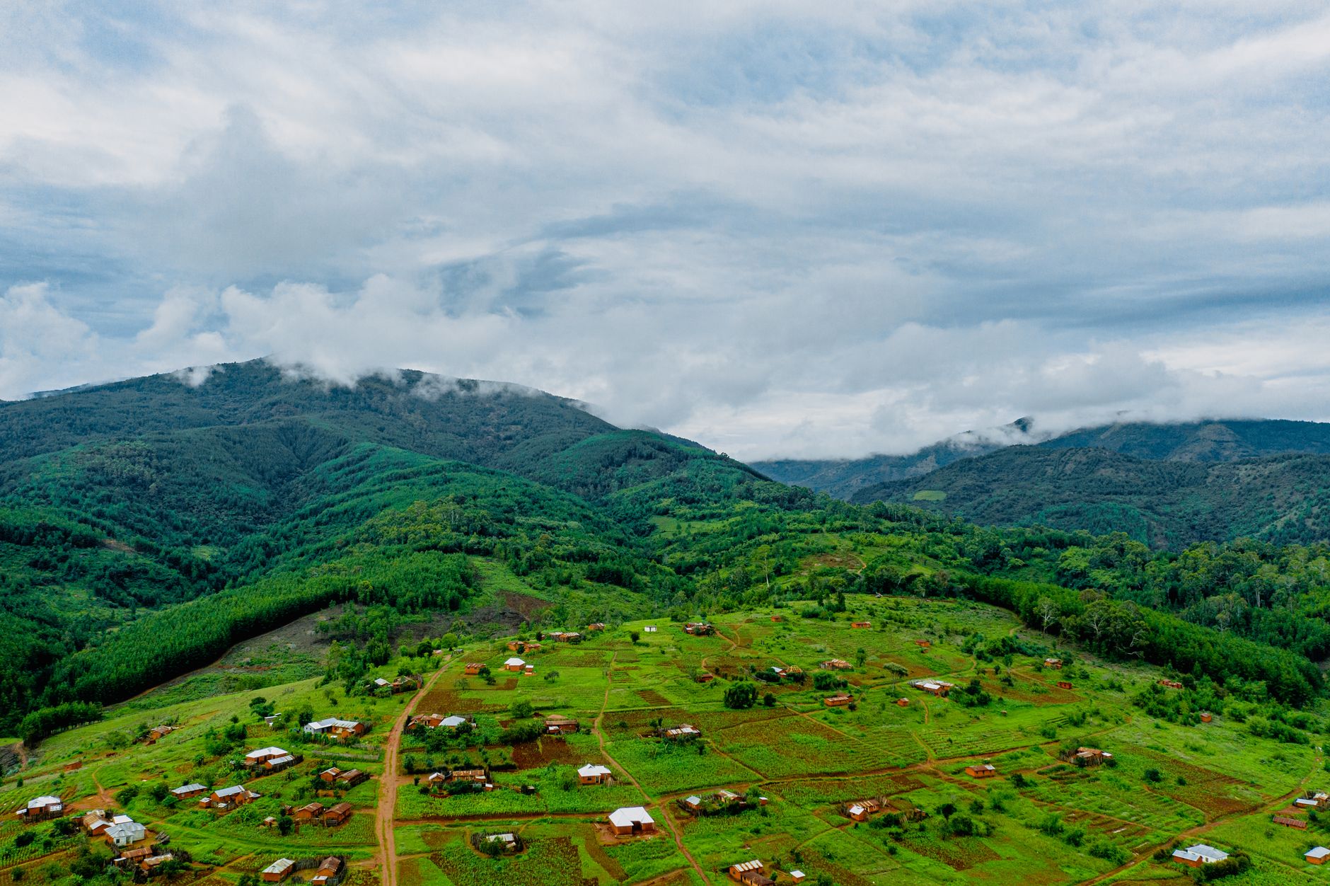

Katumba sits in Rungwe District, in Tanzania’s Mbeya Region, at an elevation of roughly 1,387 metres according to available geographical records. It is not a destination of snow-capped summits or grand infrastructure: it is a mountain village that has grown across cultivated slopes, in a landscape where volcanic terrain, moisture and altitude set the rhythm of daily life. Anyone arriving in search of the mountain as imagined in brochures finds something more interesting: a mountain that is inhabited, worked and crossed by paths linking plots, schools and homes.
This report proposes a geological, ecological and practical reading of Katumba and its surroundings. It is not a summit chronicle, but an approach to a mid-altitude territory where conservation, farming and incipient tourism share the same ground. The key is to understand the place before walking it.
A village on the Rungwe slopes
The Rungwe massif dominates much of the horizon in southern Tanzania. It is an extinct volcano whose ancient activity left a landscape of rounded hills, deep soils and a network of drainages feeding rivers and seasonal wetlands. Katumba is part of that system: it is not on the summit, but in an intermediate band where the climate is still temperate and the land, fertile.
The reference altitude, close to 1,400 metres, places the village at an interesting ecological threshold. Below it, the landscape tends toward savanna and heat-tolerant crops; above it, montane forests, ferns and vegetation dependent on mist appear. That transition explains why Katumba is both a farming village and a gateway to highland ecosystems.
Administratively, the settlement belongs to the Rungwe District Council within Mbeya Region, and its position on the map places it within a broader corridor of highland communities that share similar soils, rainfall patterns and farming calendars. Understanding this administrative and geographical context helps the visitor grasp that Katumba is not an isolated outpost but one node in a densely inhabited mountain landscape.

The mountain around Katumba is not conquered: it is walked patiently, reading the edges of the fields and the sound of water.
Geology: what the ground tells us
The volcanic origin of Rungwe left visible traces in the shape of the terrain. Gentle slopes, open valleys and the presence of fine materials on the paths speak of an eruptive past that now translates into rich but also fragile soils. In the rainy season, erosion becomes an everyday matter: paths wash out, banks give way and communities learn to live with small landslides.
For the visitor, this geology has a practical consequence: walking on the slopes requires attention to the ground, especially after heavy rain. You do not need to be a geologist to read the landscape, but it helps to understand that the mountain is alive in geological terms and that its apparent stability depends on the vegetation covering it.
Reading the volcanic signature
Volcanic landscapes reward slow observation. The colour of the soil, the rounded profile of the hills and the way water collects in shallow depressions all tell a story of past eruptions and subsequent weathering. In Katumba, that story is not confined to a viewpoint or an information panel: it is underfoot, in the texture of the path and the fertility of the plot beside it. Travellers who take time to notice these details gain a richer sense of why the land is farmed so intensively and why its conservation matters.
Mid-altitude ecosystems
The altitudinal band around Katumba holds a mix of cultivated vegetation and remnants of forest. Trees grow along the edges of the plots and serve multiple functions: shade for livestock, firewood, fruit and refuge for birds and insects. That mix, halfway between the agricultural and the wild, sustains a discreet but relevant biodiversity.
Higher up, the vegetation cover changes. Denser forest formations, mosses, ferns and constant moisture feeding streams appear. In these environments, amphibians and insectivorous birds find favourable conditions, while larger mammals depend on the continuity of the forest. Fragmentation is therefore the main ecological challenge.
The value of edges and corridors
In landscapes like this, the most valuable habitat is often not a pristine block of forest but the connective tissue between patches: hedgerows, riverbanks, shade trees and strips of uncultivated vegetation. These edges allow birds and insects to move, protect streams from silt and slow the runoff that erodes slopes. For the walker, they are also the most legible part of the ecosystem, a place where the boundary between the farmed and the wild can be observed at close range without disturbing either.
Water, mist and seasons
Katumba’s calendar revolves around water. The rainy season concentrates most precipitation and transforms the paths; the dry season reduces stream flow and eases travel. Between the two, there are transition weeks that are often the most pleasant for walking, although local variability is high and it is wise to consult residents before planning a route.
Morning mist is common on the higher slopes and plays an ecological role: it reduces evaporation and adds moisture to the soil. For the traveller, it means reduced visibility on some stretches and the need to carry light warm clothing even on days that begin warm in the village.
Planning around the rain
Rather than treating the weather as an obstacle, it helps to plan around it. Mornings tend to offer clearer views before cloud builds on the higher ground, and afternoons are better suited to shorter walks near the village. Because rainfall can vary considerably from one slope to another, the most reliable information comes from people who work the land daily. Asking about the state of a path is not a formality; it is part of how routes are chosen here.

Mountain safety: realistic criteria
The routes around Katumba are not high-difficulty alpine itineraries, but they should not be underestimated either. The combination of slopes, mud, dense vegetation and rapid weather changes calls for basic precautions. Walking in a group, sharing your itinerary and avoiding unmarked trails are elementary recommendations.
- Hire local guides when exploring areas outside the usual paths.
- Carry enough water and sun protection, even if the day dawns cloudy.
- Avoid climbing steep slopes after heavy rain.
- Ask in the village about the state of the paths before setting out.
Safety also has a community dimension: respecting the boundaries of plots and asking permission when a path crosses private land is part of the travel ethic in an agricultural landscape.
What to expect on the ground
Paths in this kind of terrain are rarely uniform. A track that is firm in the morning can turn slippery by afternoon, and a route that seems obvious from the valley may fade into grass higher up. Distances that look short on a map take longer on foot because of gradient, mud and the need to pause. Building in extra time is not a sign of caution but of realism, and it leaves room to appreciate the landscape rather than rush through it.
Conservation and farming: a necessary coexistence
In Katumba, conservation is not conceived as a space separate from daily life. Remnant forests and strips of vegetation between crops protect the soil, regulate water and shelter wildlife. Any conservation strategy that ignores local farming would be bound to fail.

That is why the most sensible initiatives tend to combine farming practices that reduce erosion with the protection of riverbanks and forest patches. Visitors can contribute in a simple way: buying local products, hiring services in the village and avoiding activities that compact the soil or disturb the vegetation at the edges.
In Katumba, protecting the mountain also means protecting the livelihoods of those who live on it.
How visitors can tread lightly
The most useful contribution a visitor can make is often the least dramatic: staying on established paths, carrying out everything brought in, and supporting local businesses rather than importing supplies from outside. These choices are small, but in a landscape where soil and water are closely linked, they add up. Conservation here is less about grand gestures than about the accumulated habits of people who depend on the land and those who pass through it.
Heritage and everyday life
Beyond the landscape, Katumba is a place with agricultural memory and community life. Markets, schools and small churches shape the social life of a village that grows slowly. Heritage here is not displayed in museums: it is practised in the ways of farming, in the names of places and in the oral transmission of knowledge about climate and seasons.
For travellers interested in local culture, the recommendation is the usual one: observe with respect, ask before photographing and avoid projecting external expectations onto a place that has its own logic.
Knowledge held in place names
Place names in highland communities often encode information about terrain, water or past events, and listening to how people refer to a slope or a stream can reveal more than any guidebook. This kind of knowledge is not a performance for visitors; it is part of how the landscape is navigated and managed. Approaching it with humility, and without demanding explanations, is the most respectful way to learn.

Practical guide
The best time to visit Katumba depends on your goal. For comfortable walking, the transition weeks between seasons usually offer a reasonable balance between vegetation and firm ground. To see the mountain at its greenest, the rainy season is more generous, though it demands greater flexibility.
- Access: Katumba lies in Rungwe District, Mbeya Region; organise transport from nearby urban centres and confirm road conditions.
- Accommodation: options are limited and local in character; booking ahead is advisable in high season.
- Equipment: footwear with grip, a light rain jacket, water, sun protection and a warm layer for the mornings.
- Language: Swahili is the lingua franca; English is used in tourist contexts but not always in rural areas.
- Ethics: hire local guides, respect the plots and leave no waste.
Before you set out
A few simple preparations make a disproportionate difference in mid-altitude terrain. Check the forecast but treat it as a guide rather than a guarantee, since conditions on the slopes can differ from those in the valley. Carry cash, as card payments are not reliable outside urban centres. And allow at least one unplanned day: in a place where weather and paths set the schedule, flexibility is the most useful item in the pack.
A closing between slopes
At the end of the day, when the light falls on the hills of Katumba and the air turns cooler, the landscape invites a simple conclusion: the mountain does not need visitors who conquer it, but travellers who understand it. In a territory where geology, farming and conservation share the same ground, the best experience is the one built with time, respect and curiosity.