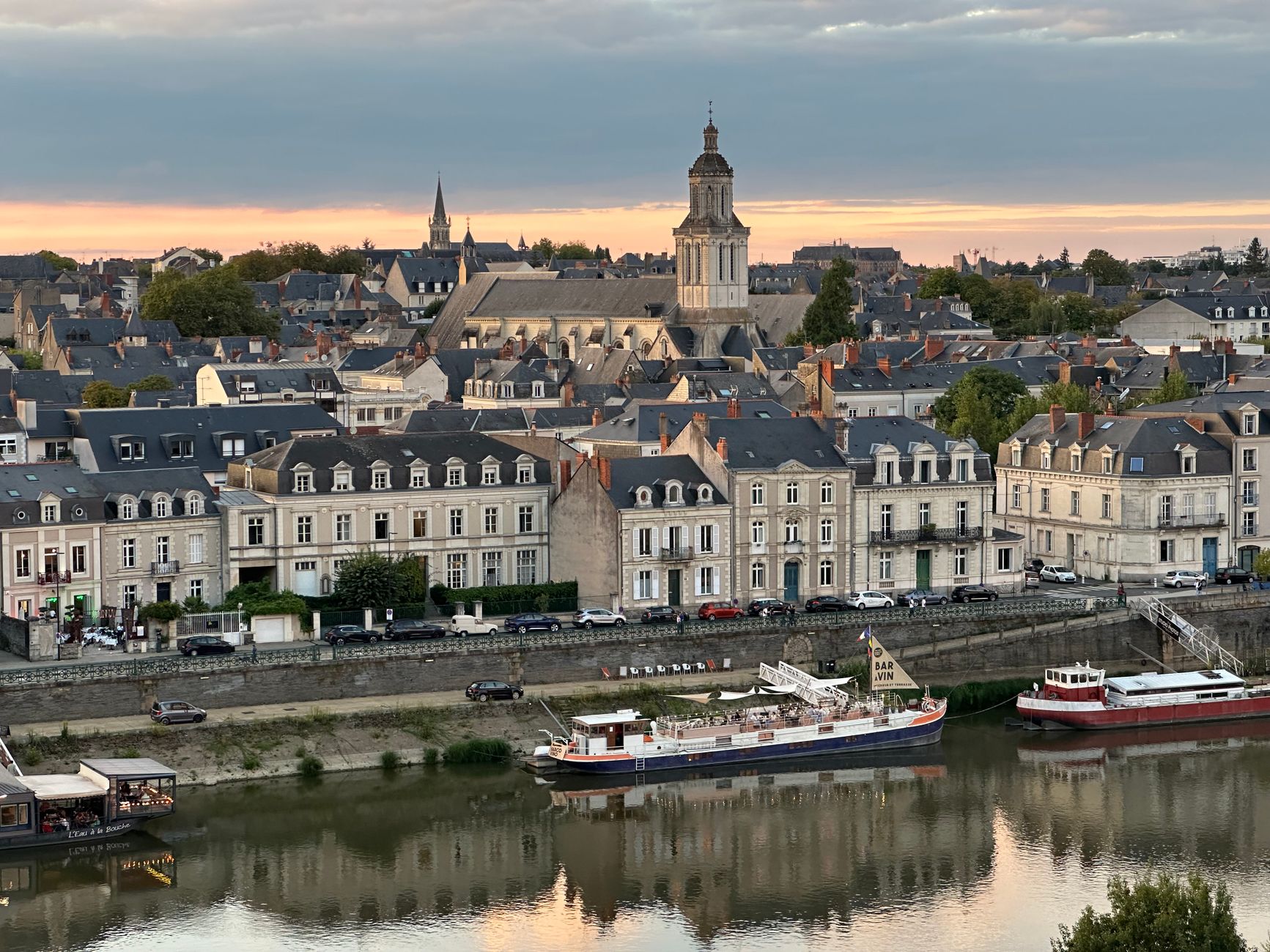

Angers, in western France, is a city of about 168,000 people crossed by the Maine, a river formed by the confluence of the Mayenne and the Sarthe that for centuries served as the backbone of trade in the Anjou region. Today, visitors looking for the sea find something different: a river with a regulated flow, a converted inland port and a nautical culture practised in fresh water, with its own rules, its own currents and its own calendar.
This report does not propose an ocean crossing but a rigorous reading of what it means to navigate in Angers: understanding how the river behaves, preparing an outing with safety criteria, respecting the ecosystem and grasping why the city has turned its riverfront into a space for leisure, heritage and environmental monitoring.
A river that behaves like a tide
The Maine is not a calm, predictable river. Its flow depends on how the dams upstream are managed and on rainfall across the catchment, and its level can shift noticeably within hours. In Angers, recreational and sporting navigation coexists with that variability: rowing and river-sailing clubs check hydrological bulletins before every outing, and local authorities issue warnings when the level or speed of the water exceeds safety thresholds.
For visitors, the lesson is clear: in Angers you don’t navigate by looking at the sky, but at the gauge. Monitoring stations across the catchment allow the flow to be checked in real time, and any plan for an outing should begin there, not with the weather forecast.

The river is not a stage set: it is a system that changes. Whoever ignores that is navigating blind.
The port that looked inland
For centuries, Angers was a significant inland port. Trade in wine, slate and agricultural produce used the Maine and the Loire to reach Nantes and, from there, the Atlantic. That port memory remains visible in the urban fabric: former warehouses, converted quays and a relationship with water now expressed in riverside walks and recreational boating.
The city has managed to transform that legacy without turning it into a theme park. The riverfront combines infrastructure, green spaces and sports facilities, and retains a practical function: it is still a water corridor that has to be managed, monitored and protected.
Currents you read on the surface
Anyone navigating the Maine for the first time is surprised by local currents that do not always match the river’s general direction. Bridge pillars, confluences and narrows generate eddies and accelerations that demand constant attention. Experienced local boaters know these points and adjust their course well in advance.

- Watch the surface before entering a narrow section: lines of foam indicate acceleration.
- Keep your distance from bridge pillars, where the current is compressed.
- Check the local wind direction, which in the valley can contradict the general forecast.
- Avoid peak hours for rowing traffic in training areas.
The Atlantic climate, continental version
Angers has a temperate climate with Atlantic influence, mild winters and moderate summers, but the city sits far enough inland to record sharper cold and heat episodes than the coast. Morning fog is common in autumn and winter, and summer storms can raise the river level quickly.
For a river outing, the weather window matters less than the hydrological window: a sunny day after a week of rain can be more dangerous than a cloudy morning with a stable flow. Proper clothing, a life jacket and a clear return plan are non-negotiable.
Safety on the river does not depend on personal courage, but on the quality of preparation.
Safety: rules, signage and common sense
Navigation on the Maine is subject to local rules governing speed, distance from the banks and right of way in certain sections. Angers’ nautical clubs offer basic training and explain the river’s particularities to those arriving from elsewhere. For visitors, the sensible approach is to contact a local organisation before setting out on their own.
River signage uses its own code, different from maritime signalling, and it is worth becoming familiar with it. Urban sections may have additional restrictions due to works, sporting events or infrastructure maintenance.

A maritime culture without a sea
Angers is not a coastal city, but its link with water runs deep. Rowing, river sailing and recreational fishing are part of everyday life, and the city maintains a cultural relationship with the Loire and with Anjou’s navigational tradition. That culture is expressed in clubs, in events and in a growing awareness that the river is a shared resource.
Visitors looking for a marina will find something else: a community of practitioners who know the river, respect it and look after it. That is perhaps the most valuable lesson Angers can offer to those who come from the world of the sea.
The ecosystem as a priority
The Maine and its banks form an ecological corridor of regional importance. Water quality, the presence of aquatic species and the conservation of riverside woodland are monitored by authorities and environmental organisations. Recreational navigation must be compatible with that protection: avoid anchoring in sensitive areas, respect nesting zones and do not introduce invasive species via boats.
- Clean and dry the boat between outings on different watercourses.
- Do not discharge waste or wastewater into the river.
- Respect riverside vegetation zones and protection signs.
- Reduce speed in sections where wildlife is present.
Heritage seen from the water
Navigating the Maine allows a different reading of Angers. The castle, with its schist walls and gardens, appears from the river in a perspective few visitors know. The bridges, quays and former port buildings tell a story of trade and adaptation to a river environment.
That view from the water does not replace a visit on land, but complements it: it helps explain why the city grew where it did and how it has managed its relationship with a river that, unlike the sea, offers no infinite horizons but a constant presence.
Practical guide
Before planning a navigable outing in Angers, several practical factors should be considered. The city lies in the Maine-et-Loire department, in the Pays de la Loire region, and is reachable by train from Paris and other French cities. Angers-Loire airport offers limited connections; many visitors arrive via Nantes or Paris.
For river navigation, it is advisable to contact local nautical clubs, which provide information on the state of the river, current rules and safety conditions. The practice season tends to concentrate in spring and summer, although the river can be navigated year-round with proper preparation.
- Check hydrological bulletins before any outing.
- Verify local navigation and speed restrictions.
- Carry a life jacket and clothing suited to the water temperature.
- Report your outing plan and expected return time.
- Respect environmental protection zones and riverside wildlife.
- Contact local organisations for training or accompanied outings.
Angers’ tourist office and sports clubs are the most reliable sources for up-to-date information on the river and its conditions.
A river that teaches you to look
Angers does not offer the epic scale of the ocean, but it proposes a more intimate and more demanding relationship with water. Here, navigation is a practice of attention: to the river level, the current, the weather, the ecosystem and other users. Those looking for adrenaline will find something else; those willing to read the river will find a city that has learned to live with it.
In the end, the image that remains is not that of a great crossing, but of a quiet morning on the Maine, with the current setting the pace and the city watching from the bank. That is the adventure possible in Angers: small in scale, rigorous in preparation and deep in meaning.