Ice is not silent. It creaks, contracts, releases air trapped for centuries. In southeast Iceland, the Vatnajökull ice cap covers roughly 7,800 square kilometres and spills over volcanoes, fissures, and black sand plains. This is not a landscape to contemplate from a distance: it is a territory that demands to be read with attention, respect, and preparation. The reward is not a photograph, but an understanding of a natural system that transforms before the visitor’s eyes.
This feature proposes an interpretive approach to Iceland’s largest national park, designated a UNESCO World Heritage Site in 2019. It is not a fixed route or a list of viewpoints, but a way of looking: understanding which processes sculpt the ice, how a safe visit is organised, and why the best time to travel depends on what each traveller wants to learn.
A territory read in layers
Vatnajökull is not just a glacier. Beneath its surface lie ten central volcanoes, eight of them subglacial, and two of the most active in Iceland. The interaction between magma and ice produces phenomena that occur in few other places on the planet. The most spectacular is the jökulhlaup, a sudden flood caused by the breach of a glacier margin during an eruption. These surges of water have shaped unique sandur plains, river systems, and canyons that evolve at great speed.
For the traveller, this means the landscape is not a static backdrop. It is a geological archive in motion. Moraines, abandoned ice blocks, and drainage channels tell a story of glacier retreat accelerated by climate change. Interpreting those signs turns an excursion into a lesson in applied geology.
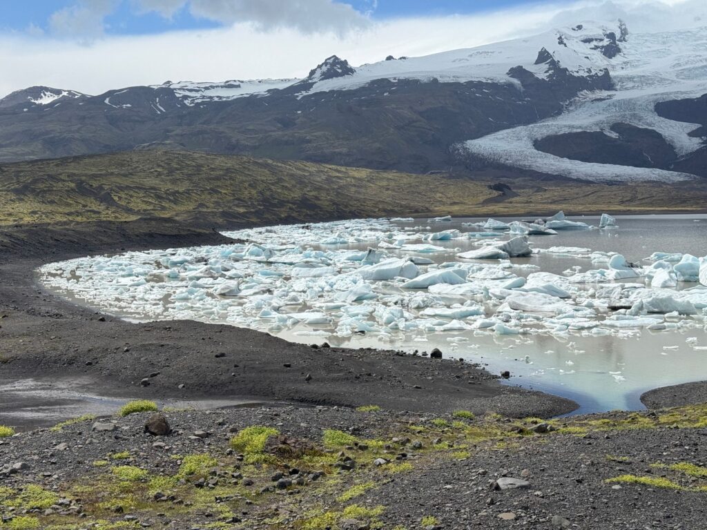
The ice of Vatnajökull does not simply melt: it leaves the traces of its retreat written in valleys, lagoons, and sediment deposits that visitors can learn to recognise.
Preparation: the difference between visiting and understanding
The immensity of the park — over 1.4 million hectares, nearly 14% of Iceland — demands planning. There is no single entrance or visitor centre that covers it all. The main access points lie in the south, near the glacier lagoons, and in the north, by the valleys of Askja and Jökulsárgljúfur. Choosing one base and exploring from there makes more sense than trying to cover the whole area in a few days.
Preparation begins with clothing. The weather changes rapidly: wind, rain, fog, and sun can follow one another within an hour. Layering is recommended, with a waterproof and windproof outer garment, sturdy hiking boots with good grip, and protection for the head and hands. In summer, the long days allow extensive excursions; in winter, daylight is scarce and many interior tracks remain closed.
Technical activities: always with local operators
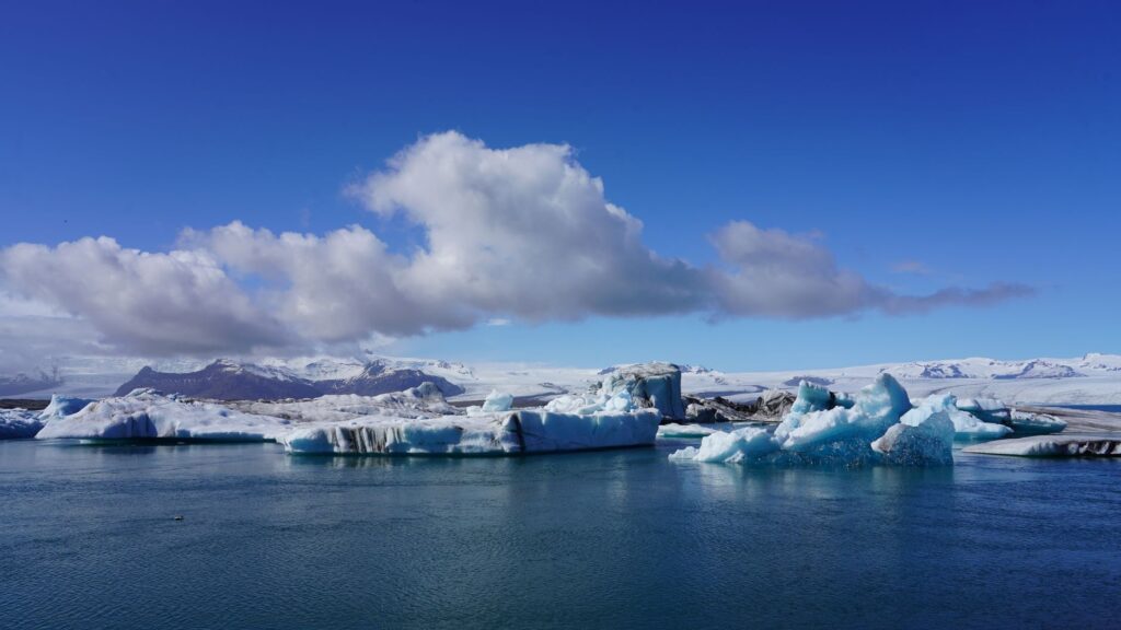
Walking on a glacier, visiting an ice cave, or sailing among icebergs are activities that require certified guides and specific equipment. These areas should not be accessed independently. Authorised local operators know the state of the ice, the wind conditions, and safety protocols. Hiring their services is not a luxury, but a measure of responsibility towards oneself and the environment.
What to observe in each season
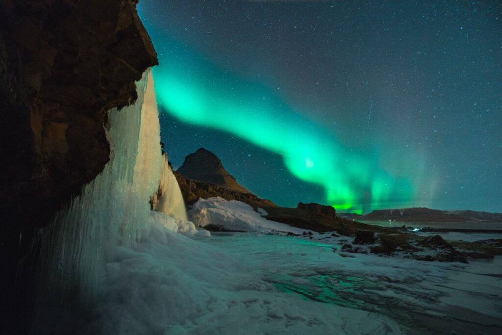
Landscape interpretation changes with light and the state of the ice. In spring, meltwater activates waterfalls and rivers; migratory birds return to the coastal wetlands. In summer, access to the highlands is easier and the endless days allow observation of the outlet glaciers’ behaviour. In autumn, the colours of the low vegetation contrast with the white ice and the first snows announce the closure of tracks. In winter, darkness and extreme cold limit options, but offer the chance to see the northern lights over the ice and to visit glacier caves with specialist guides.

The best time to travel to Vatnajökull does not exist: there is the right time for what each traveller wants to understand. The key is to match expectations and preparation to the chosen season.
Accessibility and logistics on the ground
The Ring Road skirts the park to the south and east, with turn-offs towards the main points of interest. Interior tracks, marked with the letter F, are only passable in 4×4 vehicles and in summer. Driving them without experience can be dangerous: there are fords, loose volcanic sand, and stretches without signage.
Services are limited. The nearest villages offer accommodation, fuel, and some restaurants, but it is wise to carry water, food, and a physical map. Mobile coverage is patchy outside inhabited areas. Informing someone of your itinerary and carrying an emergency communication device are basic precautions.
What to carry in your backpack
- Enough water for the day and energy food.
- Map and compass, plus GPS if available.
- Basic first-aid kit and sun protection, even on cloudy days.
- Spare clothing in a waterproof bag.
- Headlamp and spare batteries.
- Whistle and emergency thermal blanket.
The landscape as a scientific archive
Vatnajökull is one of Europe’s most important natural laboratories. The scientific community has published hundreds of studies on plate tectonics, volcanism, glaciovolcanism, and glacial geomorphology. The park is home to endemic groundwater fauna that survived the last ice age, and in its subglacial lakes single-celled organisms thrive that may replicate conditions on early Earth.
For the curious traveller, this scientific dimension adds depth to the visit. Understanding that the landscape is an object of study, and not just a setting, changes the way one travels through it. Signs of geological activity are everywhere: fissures, fumaroles, ash deposits, erratic blocks. Learning to name them is the first step to interpreting them.
Communities and responsible tourism
The national park is not an empty space. Communities live on its edges, depending on tourism and farming, and they have participated in managing the protected area. Icelandic legislation requires that any development within the park respects natural values, and most of the territory is classified as wilderness.
Visitors can contribute to conservation through simple decisions: staying on marked trails, leaving no waste, respecting nesting areas, and hiring local services. Responsible tourism is not a label, but a daily practice that protects the landscape one has come to know.
Practical guide
Getting there: Keflavík International Airport, near Reykjavík, is the main gateway. From there, the Ring Road reaches the southern part of the park in about four to five hours. Domestic flights connect Reykjavík with Höfn and Egilsstaðir, two useful bases for exploring the park.

When to go: June to September for full-day excursions and access to interior tracks. November to March for ice caves and northern lights, always with guides. May and October are transition months, with fewer services but highly changeable landscapes.
Where to stay: Höfn in the southeast and Reykjahlíð in the north offer the widest range of accommodation. There are also campsites and mountain huts managed by the park, with limited places.
What to book: Guided glacier walks, ice cave visits, iceberg sailing in Jökulsárlón lagoon, and interpretive hiking routes. Local operators publish their programmes and requirements on their official websites.
Safety: Check Iceland’s road and weather safety websites before setting out. Do not drive off-road. Do not walk on ice without a guide. Keep your phone charged and have a backup plan in case the weather worsens.
Environmental respect: Leave no waste, do not disturb wildlife, do not collect stones or geological remains. The park is a protected area and its conservation depends on the conduct of those who visit it.
A way of looking you take with you
At the end of the journey, what remains is not a specific image, but a way of looking. The traveller who has learned to read the layers of the Vatnajökull landscape carries a new sensitivity: the ability to recognise processes where before they saw only forms, to understand that nature is not a backdrop but a story in motion.
That is, perhaps, Iceland’s best lesson. It is not about conquering a territory or collecting viewpoints, but about learning to interpret it with humility. The ice will keep creaking, the water will keep carving channels, and the landscape will keep changing. The traveller who understands this does not return the same.