The Southern Pulse of the Lofoten Archipelago: Bridge Engineering, Sea Passages, and Norwegian Insular Connectivity
An in-depth analysis of the road and maritime network sustaining the Lofoten archipelago, examining the synergy between modern civil engineering and traditional cabotage routes.
Introduction to the Labyrinth of Fjords and Vertical Peaks
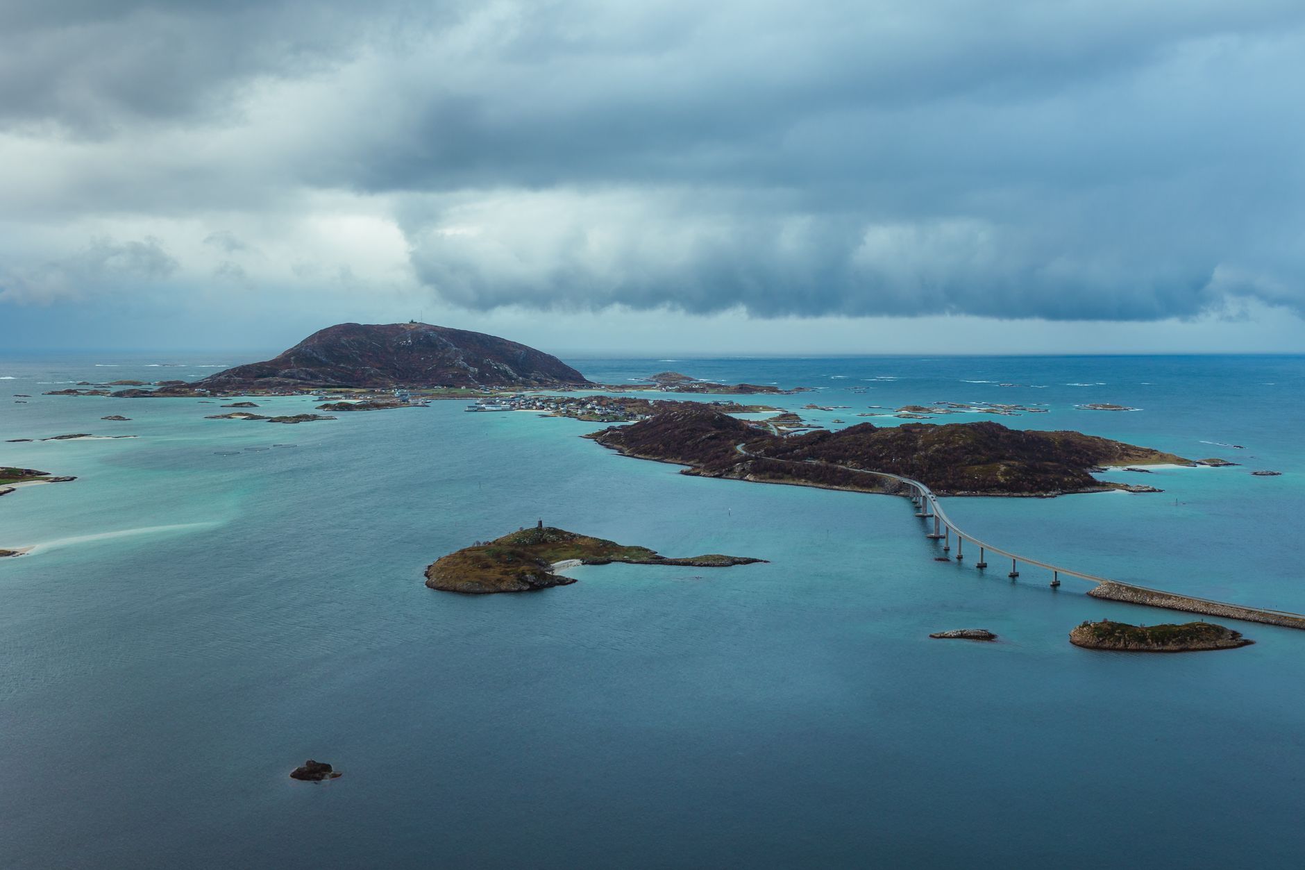
The Lofoten archipelago, located beyond the Arctic Circle in Nordland county, Norway, presents itself to the traveler as an imposing wall of dark granite rising directly from the turbulent waters of the Norwegian Sea. For centuries, this territory of alpine summits sculpted by glacial erosion was defined by its geographical isolation. Travel between the islands of Austvågøy, Sund, Moskenesøy, and Flakstadøy depended exclusively on rowing boats or fragile sailing vessels that challenged treacherous currents such as the famous Moskenesstrømmen whirlpool. Today, reality in this northern outpost has transformed thanks to one of Scandinavia’s most ambitious infrastructure projects: a network of monumental bridges and undersea tunnels stitching the archipelago into a continuous corridor.
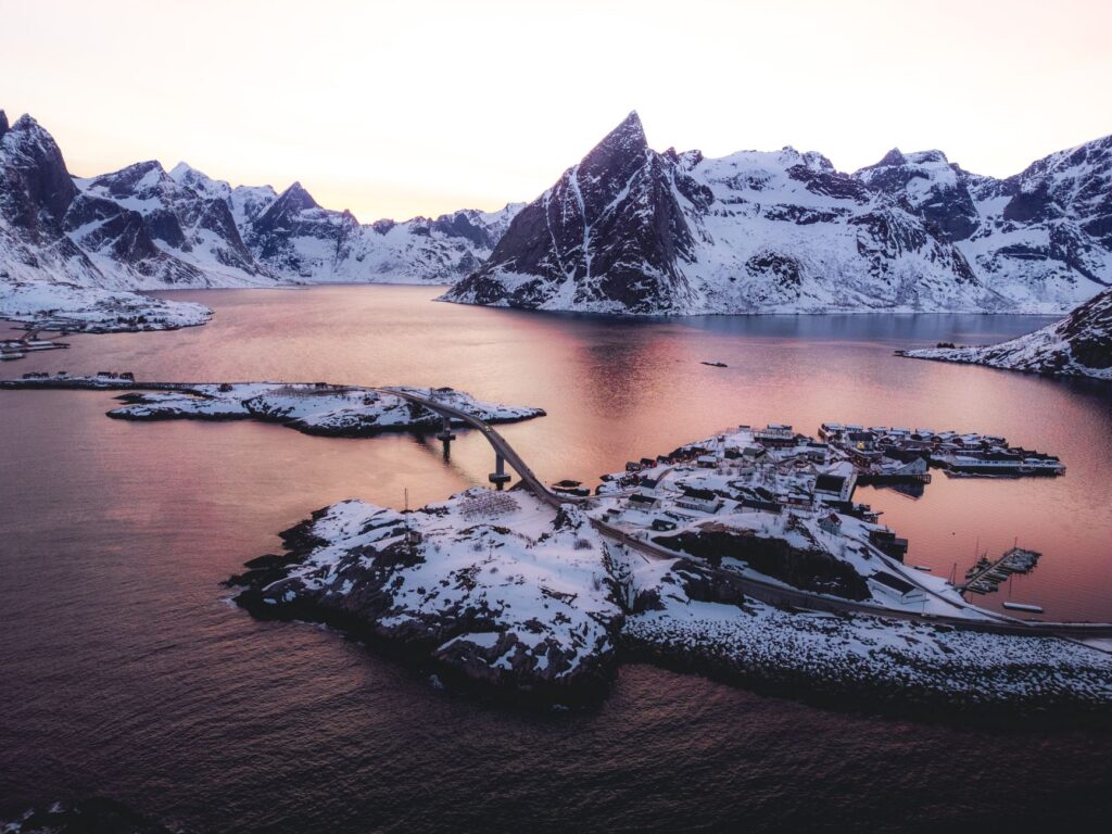
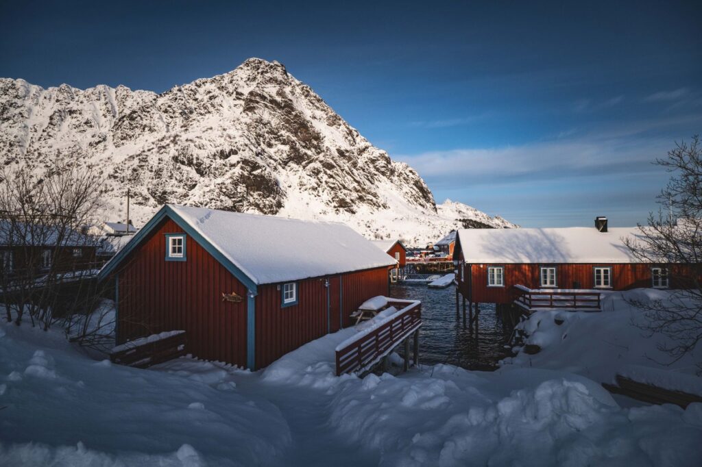
Understanding Lofoten’s connectivity requires looking beyond the tourist postcard of red fisherman’s cabins—the traditional rorbuer—suspended on wooden stilts. The true backbone of this insular community lies in European Route E10, known locally as Kong Olavs vei. This asphalted artery runs from one end of the archipelago to the other, turning a maze of freezing marine channels into a drivable highway. Experiencing this route is not merely a transit from A to B; it represents a living study of how contemporary civil engineering integrates into an extreme natural environment without disrupting its fragile ecological balance.
The Pre-Road Era: The Historic Dominance of Cabotage
Before concrete and steel structures altered the marine horizon, life in Lofoten revolved entirely around the sea. Cabotage vessels, known as old mail boats and local merchant ships, formed the sole link between communities separated by barely five hundred meters of water. The transport of goods, the trade of coveted dried cod—the stockfish that brought global fame to the region—and the movement of passengers depended on the expertise of local skippers. These navigators understood the whims of the tide, the fury of winter gales, and the shifting sandbanks that characterize the narrow fjords.
Local populations relied on small stone docks erected in sheltered coves. Built using dry-stone walling techniques by itinerant craftsmen, these piers still dot the coast, serving as silent testimony to an era when water united rather than separated. With the growth of the fishing industry in the late 19th and early 20th centuries, the demand for more agile transport spurred the creation of regular steamship routes. However, dependence on the weather remained absolute; arctic storms could isolate an entire village for weeks, paralyzing the local economy and cutting off basic supplies.
Cutting-Edge Engineering Above Marine Abysses
The radical transformation of Lofoten’s connectivity began to take shape in the mid-20th century, culminating in recent decades with the construction of titanic infrastructure. The Gimsøystraumen Bridge, inaugurated in 1981, marked a milestone by connecting the islands of Gimsøya and Austvågøy through a free span allowing large fishing vessels to pass underneath. Yet the most emblematic project vertebrating the southern tip of the archipelago is the Lofotensfasten complex, completed in 2007. This integrated system of cantilever bridges and seabed tunnels definitively connected the mainland to the main islands without requiring ferries for the trunk route.
Technical challenges in this environment are monumental. Engineers must design structures capable of withstanding hurricane-force winds exceeding 150 kilometers per hour, persistent ice loads, and extreme corrosion caused by the saline environment. The E10 bridges, such as the celebrated Raftsund Bridge or the narrow Fredvang spans—featuring characteristic double parabolic arches connecting Moskenesøy with Flakstadøy island—have become works of art in modern civil engineering. Their aerodynamic design deflects lateral gusts, ensuring the safe transit of freight trucks and motorhomes even during the darkest months of the polar winter.
The Symbiosis Between Asphalt and Secondary Maritime Routes
Despite the efficiency of the road and bridge network, Lofoten’s transport system retains an essential amphibious nature. While the E10 absorbs heavy traffic and mass tourism, traditional coastal ferries continue operating as lifelines connecting peripheral islands such as Værøy and Røst, situated far offshore at the southern tip. These communities lack bridge connections due to ocean depth and extreme current velocities, making high-seas ferries irreplaceable mother ships.
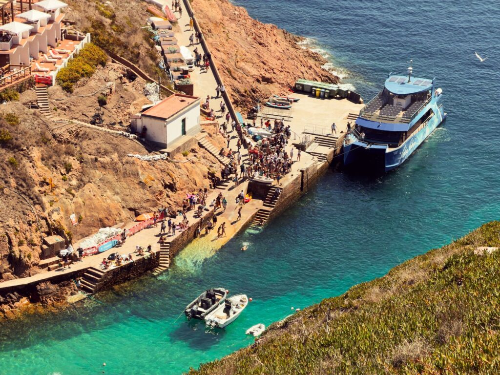
This coexistence between asphalt and ferry wakes generates a highly efficient logistics network. Local residents combine private car use with short-haul maritime transport for fuel supplies, building materials, and fresh fish. Modernized docks equipped with hydraulic ramps adapted for the Atlantic tide allow rapid ro-ro (roll-on/roll-off) vessel berthing. Far from competing, road and sea collaborate in a transport ecosystem sustaining the demographics and seasonal economy of an archipelago permanently challenged by its geography.
The Socioeconomic Impact of High Connectivity
The opening of the bridge and tunnel network completely redefined Lofoten’s social fabric. In the past, young people had to temporarily emigrate to mainland centers like Bodø or Tromsø due to a lack of stable educational and employment opportunities. Today, road connectivity allows the creation of centralized employment hubs, where workers and students can commute daily between neighboring municipalities without the uncertainty of weather-dependent maritime transport.
Likewise, the tourism sector has undergone a radical metamorphosis. While the massive influx of visitors in summer sparks local debates over territorial sustainability, road infrastructure has helped decentralize traveler flows toward less crowded fishing villages. Small active tourism businesses, local craft workshops, and gastronomic cooperatives benefit from logistical fluency. Nevertheless, local authorities and urban planners face the ongoing challenge of maintaining a fragile balance between modernizing communication routes and preserving the rugged, untamed character defining the historical identity of the islands.
Sustainable Mobility Practices and Environmental Respect
Traveling Lofoten’s routes today requires profound environmental awareness. With the exponential increase in road traffic, particularly during the arctic summer and the winter northern lights season, infrastructure wear and congestion at key viewpoints have triggered conservation alarms. The Norwegian government and local municipalities have implemented strict road management guidelines, promoting electric vehicles—supported by a dense charging network powered by renewable hydropower—and restricting parking in ecologically sensitive areas.
Travelers traversing the archipelago are urged to adopt responsible driving practices, respecting strict speed limits and yielding on the single-lane sections characterizing some of the older bridges. Preserving scenic routes not only protects the asphalt and guardrails from marine corrosion but also safeguards local wildlife, including populations of sea eagles and cormorants nesting on cliffs adjacent to roads. Mobility in Lofoten demonstrates that connecting extreme territories without sacrificing the integrity of the natural landscape is entirely achievable.
«Connecting the islands of Lofoten did not mean subduing nature to human dominance, but learning to trace paths over the abyss while respecting the fury of the sea.»
Practical guide
Planning a road and sea journey across the Lofoten archipelago requires logistical rigor, awareness of seasonal weather conditions, and profound respect for local traffic regulations.
How to Get There and Connection Networks
The main gateway to the archipelago is Leknes Airport (LKN) or Svolvær Airport (SVJ), with connections from Bodø. For those opting for the land and maritime route, the ferry from Bodø to Moskenes is the classic choice for vehicles. The E10 highway forms the backbone traversing the archipelago from Å to the mainland, allowing smooth transit across all major bridges without direct tolls on most sections, though some recent tunnels operate with automated electronic toll collection systems (AutoPASS).
When to Travel and Seasonality
Summer (June to August) offers continuous daylight (midnight sun) and optimal driving conditions, albeit with heavier traffic density. Winter (November to February) features the polar night and the spectacle of the northern lights, but demands maximum caution behind the wheel due to black ice, extreme winds, and sudden weather shifts that can temporarily close exposed bridges like Raftsund.
Driving Rules and Safety
Speed limits are strict (generally between 70 and 80 km/h on open roads, dropping to 50 km/h or less in urban areas). Many historic bridges feature a single lane with passing bays; yielding right-of-way according to specific road signs is mandatory. Studded winter tires are required by law between November 1 and the first Sunday after Easter. Park only in designated viewpoints (nasjonale turistveger) to avoid severe fines and damage to the fragile arctic tundra.
Accommodation and Support Services
Booking traditional rorbuer months in advance is strongly recommended, especially when traveling during the cod fishing season (skrei) between February and April. Service stations are sparse on remote stretches; keeping fuel tanks above half capacity is advisable. Strict respect for the right to roam (allemannsretten) is mandatory for any camping or hiking activities outside main road infrastructures.
Epilogue: The Silent Wake at the Edge of the World
When the midnight sun bathes the concrete pillars of the Fredvang Bridge in a cold golden tone, the Lofoten archipelago reveals its true essence. It is no longer the isolated territory feared by ancient mariners, but an advanced model of how human engineering can converse with the most implacable ocean. Every vehicle crossing these metal arches perpetuates the pulse of a community that refused to surrender to geography. On the horizon, the white wake of a ferry leisurely crosses the channel, reminding us that beneath the asphalt and the speed of modern roads, the ancient heartbeat of the sea continues to keep time in the heart of the north.
ATLAS LUME · BEFORE YOU GO
A story that continues at the destination
DocumentsCheck visas, health requirements and document validity with official sources.
BookingsConfirm the final price, taxes and conditions directly with the provider.
Responsible travelRespect local communities, heritage and ecosystems.