The Hidden Artery Between Vineyards and Locks
The Alsatian landscape is frequently viewed through the lens of its winding roads, medieval markets with pointed rooftops, and the imposing silhouettes of castles perched on the Vosges foothills. Yet beneath this postcard-perfect exterior lies a transportation infrastructure as discreet as it is monumental: the eastern section of the Marne-Rhine Canal. Conceived in the nineteenth century to articulate heavy freight traffic between the Paris basin and the central Rhine, this waterway now acts as a corridor of slow mobility redefining connectivity between France and Central Europe. It is not merely a recreational navigation channel, but a logistical ecosystem repurposed into a premier heritage and environmental artery.
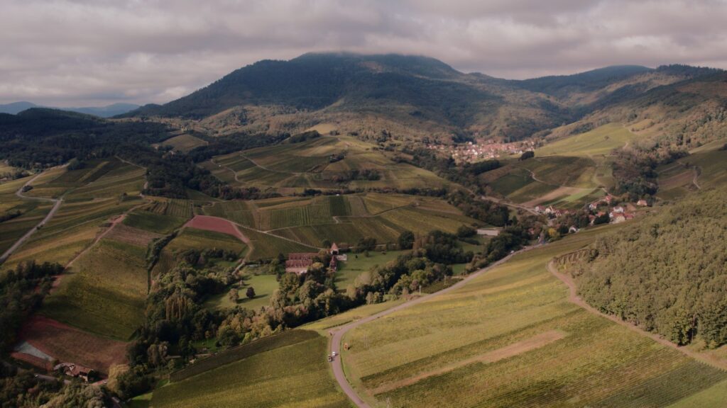
Along its course, the canal quietly accompanies the Ill River and meanders at the foot of slopes where legendary vines like Riesling and Gewürztraminer ripen. The construction of this infrastructure represented a colossal civil engineering challenge for its time, requiring the design of locks capable of overcoming steep gradients without altering the delicate hydrological balance of the river valleys. Today, traversing this water route reveals how the territory was shaped by the necessity of integrating heavy cargo transport—such as timber, coal, and grain—with a geography marked by the Rhine’s natural frontier.
The Engineering of Water: Locks and Gradients in the Alsatian Plain
The daily operation of this canal rests upon a meticulously calculated system of manual and automated locks punctuating the landscape every few kilometers. Each of these water gates represents a point of technical friction and resolution where water levels are adjusted with millimeter precision to accommodate vessels of standardized beam. Local operators, guardians of a nearly centennial tradition of hydraulic maintenance, monitor gates and spillways that prevent flooding in the surrounding agricultural plains.
The constructive typology of these locks reflects the functional sobriety of Second Empire French civil engineering, combining Vosges pink sandstone ashlar blocks with wrought iron mechanisms that still resist the passage of time. This network not only facilitates the passage of tourist barges and kayaks, but functions as an ecological regulation grid. The side channels act as sumps and flow regulators for the water table aquifers of the Alsatian plain, demonstrating that the original transport infrastructure now possesses a dual environmental protection role.
The Multimodal Axis: Integration Between Greenways and Inland Navigation
The true connectivity revolution of the Marne-Rhine Canal lies not exclusively in the water, but on its adjacent surface. The historic towpath, once trodden by draft horses pulling wooden barges, has been transformed into a modern paved greenway forming part of the European EuroVelo 5 network. This peaceful coexistence between cycling traffic and river navigation generates a decarbonized mobility model that attracts both local travelers and international cycle tourists.
The synchronization between train, bicycle, and boat constitutes the core of current accessibility in the region. The railway stations of Saverne, Hochfelden, and Strasbourg are located mere meters from the canal basins, allowing users to combine medium-distance rail legs with slow river cruising or uninterrupted pedaling. This multimodal approach drastically reduces dependence on private vehicles for commuting and leisure travel between rural areas and urban centers in the Bas-Rhin department.

The gentle waters of the Alsatian canals are not a relic of industrial the past, but the foundation upon which tomorrow’s sustainable mobility is built in the heart of Europe.
The economic impact of this green corridor is felt in the local economies of the riverside villages, which have seen the birth of a network of services tailored to slow-speed travelers. Bicycle repair shops, small wine cooperatives with docking points, and former lock-keeper houses converted into guesthouses demonstrate that infrastructure can generate wealth without compromising the landscape integrity of the environment.
Iron and Water Architecture: Canal Bridges and Inclined Planes
One of the most fascinating milestones of the route is found near Arzviller, where the canal overcomes the Vosges massif through an exceptional engineering feat: the Saint-Louis-Arzviller inclined plane. Inaugurated in 1969 to replace a monumental staircase of seventeen traditional locks that demanded an entire day of travel, this boat lift transports entire barges in a giant water trough on rails, overcoming a drop of over forty meters in just four minutes.
This technical solution, unique of its kind in Western Europe, marked a quantum leap in inland navigation efficiency, drastically reducing transit times and optimizing water consumption. The metallic structure, reminiscent of major twentieth-century industrial architecture works, contrasts sharply with the lushness of the surrounding Vosges forest. For the contemporary traveler, descending or ascending in the trough offers an unusual perspective on the scale human intervention can achieve in harmony with mountainous topography.
The Urban Pulse: From Rural Locks to the Autonomous Port of Strasbourg
Following the course of the water eastward, the rural landscape of hop fields and vineyards gradually gives way to the dense urban fabric of Strasbourg, European capital and multinational logistics hub. The canal ultimately empties into the docks of the Autonomous Port of Strasbourg, one of France’s most important river transport hubs and a key node in connections with the ports of Rotterdam and Basel via the Rhine.
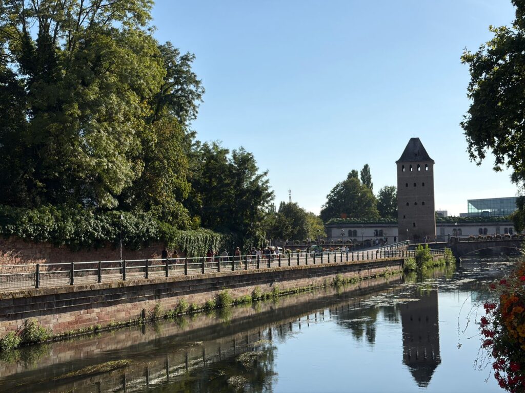
This transition from the human scale of the secondary canal to the colossal international port infrastructure illustrates the complexity of the Alsatian transport system. The urban basins not only manage heavy cargo containers, but also host passenger terminals and river cruise ships connecting cultural tourism with the continent’s major waterway network. The landscape integration of these industrial docks with historic districts—such as Petite France, where water also plays a starring role—evidences territorial planning that values liquid heritage as a backbone of urban life.

Practical guide
How to get there: Strasbourg-Entzheim International Airport connects with major European hubs. From Strasbourg central station, regional TER trains provide access to strategic canal points such as Saverne or Hochfelden in under thirty minutes.
When to travel: The optimal months to explore the canal and its greenways run from May to October, a period when locks operate on full schedules and weather conditions are ideal for cycle tourism and recreational boating.
Rental and navigation: Multiple unlicensed riverboat rental bases operate in towns like Waltenheim-sur-Zorn. It is mandatory to check the official canal maintenance calendar managed by VNF (Voies Navigables de France).

Accommodation and services: The route features numerous chambres d’hôtes and small hotels certified with the Accueil Vélo label, guaranteeing secure bicycle spaces and basic technical assistance for cyclists.
The Liquid Memory of the Frontier
At the end of the journey, when the last sunset lights dye the tranquil canal waters amber and reflections of grapevine shoots multiply on the surface, the infrastructure reveals its most intimate dimension. Beyond its logistical efficiency or value as a tourist attraction, the Marne-Rhine Canal in its Alsatian section functions as a liquid archive of European history. The stones of its locks have witnessed empires march, borders shift, and goods transit, constructing the prosperity of a hinge region.
Conserving these waterways is not an exercise in archaeological nostalgia, but a lucid commitment to a mobility model where time recovers its human value and the landscape ceases to be a backdrop, becoming a shared experience.
Traveling along this aquatic corridor is ultimately a reminder that true connectivity is not measured exclusively by the speed with which a destination is reached, but by the quality of the relationship established with the territory crossed. On the Alsatian riverbanks, water continues to set the tempo of an integrated, slow, reflective Europe deeply rooted in its soil.