
Bank and Current: The Fluvial Geography That Shaped Porto’s Atlantic Destiny
The mouth of the Douro River where it meets the Atlantic Ocean is not merely a geographic feature, but a historical fracture line that has defined the commercial and cultural character of northern Portugal for centuries. Porto and Vila Nova de Gaia face each other across a granitic canyon where the force of the river current collides head-on with ocean tides. This constant friction between fresh and salt water has demanded bold engineering solutions since ancient times to guarantee the economic survival of a region dedicated to foreign trade.
While the peninsular interior fed the flow with agricultural and timber surpluses, the outlet to the sea became the system’s ultimate bottleneck. The treacherous sandy bar at the river mouth, historically dangerous due to shifting sandbanks and western gales, forced Portuguese authorities to radically rethink their relationship with nautical infrastructure. The river ceased to be a mere natural obstacle and transformed into the backbone of a complex logistical system, where civil engineering and artisanal navigation wove an unusual network of interdependent infrastructure that still permeates the urban landscape today.
Iron and Stone Arteries: Historic Bridges as Milestones of Connectivity
The true revolution in Douro connectivity arrived with the Industrial Revolution and the introduction of molded metals. For centuries, crossing from one bank to another depended on precarious wooden barges or the obsolete pontoon bridge that collapsed with every unexpected flood. The urgent need to connect the national railway network with the Port of Leixões and northern lines forced 19th-century engineers to defy the limits of physics by designing decks suspended over empty space.
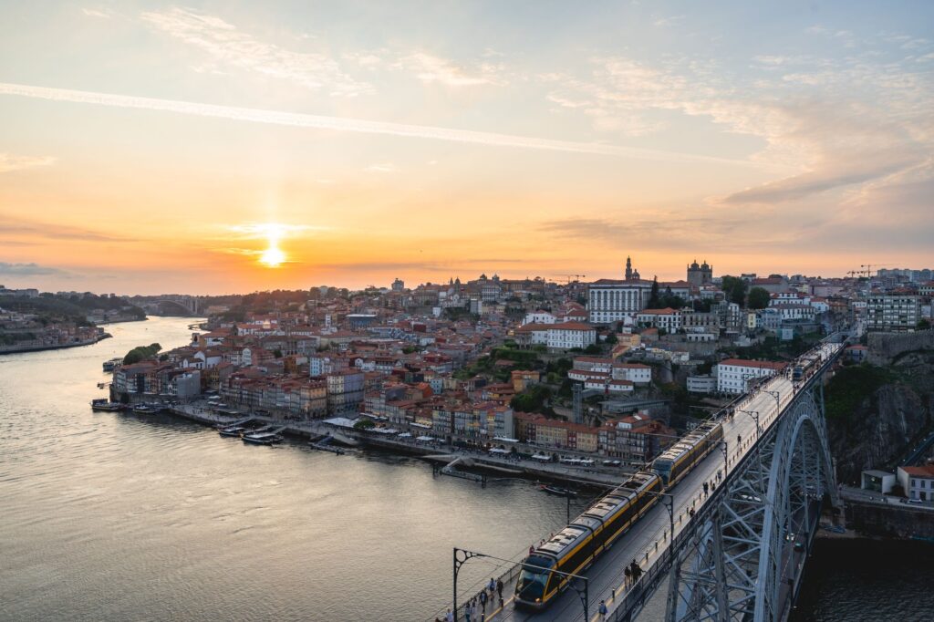
The Dom Luís I Bridge, inaugurated in 1886 by Gustave Eiffel’s disciple Théophile Seyrig, represents the peak of this technical audacity. With its double-tiered metal arch, it simultaneously resolved urban transit and high-level railway connection without interrupting lower river traffic. Nearby, the Maria Pia Bridge had already demonstrated that the visual lightness of puddled iron could conquer impassable abysses. These structures not only united two independent municipalities, but redefined the territorial scale of the entire valley, allowing wine production from the upper Douro to flow uninterrupted toward the storage cellars in Gaia.
The Memory of Wood: The Operational Legacy of Rabelo Boats
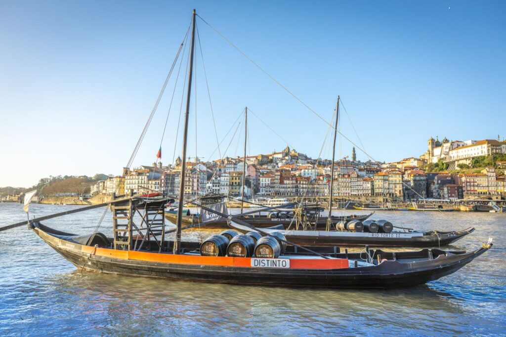
Before railways and paved highways monopolized freight transport, the lower course of the Douro was a fluvial highway saturated with cabotage traffic. The undisputed protagonists of this landscape were rabelos, flat-bottomed boats with square sails and an exceptionally long rudder known as an espadela. Designed specifically to navigate rapids, whirlpools, and treacherous elevation drops of the upper Douro before the construction of massive hydroelectric dams, these vessels were marvels of river navigation.
Every spring, rabelos descended loaded with port wine barrels from the terraced vineyards of Pinhão and Régua to the cellars located at the river mouth. The return journey upstream, however, required superhuman effort: boatmen had to tow the vessels from the bank using ropes on foot, battered by wind and mud. Although their commercial function has completely disappeared today, their presence in Porto’s urban waters remains a tangible reminder of the harshness of that ancestral logistics. The survival of these oak hulls symbolizes the victory of maritime memory over the amnesia of modern progress.
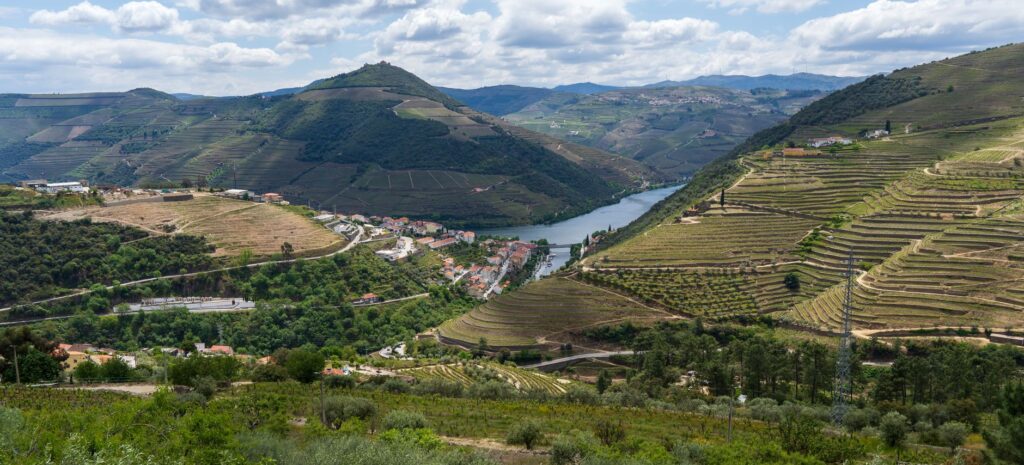
The Douro is not merely the river dividing two cities, but the fertile scar upon which a nation’s Atlantic vocation was founded, sculpted from iron, tide, and stone.
The Northern Alternative: The Port of Leixões and the Open Sea Outlet
As merchant ships increased in draft and tonnage, the Douro’s sedimentary bed proved inadequate to handle 20th-century international maritime traffic. The technical response to this geographic limitation was the construction of the artificial port of Leixões, located a few kilometers further north in the municipality of Matosinhos. Formally inaugurated in the late 19th century following decades of titanic dredging and breakwater construction, Leixões became Porto’s true maritime escape valve.
This port complex represented a strategic shift in the regional supply chain. Heavy cargo, fuel, and global containers abandoned the traditional riverbed to centralize in a deep-water basin protected by imposing granite breakwaters. However, this modernization did not isolate the Douro; instead, it integrated the estuary into a broader intermodal network. The system combined the agility of coastal container transport with the persistence of river tourism within the interior estuary, generating an operational balance that prevents the saturation of historic urban centers.
The Tourism Transformation: From Cargo Transport to Leisure Navigation
In recent decades, the Douro river corridor has undergone one of the most radical transformations in the transport sector in southern Europe. The ancient smuggling and wine routes have been massively converted into high-end river cruise itineraries, attracting thousands of international visitors each year. Fleets of modern catamarans and adapted vessels daily navigate the monumental locks built during the 20th century in the middle course, such as Carrapatelo or Crestuma-Lever.
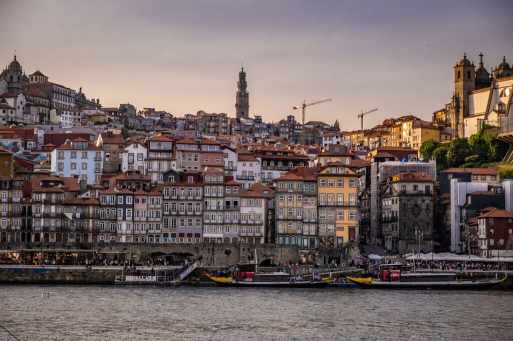
This tourist traffic demands meticulous management of docking infrastructures and passenger flows at the Ribeira and Gaia docks. Former wine cellars, once simple industrial warehouses, now function as logistics terminals for receiving visitors arriving by water and land. The current challenge for local authorities lies in absorbing this massive volume of mobility without compromising the structural integrity of centennial docks or altering the residential fabric of riverside neighborhoods. The touristification of the riverbed poses a sustainability dilemma that tests the resilience of hydraulic heritage.
The Pedestrian Pulse: Funiculars, Walkways, and New Vertical Mobility
Porto’s rugged topography has historically forced its inhabitants to master verticality through an engineering system of staircases, ramps, and public elevators. In recent years, this intermodal transport system has been enriched by the integration of restored funiculars, such as the Guindais, and panoramic elevators that bridge dizzying elevation gaps between the riverside and the upper cathedral district.
This vertical mobility network is complemented by the expansion of pedestrian paths and bike lanes running parallel to the coastline and estuary. Recent waterfront recovery projects have successfully connected the city’s medieval core with the Atlantic beaches of Foz do Douro via elevated wooden promenades that protect the fragile dune ecosystem. Walking through Porto today is an exercise in urban engineering where every elevation change is resolved through a fluid transition between public transport, heritage, and landscape.
Practical guide
How to get there: Francisco Sá Carneiro Airport (OPO) connects Porto with major European hubs via regular and low-cost airlines. From the terminal, the metro (Line E – Violet) takes you directly and economically to the city center in approximately 30 minutes.
Local transportation: The multimodal Andante card allows integrated use of the metro, STCP buses, and CP urban trains within metropolitan zones. To overcome the steepest urban elevation changes, the Guindais Funicular and the Gaia Cable Car (located on the opposite bank) are strongly recommended.
Fiver navigation and cruises: Traditional rabelo boat tours across the Douro’s six bridges depart constantly from the Ribeira and Gaia docks, lasting an average of 50 minutes. For long-distance trips toward the upper Douro, multi-day tourist cruises depart from São Bento station combined with river segments.
The Embrace of the Atlantic: Final Glance Over the Estuary Mist
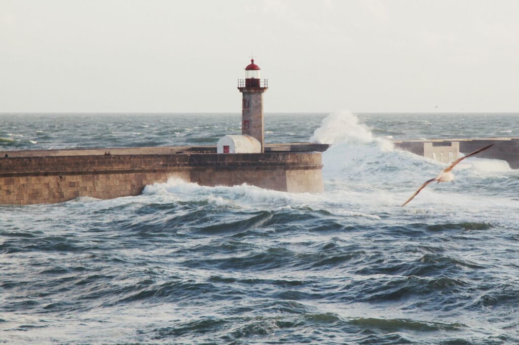
When the sun begins to sink over the Atlantic horizon, the granitic stone of Porto’s docks acquires a coppery hue that seems to fuse medieval architecture with the metallic surface of the river. At the Foz do Douro breakwater, where the Felgueiras lighthouse takes the direct impact of open sea waves, the energy accumulated over hundreds of kilometers of river current finally dissipates into the immensity of the ocean. It is at that precise moment that the true magnitude of this territory becomes clear: a fragile balance between the untamed force of nature and the obstinate human will to build paths over water.
Seulls circle the buttresses of the centennial bridges as city lights begin to flicker on both banks, reflecting upon the dark surface of the estuary. Far from commercial hustle and standardized tourist routes, Porto’s coastal pulse continues its unperturbed cycle, sustained by the rising and falling tide, reminding every visitor that no city is an island, but rather the port where all possible paths converge.