
Origins of an Archipelago Forgotten by Geological Time
California’s Channel Islands, located just a few nautical miles off the frantic megalopolis of Los Angeles, represent an unusual sanctuary where geology and marine biology have evolved far beyond continental pressures. This island chain, comprising Santa Cruz, Santa Rosa, San Miguel, Anacapa, and San Clemente, rises as the submerged peaks of a submarine mountain range known as the Northern Peninsular Ranges. Plate tectonics have carved over millennia an abrupt topography of basaltic cliffs, eolian mesas, and deep marine canyons that defy human settlement.
Historically inhabited by the Chumash nation, whose communities relied on sturdy plank canoes known as tomols, these insular lands preserve an exceptional archaeological footprint. Navigation through these waters is not a mere recreational transit, but an immersion into an ecosystem where the California Current collides with warm southern countercurrents, generating a marine upwelling zone of extremely high biological productivity. Understanding this oceanic dynamic is the first essential requirement for any mariner aspiring to anchor safely in its sheltered coves.
The Biogeography of Isolation and Insular Endemism
Unlike islands formed by oceanic volcanic activity, the Channel Islands are continental, separated from the Baja California peninsula and the California coastline during the Miocene. This prolonged isolation has favored terrestrial speciation, giving rise to evolutionary jewels such as the island fox and the island spotted skunk. In the marine realm, the landscape is equally unique: giant kelp forests of Macrocystis pyrifera harbor everything from the vulnerable sea otter to dense populations of sea lions and white sharks.
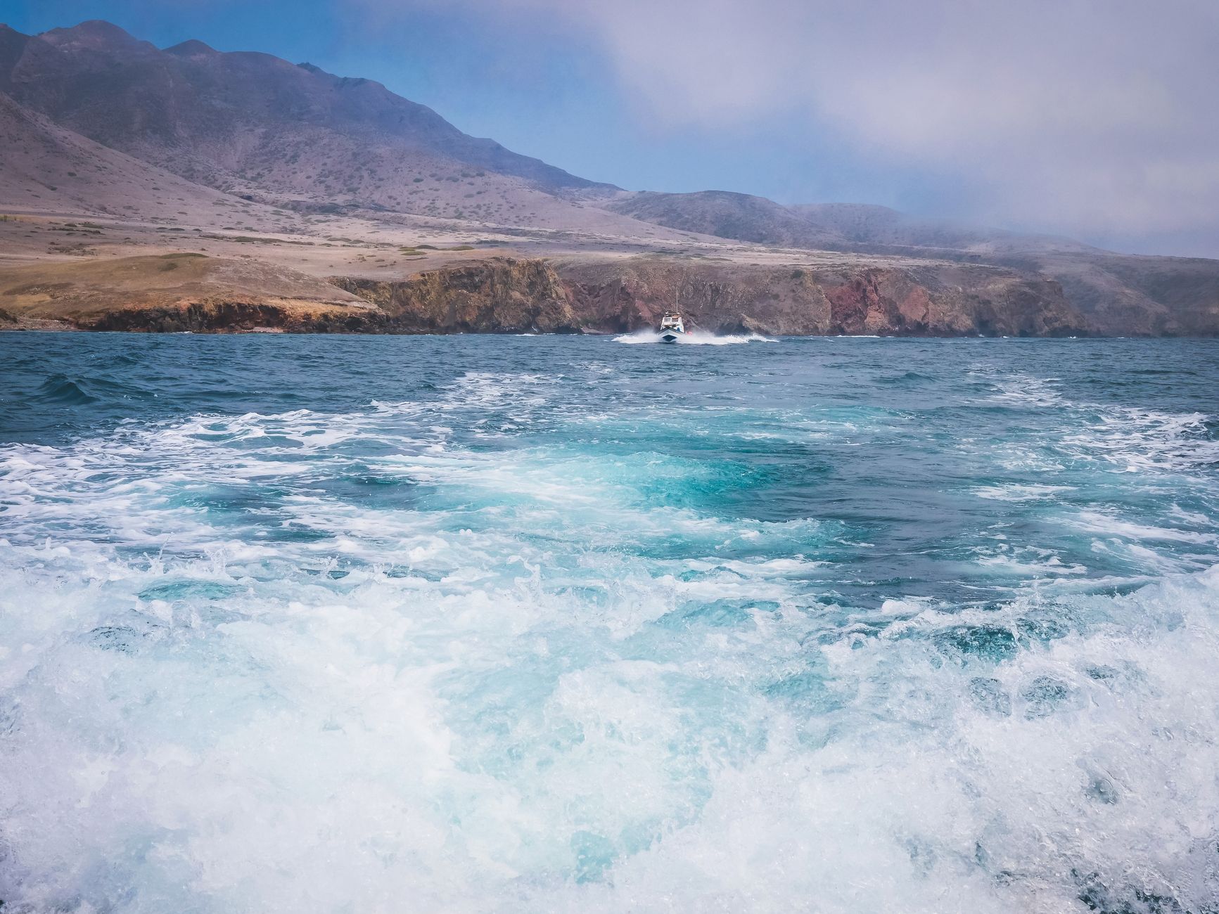
Analysis of regional nautical charts reveals a complex underwater topography, with bathymetric canyons that channel open-Pacific swells and multiply the force of prevailing winds. Modern expeditions tackling these waters must rely on vessels capable of withstanding abruptly forming seas when northwestern gales lash the exposed headlands of San Miguel and Santa Rosa.
Nautical Planning and Santa Barbara Channel Meteorology
Navigating the Santa Barbara Channel requires absolute mastery of local weather models and the interpretation of United States Coast Guard marine forecasts. The region’s climate is dominated by the North Pacific High pressure system, which generates steady westerly and northwesterly winds—locally known as summer westerlies—capable of whipping up seas over three meters within hours. Summer fog patterns, caused by thermal inversion over cold current waters, drastically reduce visibility, making radar and global positioning systems critical survival tools.
The choice of departure ports—such as Ventura, Santa Barbara, or Port Hueneme—dictates the approach strategy to the eastern islands of Anacapa and Santa Cruz. Tidal currents, while less extreme than in northern high latitudes, gain significant velocity when compressed through the narrow straits separating the islands, creating eddies and cross-swells that complicate the handling of sailboats and small motor vessels.

The Californian Pacific sea tolerates no improvisation; every nautical mile traversed demands absolute respect for a meteorology that shifts as rapidly as the sun vanishing behind marine mist.
Port Infrastructure and Emergency Anchorages
Unlike the densely urbanized mainland coasts, the Channel Islands lack commercial marinas in their interior. Navigators depend exclusively on natural anchorages and mooring buoys managed by the U.S. National Park Service. On Santa Cruz Island, bays like Prisoners Harbor and Scorpion Anchorage offer relative protection against prevailing northwestern swells, though they remain vulnerable to eastern and southeastern winds during winter storms.
Conservation regulations are strict: much of the surrounding waters are designated as State Marine Reserves or Marine National Parks, prohibiting anchoring over seagrass beds and sharply limiting recreational and commercial fishing. Vessel self-sufficiency regarding fresh water, fuel, and waste management is absolute, as there are no supply facilities within the interior of the national park.

Marine Geology and Dynamics of the Anacapa Cliffs
Anacapa, the smallest and westernmost of the eastern islands, constitutes a fascinating open book on marine erosion. Formed by three closely aligned volcanic islets—East, Middle, and West Anacapa—its profile is dominated by steep andesitic cliffs plunging vertically into intense turquoise waters. The famous Anacapa Arch, a natural basalt bridge sculpted by the constant hammering of waves, stands as the most visible testimony to the sea’s relentless force against volcanic rock.
Geological and diving expeditions exploring this area must exercise extreme caution regarding unstable rock walls and strong tidal flows sweeping through the Anacapa Strait. Dive sites around Cathedral Cove offer exceptional biodiversity visibility within kelp forests, always under the supervision of skippers experienced in open waters exposed to sudden swell shifts.
Coastal Ecology: The Rebirth of the Island Fox
The conservation history of the Channel Islands is a global benchmark for applied scientific management. During the 1990s, accidental introduction of invasive species and predation by golden eagles pushed several endemic subspecies to the brink of extinction, most notably the dramatic decline of the island fox (*Urocyon littoralis*), whose weight barely reaches two kilograms.
Thanks to a coordinated captive breeding program, eradication of feral pigs, and reintroduction of native raptors, the island fox population has rebounded with unprecedented success. Scientists and naturalists traversing the trails of Santa Cruz and San Miguel today document a biodiversity in fragile yet resilient equilibrium. Landing regulations require exhaustive inspection of all footwear and camping gear to prevent the introduction of foreign seeds or rodents that could compromise this delicately restored ecosystem.
Water Resource Management in Arid Insular Environments
Despite being surrounded by salt water, the islands suffer from chronic shortages of fresh water resources. Scanty winter precipitation, concentrated between November and March, evaporates quickly due to high winds and summer insolation. Land expeditions must transport all necessary drinking water for the traverse or rely on filtration systems in rare, protected mountain springs.
Planning walking routes across the ridge of Santa Rosa Island requires meticulous calculation of hydration rations, especially on days where elevation gains exceed eight hundred meters beneath direct Pacific solar radiation. Knowledge of insular geography and exact emergency shelter locations are vital elements for preventing heat stroke and severe dehydration.

Cultural Heritage and Vestiges of the Chumash Nation
Human legacy across the archipelago spans more than thirteen thousand years. The archaeological sites of the Channel Islands rank among the oldest and best preserved in North America. The ancient Chumash inhabitants developed a complex society based on maritime trade with the mainland, utilizing *tomols*—plank canoes sewn together and sealed with natural asphalt from offshore seeps—to transport goods like abalone shell beads.
Exploring these landscapes implies a rigorous ethical and legal commitment: the Archaeological Resources Protection Act strictly prohibits the collection, alteration, or displacement of any historical artifact. Interpretive panels installed at main campgrounds detail how indigenous communities sustainably managed fish and shellfish populations, offering a masterclass in traditional ecology that continues to inspire modern national park managers.
Practical guide
- How to get there: Maritime access is provided via authorized ferry services departing from mainland ports in Ventura and Oxnard operated by Island Packers, with crossings ranging from one to three hours depending on the destination island.
- Permits and reservations: Private boat traverses require advance reservation of mooring buoys via the Recreation.gov platform. Overnight stays at island campgrounds require camping permits issued months in advance due to strict visitor caps.
- Recommended gear: Technical windproof and waterproof clothing (Gore-Tex type), high-traction footwear for rocky terrain, standalone water purification systems, a comprehensive first aid kit, and a marine VHF radio with DSC.
- Best time for navigation: Months between July and October offer the greatest meteorological stability, lower wind intensity, and optimal underwater visibility, though spring stands out for endemic wildflower blooms.
- Environmental regulations: Landing domestic pets, collecting shells or rocks, and any activities disrupting protected wildlife under federal jurisdiction of the National Park Service are strictly prohibited.
Emotional Epilogue: The Echo of Silence Over the Oceanic Horizon
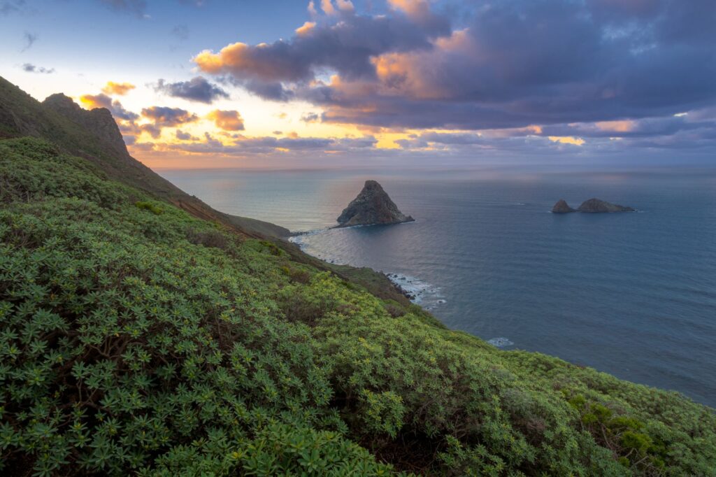
As the sun slowly descends toward the horizon line over the Pacific, painting Anacapa’s basaltic cliffs in ochre and violet tones, the archipelago reclaims its timeless frontier status. In that instant of absolute stillness, where the rhythmic murmur of breaking waves replaces every other human concern, the Channel Islands reveal their true essence. It is not merely a geographical destination accessible after a complex nautical traverse, but an eloquent reminder of the fragility of the planet’s remaining wild refuges—a space where nature dictates the rules and the traveler learns, with humility, to listen to the deep heartbeat of the ocean.