Introduction to the Atlantic Isolation of Fernando de Noronha
The Fernando de Noronha archipelago, situated more than three hundred and fifty nautical miles off the Brazilian continental coast, represents one of the most isolated and protected insular enclaves in the South Atlantic. This condition of isolation has not only preserved a marine ecosystem of incalculable value but also imposes extraordinary logistical challenges for any expedition intending to venture into its waters or anchor in its limited roadsteads. Unlike other mass-market tourist destinations, Noronha operates under a strict environmental conservation regime that regulates every aspect of navigation, anchoring, and human permanence on land. Understanding the volcanic nature of the archipelago and the interaction of oceanic currents is the first indispensable step for any navigator or researcher charting a course toward this remote boundary.
The history of navigation in Noronha is marked by the difficulty of its approach. Lacking deep natural shelters that offer absolute protection against the southeast trade winds, historical captains had to face violent breakers and an abrupt insular platform. Today, satellite technology and electronic cartography facilitate landfall, but the severity of the marine environment remains unaltered. Brazilian authorities, through the Chico Mendes Institute for Biodiversity Conservation (ICMBio) and local administration, have implemented a rigorous regulatory framework prioritizing coral habitat preservation over commercial comfort. This turns the expedition into an exercise in seamanship precision and absolute ecological respect.
Equatorial Current Dynamics and Marine Meteorology
Planning the crossing from the mainland, whether departing from Natal or Recife, requires absolute mastery of the Brazil Current and the trade wind system dominating the equatorial belt. For much of the year, winds blow steadily from the east-southeast quadrant with intensities ranging from fifteen to twenty-five knots, generating a short, persistent swell that tests the structural endurance of vessels and the fortitude of the crew. The approach to the archipelago must be calculated meticulously to avoid nighttime hours, when visibility of shallow banks and peripheral rock formations, such as Rata Island or the Salsos, is drastically reduced.
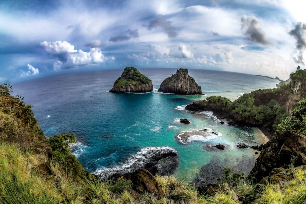
The sea in Fernando de Noronha tolerates no improvisation; every nautical mile sailed toward this sanctuary demands constant barometric pressure reading and absolute respect for the limits imposed by insular nature.
Beyond wind, tides play a decisive role in maneuvering within Baía de São Antônio, the archipelago’s only operational port for vessels of a certain draft. Tidal variations generate crosscurrents that can push a vessel off course within minutes during approach maneuvers to the dock or anchoring in authorized areas. Expedition skippers must have meteorological contingency plans, as occasional tropical storms—though infrequent in their most destructive form—can alter permanence times and force open-water drifting if ecological anchorage sites become saturated or conditions worsen abruptly.
Nautical Logistics and Anchorage Restrictions Within the National Park
Maritime access to Fernando de Noronha is conditioned by prior permits and environmental conservation fees that must be arranged weeks or months in advance. No vessel may anchor freely within the waters of the Marine National Park. Anchorage zones are strictly delimited using ecological buoys designed to prevent the destruction of coral formations and algae meadows serving as nurseries for numerous fish species and sea turtles. Traditional anchoring is prohibited across most of the protected perimeter, compelling crews to verify the compatibility of their mooring systems with institutional buoys.
The replenishment of fuel, fresh water, and fresh provisions in the archipelago presents severe limitations. Relying almost entirely on weekly cargo shipments from the mainland, the availability of these resources can be interrupted by logistical delays or adverse sea conditions. Self-sufficient expeditions must calculate reserves with a generous safety margin, ensuring onboard water purification capabilities if necessary and optimizing energy consumption. Solid waste and grey or black water management is another aspect scrutinized with extreme rigor; dumping any type of waste into the sea within reserve boundaries is strictly prohibited.
Marine Life and Wildlife Approach Protocols
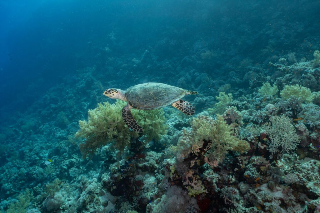
One of the greatest rewards of reaching the archipelago is the opportunity to observe exceptional marine biodiversity, notably the permanent presence of spinner dolphins in the renowned Baía dos Golfinhos, alongside stable populations of nurse sharks, hawksbill turtles, and an infinite variety of reef fish. However, this biological wealth carries an inescapable responsibility for expeditionaries. Park regulations establish minimum approach distances for any vessel or swimmer, prohibiting the harassment of marine mammals and the use of unauthorized underwater sound equipment that could alter species behavior.
Autonomous diving and snorkeling are highly regulated and permitted only at specific locations with authorized operators or under strict supervision by park rangers. Wildlife interaction must be governed by the principle of non-interference. Scientific expeditionaries and underwater photographers must exercise extreme caution not to touch fragile fire corals or disturb sandy substrates inhabited by endemic species. Each dive is a privilege conditioned by ecosystem fragility, and failure to comply entails severe penalties, including temporary equipment confiscation and a ban on returning to the park.
Defensive Architecture and Colonial History on Land
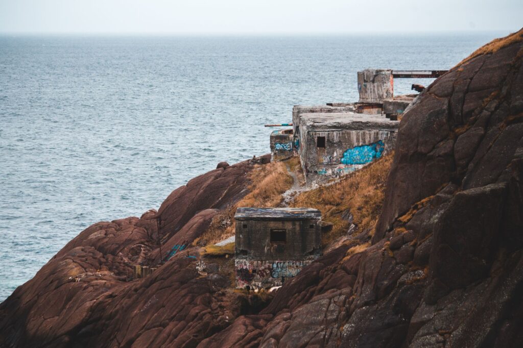
Away from the water, the archipelago guards a fascinating historical testimony awaiting exploration on foot. Throughout the 18th and 19th centuries, European colonial powers and the Brazilian Empire disputed the strategic control of Noronha, erecting a defensive fortification system whose centerpiece is the Forte de Nossa Senhora dos Remedios. These structures of volcanic stone and lime-whale oil mortar are distributed strategically across promontories dominating the coasts, offering today a unique perspective on colonial military architecture in isolated insular environments.
Exploring these historical enclaves must be done while respecting marked trails to prevent volcanic soil erosion and the disturbance of native flora, including endemic species like the mofumbo. Expedition historians and chroniclers find in Noronha an exceptional geological and human archive, where traces of ancient military prisons coexist with modern meteorological stations. The integration between cultural heritage and pristine nature requires hikes to be conducted with accredited guides, fostering expedition tourism based on deep understanding and rigorous territorial interpretation.
Sustainability and the Future of Expeditions in the Tropical Atlantic
Fernando de Noronha’s management model is frequently cited internationally as a benchmark for balancing human activity and environmental conservation. With a strictly controlled daily carrying capacity for both land visitors and the nautical fleet, the archipelago demonstrates that curbing mass tourism pressure through firm public policies and transparent oversight is entirely achievable. For modern expedition leaders, Noronha poses a necessary reflection on the navigator’s role: reaching a remote destination is no longer enough; minimizing the ecological footprint during transit and stay is imperative.
True contemporary exploration does not consist of conquering pristine territories, but of learning to inhabit them without leaving a trace, ensuring their biodiversity remains intact for future generations of navigators.
Future challenges for the archipelago include adapting to climate change, rising sea surface temperatures and their impact on coral reefs, and efficiently managing renewable energy on land. Scientific expeditions arriving regularly at its shores play a crucial role in monitoring these ecological indicators, collaborating closely with Brazilian universities and government agencies. Thus, each successful voyage to Fernando de Noronha transforms into a direct contribution to understanding and defending the planet’s fragile oceanic ecosystems.
Practical Information for Expedition Planning
- Mandatory Permits: It is essential to pay the daily Environmental Preservation Tax (TPA) established by the local administration, alongside specific Marine National Park access permits managed by ICMBio prior to landfall.
- Ports and Anchorages: Baía de São Antônio is the official maritime entry point. Vessels must coordinate arrival with the port captaincy and exclusively use assigned ecological mooring buoys.
- Recommended Season: The period between August and February offers the most favorable calm sea conditions and optimal visibility for navigation and diving, coinciding with lower tropical Atlantic storm frequencies.
- Self-Sufficiency: Given that the archipelago lacks advanced shipyards or extensive nautical supplies, carrying critical spare parts for engines, navigation systems, and onboard safety equipment is mandatory.
Conclusion and Legacy of the Oceanic Voyage
Venturing into the Fernando de Noronha archipelago as an expeditionary is an exercise in seamanship humility and logistical rigor. Continental distance, the fierceness of equatorial currents, and the severity of conservation regulations demand technical preparation far exceeding any conventional coastal voyage. Those managing to overcome these difficulties and anchor in protected waters discover a sanctuary where nature retains its primordial pulse. Upon weighing anchor for the mainland, the experience leaves an indelible mark, reminding us that true oceanic adventure lies in the ability to connect with the vastness of the sea without disrupting its fragile balance.