The Invisible Artery of the Central Sahel
The territory of Niger, crossed by the vast expanses of the Sahara Desert and the transitional band of the Sahel, has historically relied on a network of dusty tracks and caravan routes that defy climatic severity. Far from the bustling coastal metropolises of the African continent, the corridor connecting the historical capital with the ancient city of Zinder represents a fascinating study in human adaptation and the engineering of survival. Here, mobility is not merely a matter of commercial convenience, but the vital fabric preventing the absolute isolation of entire communities during the dry season and sudden summer floods.
For decades, state planners and transport engineers have faced a monumental challenge: how to unify a landlocked country whose dimensions span over twelve hundred kilometers from east to west. The answer lies not in a single pharaonic infrastructure, but in a complex intermodal ecosystem where the centuries-old tracks of Tuareg nomads converge with heavy-duty cargo trucks adapted to extreme temperatures and uncompleted railway projects that once promised to connect southern savannas with northern trans-Saharan trade routes.
The Geography of Sand and Asphalt
The surface of National Route 1, the main paved backbone crossing the country from west to east, acts as a thermometer for the region’s economic resilience. As one leaves Niamey behind and ventures deeper into the regions of Maradi and Zinder, asphalt progressively yields ground to the relentless march of shifting dunes and erosion driven by harmattan winds. This natural phenomenon demands constant maintenance and redefines the very notion of road infrastructure, compelling local authorities to implement soil stabilization techniques based on the strategic planting of vegetative barriers and crushed volcanic gravel.
In this unforgiving landscape, the transportation of goods and passengers assumes an almost heroic dimension. Intercity public transport vehicles, locally known as ‘bush taxis’, push the limits of physics by loading everything from sacks of millet to improbable household goods onto their roofs. The synchronization of these journeys depends as much on the drivers’ mechanical ingenuity as on information passed from village to village through informal networks, serving as a reminder that connectivity in the Sahel is fundamentally a social and collaborative phenomenon.
The true engineering of the Sahel is not measured in tons of reinforced concrete, but in the ability to keep routes open when nature erases the boundaries of the road.
The role of regional markets along this corridor is essential to understanding the economics of movement. Each week, the convergence of dromedary caravans and vintage truck fleets transforms dusty enclaves into vibrant logistical hubs where everything from livestock to imported textiles is traded. These exchange points act as nodal stations of an invisible network, compensating for the absence of high-capacity railways and demonstrating that commercial efficiency can flourish in the most restrictive geographical environments.
Mud Architecture and Caravan Routes
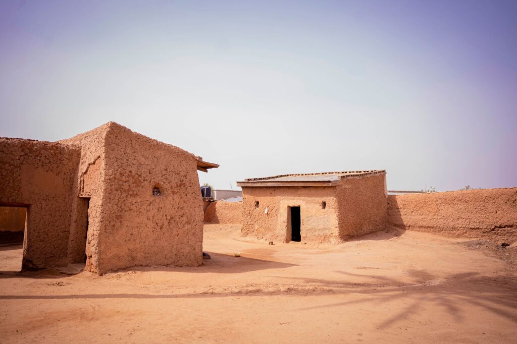
Beyond the main roads, the urban architecture of cities like Zinder reveals the deep interweaving of spatial design with historical trade routes. Traditional neighborhoods, built using adobe and ancestral mud-dome techniques, are strategically oriented to channel cooling breezes and protect interior courtyards from abrasive sand. Ancient walls and sultanate palaces not only testify to an imperial past of splendor, but delineate the old checkpoints where transit taxes were levied on salt caravans arriving from Bilma.

The conservation of this architectural heritage ties directly into contemporary transport challenges. The arrival of new paved routes threatens to alter the historic urban layout, attracting heavy traffic that puts ancient unbaked-earth structures at risk. Urban planners and local historians advocate for the creation of peripheral bypasses that divert commercial transit away from ancient centers, thereby preserving the integrity of a legacy built upon clay, water, and millennial patience.
The Logistics of the Rainy Season
Niger’s annual cycle is marked by a dramatic contrast: the prolonged, arid dry season abruptly gives way to the rainy period, locally known as the Sahelian winter. Within days, dry riverbeds or ‘wadis’ transform into roaring torrents that halt road traffic and temporarily isolate numerous rural communities. This extreme seasonality demands meticulous logistical planning from transport authorities, who must pre-position medical supplies and food before routes become impassable.
During this period, light watercraft and wooden pirogues take on an unusual prominence across navigable stretches of the Niger River and its temporary tributaries. The transition between land and water mobility becomes a precision exercise where small local cooperatives manage passenger transfers with surprising efficiency. This seasonal dynamism proves that connectivity in Niger is not a static system, but an adaptive choreography that responds nimbly to the whims of the African monsoon.

The Human Factor in Sahelian Transport
Behind every trade flow statistic and infrastructure maintenance effort lies the daily toil of drivers, mechanics, porters, and merchants. In roadside open-air repair shops across Maradi, master mechanics of salvaged parts manage to resurrect decades-old engines using rudimentary tools and recycled scrap metal. This repair culture not only sustains the transport economy, but embodies a radical form of sustainability in a region where importing new spare parts is prohibitively expensive.
Local transport associations also operate as mutual support networks, establishing convoy systems to cross the most solitary stretches of the journey and guaranteeing safety against terrain hazards or unforeseen mechanical breakdowns. Mutual respect among various road actors creates a highway ethic where solidarity among travelers is an unwritten rule for survival in the desert.
Technological Innovation and Clean Energy en Route
In recent years, the Zinder corridor has begun experiencing a silent transformation driven by the deployment of decentralized energy solutions. Hybrid service stations, equipped with high-efficiency solar panels, supply energy not only to fuel pumps but also to refrigeration systems for perishable goods and charging points for mobile devices used by transport workers. This integration of photovoltaic technology drastically cuts operating costs and mitigates reliance on traditional diesel generators.

Likewise, the use of satellite positioning systems and mobile messaging apps among fleet operators has markedly improved freight traceability and safety in remote stretches. Although digital connectivity in the interior of the Sahel continues to face structural limitations stemming from a scarcity of telecommunication towers, the gradual digitization of overland logistics marks the dawn of a new era for cross-regional trade in Niger.
Practical guide
How to get there: The main air access is through Diori Hamani International Airport in Niamey, with regular connections from major hubs in West Africa and Europe. Travel toward the interior and the eastern corridor is conducted via occasional domestic flights or overland along Route Nationale 1.
When to travel: The optimal period spans from November to February, during the cool and dry season, when daytime temperatures are moderate and land routes are at their most passable state.

Internal transport: Hiring four-wheel-drive vehicles with experienced local drivers is recommended for journeys outside main paved routes. Intercity bus services connect major cities, though flexibility is required regarding potential delays from checkpoints or mechanical issues.
Requirements and safety: A valid visa, yellow fever vaccination certificate, and strict consultation of updated travel advisories issued by consular authorities are essential before planning travel to the interior of the country.
Memory and Horizon at the Edge of the Desert
As dusk falls on the outskirts of Zinder, when the city’s profile merges with the ocher and golden tones of the Sahelian twilight, market bustle gives way to a profound silence broken only by the distant whisper of wind over sand. In that suspended moment, the apparent harshness of the landscape reveals an austere and magnetic beauty, woven by centuries of human endurance and cultural exchange. The routes crossing this territory are not mere lines on a map, but the latent pulse of civilizations that have turned isolation into community and the vastness of the desert into a shared home.